

One Mission. One County. Ready Together.
- Tweets901
- Following31
- Followers1.3K
- Likes5








ALT Critical Fire Weather Conditions Wednesday to Thursday. Avoid outdoor burning, avoid using equipment that creates sparks, keep vehicles off of dry grass, and properly dispose of cigarettes.


ALT Foggy weather driving tips with road conditions found at quickmap.dot.ca.gov SLOW DOWN AND ALLOW EXTRA TIMETO REACH YOUR DESTINATIONINCREASE FOLLOWING DISTANCE USE YOUR LOW-BEAM HEADLIGHTS IN EXTREMELY DENSE FOG, PULL INTO A SAFE LOCATION

ALT Infographic from the National Weather Service in Sacramento, CA, titled "Flooding Potential," updated Friday, December 19, 2025. The graphic includes a map of Northern and Central California with a large green "Flood Watch" area covering the Central Valley, Sierra Foothills, and Northern mountains, including cities like Redding, Chico, Sacramento, Stockton, and Modesto. Key details include: Timing: 4 pm PST Saturday to 4 pm PST Friday, December 20–26, 2025. Impacts: Rockslides and mudslides in foothills and mountains; rises on mainstem rivers; flooding in urban/low-lying areas, small streams, and creeks; and a low burn scar threat. Precautions: Never drive across flooded roads; be aware if living near streams and creeks; and have an evacuation plan and emergency kit.


ALT Dense Fog This Morning. Allow extra time to reach destination and increase following distance. Fog image from the northeastern foothills.


ALT Timing: 10 PM Tuesday through 4 PM Wednesday. Southerly winds 15-25 with gusts 30-50 mph. Impacts: loose objects may blow around, difficult driving conditions, downed branches and trees, power outages


ALT Forecast Highlights: Weather system brings unsettled weather Thursday through Sunday Widespread showers. Potential for light snow accumulations over highest elevations. Periodically breezy onshore winds. Noticeably cooler, below-normal temperatures


ALT Red Flag Warning 10 AM Tuesday November 5 to 4 PM Wednesday, November 6, 2024. North Wind: Valley: 15 to 25 mph, gusts 35 to 45 mph In the Delta: 20 to 30 mph, gusts 40 to 50 mph Strongest winds expected Wednesday Relative Humidity: Minimum daytime: 10 to 25% Overnight Maximum: 25 to 45% Easier fire starts & potential for rapid spread of fire Fire safety precautions should be exercised to prevent fires Always have an emergency plan for if a fire starts near you


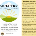
ALT Keep refrigerator and freezers closed Only use generators outdoors and away from windows Do not use a gas stove to heat your home If safe, go to an alternate location for heating/cooling Disconnect appliances and electronics Check on neighbors
