

I am The Starving Meteorologist™. I have a BS in Meteorology from @RutgersSEBS. I use it to deliver pizzas. Member: @AMSnwaATL, @skywarn, @WX2BC
- Tweets32.1K
- Following1.4K
- Followers385
- Likes539


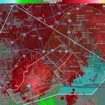




ALT This graphic displays a tornado warning plotted on a map. The warning is in effect until 4:30 PM EST. The warning includes Shrewsbury NJ, Robbinsville NJ and Groveville NJ. This warning is for Southeastern Mercer County in central New Jersey, Northern Burlington County in southern New Jersey and Southwestern Monmouth County in central New Jersey. The threats associated with this warning are a observed tornado and quarter sized hail. There are 36,772 people in the warning along with 8 schools and 0 hospitals.

ALT This graphic displays a severe thunderstorm warning plotted on a map. The warning is in effect until 5:15 PM EST. The warning includes Lakewood NJ, West Freehold NJ and Hamilton Square NJ. This warning is for Northwestern Ocean County in southern New Jersey, Southeastern Mercer County in central New Jersey, Northeastern Burlington County in southern New Jersey, Monmouth County in central New Jersey and Southeastern Middlesex County in northern New Jersey. The threats associated with this warning are wind gusts up to 60 MPH and ping pong sized hail. There are 417,250 people in the warning along with 102 schools and 1 hospital.

ALT This graphic displays a tornado warning plotted on a map. The warning is in effect until 4:15 PM EST. The warning includes Fieldsboro NJ and Columbus NJ. This warning is for North central Burlington County in southern New Jersey. The threats associated with this warning are a radar indicated tornado and quarter sized hail. There are 34,491 people in the warning along with 19 schools and 0 hospitals.

ALT This graphic displays a severe thunderstorm warning plotted on a map. The warning is in effect until 4:30 PM EST. The warning includes Trenton NJ, Levittown PA and Hamilton Square NJ. This warning is for Northwestern Ocean County in southern New Jersey, Southern Mercer County in central New Jersey, Northeastern Burlington County in southern New Jersey, Southwestern Monmouth County in central New Jersey and Southeastern Bucks County in southeastern Pennsylvania. The threats associated with this warning are wind gusts up to 60 MPH and quarter sized hail. There are 767,240 people in the warning along with 227 schools and 16 hospitals.


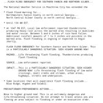
ALT This graphic displays a flash flood warning plotted on a map. The warning is in effect until 6:45 PM EST. The warning includes Philadelphia PA, Drexel Hill PA and Gloucester City NJ. This warning is for West Central Camden County in southern New Jersey, Northwestern Gloucester County in southern New Jersey, Southeastern Delaware County in southeastern Pennsylvania and Southwestern Philadelphia County in southeastern Pennsylvania. Avoid walking or driving through flood waters! Move immediately to higher ground! There are 919,005 people in the warning along with 191 schools and 20 hospitals.


ALT This graphic displays a special marine warning plotted on a map. The warning is in effect until 2:30 PM EST. The warning includes Sandy Hook NJ to Fire Island Inlet NY out 20 NM. The threats associated with this warning are wind gusts greater than 34kts and large hail possible.Waterspouts are possible. Steep waves can be expected. Seek safe harbor and take protective actions.


ALT This graphic displays a tornado warning plotted on a map. The warning is in effect until 2:00 PM EST. The warning includes Queens County, NY. This warning is for Queens County. The threats associated with this warning are a radar indicated tornado and quarter sized hail. There are 130,307 people in the warning along with 37 schools and 2 hospitals.
