

Weather Enthusiasts from East Germany. We love to share our hobby by predicting and discussing any kind of (extreme) weather. 🇬🇧🇩🇪
Joined June 2022
- Tweets1K
- Following72
- Followers153
- Likes3.2K




Pinned Tweet
Passend für die neue Gewittersaison, ist ab heute unsere Webseite online (team-bl.de). Momentan könnten noch einzelne Anzeigefehler auftreten. Falls größere Probleme auftreten, einfach Problem melden und wir versuchen es zu lösen.
1
5
3,163
Team B.L. retweeted

La meteorología es maravillosa, cuando menos te lo esperas hace cosas que te dejan flipando 😬
Supercelula vista desde Sant Joan Despí, Barcelona. Recuerdo que estamos en NOVIEMBRE!

Team B.L. retweeted

Posible #supercélula LP esta tarde desde #obsFabra #Barcelona @btveltemps @3CatInfoelTemps @meteocat @AEMET_Cat @WMO @RMetS

Team B.L. retweeted

Wide shot of June 16, 2025 Dickens/Wellfleet, Nebraska. Probably my favorite tornado of the year (Couldn't chase Gary, SD due to it being an in between day for tours grrrrr). What this tornado did over it's nearly hour lifetime was amazing. #newx

Team B.L. retweeted
May 18, 2025 was an amazing day at various places across the plains. We chose northwest Oklahoma and intercepted the Arnett tornadic supercell. Sometimes I like getting real close and others I like to stay back a couple miles for structure. This day was both! But man, the 11mm wide shot of that supercell and EF3 tornado was so sweet!! #okwx


Team B.L. retweeted

I’m seeing the ocean do things I’ve not seen in 20 years of doing this!! A fierce storm tide is surging through the narrow channel entrance to Ishigaki’s harbor pushed typhoon Champi’s strong winds
Team B.L. retweeted
Think we have another physics versus AI model battle with STY Champi. Euro, HWRF, HAFS take it to Taiwan. ECAI and DeepMind recurve it into the southern Ryukus. My money would be on the latter.


Team B.L. retweeted

A powerful and potentially violent extratropical cyclone is forecast to develop south of Iceland on Wednesday, bringing an extraordinary combination of exceptionally low atmospheric pressure and hurricane-force wind gusts across the North Atlantic.
The latest GFS model chart depicts a central pressure of approximately 928 hPa, with tightly packed isobars wrapping around the storm's compact centre. This exceptionally deep low-pressure system is forecast to generate a formidable wind field just off Iceland's southern coast.
Peak wind gusts could approach 200–210 km/h (124–130 mph) in the most exposed areas near the storm's core, according to the wind forecast under consideration. Such gusts would be exceptionally dangerous, capable of producing violent seas, severe turbulence and significant damage wherever winds of comparable strength reach land.
The cyclone's intense pressure gradient suggests a powerful circulation, although the strongest gusts may occur some distance from the centre rather than directly at the lowest-pressure point.
Despite its hurricane-like intensity, this system is an extratropical Atlantic cyclone rather than a tropical hurricane. Its eventual strength, precise track and maximum wind speeds remain dependent on how the forecast evolves and whether the model projections verify.


Team B.L. retweeted

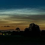
Aurora slightly visible in the heavily light polluted area between Bonn and Cologne, Germany 😍


Team B.L. retweeted

Unbelievable tornado in marginally favourable conditions for strong low-level rotation, but a strong storm zipping south along a pre-existing boundary. Incredible.


Team B.L. retweeted

Red sprites (farfadets) au dessus d'un système orageux très développé, situé en Méditerranée, entre les Baléares et Barcelone, dans la nuit du 03 au 04 octobre 2026.
#orages orages #redsprites #lightning @PlanetarioMad
Team B.L. retweeted

The Akçamezra, Turkey tornado from May 3rd of this year appears to have been upgraded to IF4!
This makes three F4/IF4/EF4 tornadoes this year, two of which have been international.
This is the first recorded official IF4/F4 in the Middle East.

Team B.L. retweeted

The Akçamezra tornado has officially been upgraded to IF4 intensity! This upgrade comes following analysis of extreme tree damage in the Çaybeyi area. This truly anomalous event marks the first violent tornado recorded in the Middle East, thankfully with no fatalities.


Team B.L. retweeted
Voici une vidéo de l'ELVES au dessus d'un orage en Catalogne, filmé le 16 septembre 2026, à 20h55:17 utc, face à Sainte Maxime (Var).
Pour vous représenter le tableau, en largeur l'anneau mesure plusieurs centaines de kms. Cela se déroule entre 80 et 100km au dessus de l'orage.
L'ELVES est un immense anneau de lumière, de couleur rougeâtre, qui s'étend horizontalement dans l'ionosphère, entre 80 et 100 kilomètres d'altitude . Cet anneau s'étend si vite qu'il peut atteindre plus de 200 à 500 kilomètres de diamètre en une fraction de seconde.
Le déclencheur est un éclair puissant qui frappe le sol ou l'océan. Cette décharge électrique soudaine génère instantanément une onde de choc radio-électromagnétique (l'EMP).
L’ELVES est totalement invisible à l'œil nu car il ne dure qu'une fraction de seconde. #ELVES #TLE #redsprites #orage #orages @AEMET_Esp @AEMET_Cat
Team B.L. retweeted

A spectacular lightning barrage along the western Istra Peninsula, Croatia, last night, September 18th, 2026. Slow-moving, isolated storms produced massive CG lightning bolts for several hours.


Team B.L. retweeted

¿Os acordáis de esto? Pues ya teneis un video recopilatorio de todos los sprites que pude grabar esa magnifica noche
Entrad aquí para verlo:
youtu.be/QzXCGIwrGw0?si=Cxxc…


Parecen extraterrestres descendediendo del cielo, pero es ciencia pura
Madrugada del 10 de septiembre. Desde Almería capturé este espectro rojo (Sprite), un fenómeno luminoso que ocurrió sobre una tormenta situada a 200 km en el mar.
Dura milisegundos y ocurre a 80 km de altura. ¡RT para que más gente conozca este fenómeno!
#RedSprites #Meteo #Almeria #Tormenta

Team B.L. retweeted
Srite rojo de la tormenta de Valencia el pasado 17 septiembre
La tormenta la tenía situada a unos 400 km en línea recta. Fue una noche complicada lidiando con las nubes a primera hora. Como curiosidad este sprite pude verlo a simple vista, pero fue rápido y fugaz

Team B.L. retweeted

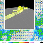
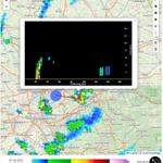
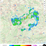
Am 19.08.2026 kam es zum größten jemals in Deutschland dokumentierten #Tornado-Ausbruch: Bislang konnten 16 Tornados bestätigt werden, weitere Verdachtsfälle werden noch aufwendig untersucht. Analysen zu den Fällen folgen noch.
➡️ zum Data Viewer: karte.torkud.de/de/map/data-…

Team B.L. retweeted

Wir haben heute ein geniales Wasserhosen Chasing in Recco bei Genau, Italien erlebt 🌪️🌪️🌪️


