

Founded by Meteorologist Austin Bowling | Daily forecasts for southwest Oklahoma | Formerly of KSWO and WVLT | NC State Meteorology '09
Lawton, OK
Joined June 2016
- Tweets1K
- Following667
- Followers526
- Likes198


Dense Fog Advisory has been extended for Kiowa County, OK until 10:00 AM CST 11/10/26. Visibility may drop to 1/4 mile or less in dense fog, making driving hazardous—use extra caution.

18
Dense Fog Advisory is in effect for Greer and Harmon Counties until 10 AM CST. Visibility may drop to 1/4 mile or less in dense fog, making driving hazardous—use extra caution.

12
Dense Fog Advisory is in effect for Beckham, Washita, and Caddo until 10:00 AM CST. Visibility may drop to 1/4 mile or less in dense fog, making driving hazardous—use extra caution and slow down.

17
Dense Fog Advisory is in effect for Beckham, Washita, Caddo & Others until 11 AM CST today. Visibility may drop below 1 mile in dense fog, making driving hazardous—use extra caution and slow down.

17
Dense Fog Advisory is in effect for Tillman and Comanche Counties until 10 AM CST 11/7/26, with visibility 1/4 mi or less in dense fog. Low visibility may make driving hazardous.

21
Dense Fog Advisory is in effect for Grady and Oklahoma Counties until 10:00 AM CST 11/7/26. Visibility may drop to 1/4 mile or less in dense fog, making driving hazardous.

22
Dense Fog Advisory is in effect for Woods, Greer, Harmon, Jackson, and Kiowa Counties until 10 AM CST this morning. Visibility may drop to 1/4 mile or less in dense fog, making driving hazardous.

22
Dense Fog Advisory is in effect for Beckham, Washita, and Caddo until 10:00 AM CST today. Visibility may drop to 1/4 mile or less in dense fog, making driving hazardous—use extra caution and slow down.

17
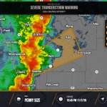
Severe Thunderstorm Warning has been issued for Johnston, Carter, Pontotoc, Marshall and Murray counties in Oklahoma, valid until 10:45 PM CST. Radar-indicated storms may bring 60 mph wind gusts and damage to roofs, siding and trees; move to an interior room on the lowest floor.

27
A Severe Thunderstorm Warning has been issued for Garvin, OK, Murray, OK, Pontotoc, OK. | Max Hail: 0.75 inches, Wind: 60 MPH | Expires Monday, 11/2/26 at 10:45 PM.

28
Severe Thunderstorm Warning has been issued for Carter and Love counties in southern Oklahoma and is in effect from 9:30 PM to 10:15 PM CST. Radar-indicated storms near Rubottom may bring 60 mph wind gusts and hail up to 0.75 inches; move to an interior room on the lowest floor.

83
Severe Thunderstorm Warning has been issued for central Carter County and southern Murray County in southern Oklahoma until 10:15 PM CST. Radar-indicated storms near Milo move NE; expect 60 mph wind gusts and quarter-size hail, with hail and wind damage.

60
A Severe Thunderstorm Warning has been issued for Carter, OK, Jefferson, OK, Love, OK. | Max Hail: 0.75 inches, Wind: 60 MPH | Expires Monday, 11/2/26 at 9:15 PM.

34
A Severe Thunderstorm Warning has been issued for Cleveland, OK, Garvin, OK, McClain, OK, Murray, OK, Pottawatomie, OK. | Max Hail: 1.0 inches, Wind: 60 MPH | Expires Monday, 11/2/26 at 9 PM.

24
Severe Thunderstorm Warning is in effect for Jefferson, OK and Clay, TX through 9:00 PM 11/2/26. Radar-indicated storms near Ryan are producing up to 70 mph wind gusts and 0.75-inch hail, with considerable tree damage possible; move to an interior room on the lowest floor.

31
Severe Thunderstorm Warning has been issued for western Jefferson County in southern Oklahoma and northeastern Clay County in northern Texas, valid from 8:11 PM through 9:00 PM CST. Radar-indicated storms near Petrolia may bring 60 mph wind gusts and hail up to 0.75 inch.

49
Tornado Watch in effect for Carter, OK, Cotton, OK, Garvin, OK & Others until 3 AM CST Tuesday. Tornadoes possible.

36
A Severe Thunderstorm Warning has been issued for Jefferson, OK, Clay, TX. | Max Hail: 1.0 inches, Wind: 60 MPH | Expires Monday, 11/2/26 at 8:30 PM.

17
A Severe Thunderstorm Warning has been issued for Jefferson, OK, Stephens, OK. | Max Hail: 1.0 inches, Wind: 60 MPH | Expires Monday, 11/2/26 at 8:15 PM.

16
