

Stop the widening of US-23 in Ann Arbor!
- Tweets33
- Following6
- Followers78
- Likes3




ALT MDOT slide showing the key points of the "Safely Connecting Communities" alternative; specifically: • Rebuild two lanes in each direction. • Improve to accommodate future transit plans (I-94 to M-17). • Improve the westbound I-94 ramp to northbound US-23. • Rebuild bridges to accommodate multimodal improvements. • Address geometric deficiencies and safety issues. The slide is from https://www.michigan.gov/mdot/-/media/Project/Websites/MDOT/Projects-Studies/Studies/Traffic-and-Environmental-Assessment-Studies/US-23-Ann-Arbor/Local-Advisory-Group-Presentation-May-2024.pdf

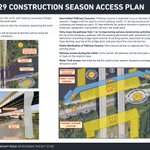
ALT MDOT's plan to build a temporary "floating causeway" in the Huron River as a detour for the B2B trail, taken from https://www.michigan.gov/mdot/-/media/Project/Websites/MDOT/Projects-Studies/Studies/Traffic-and-Environmental-Assessment-Studies/US-23-Ann-Arbor/Recreational-information.pdf


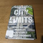
ALT Front cover of "City Limits: Infrastructure, Inequality, and the Future of America's Highways", by Megan Kimble. It's marked as a library book from the Ann Arbor District Library.

ALT A passage from page 119 of City Limits. The relevant paragraph begins: "Traffic models are slippery things, presented as scientific fact when they are actually best guesses, extrapolations of the future from the past. 'A lot of people want to avoid the conversation of what is desirable, and they just say, Well, the number says this, and so we've got to accommodate it,' says Robert Goodspeed, a professor of urban planning at the University of Michigan..." Robert Goodspeed's name and title have been underlined.





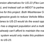
ALT I oppose all three expansion alternatives for US-23 (Flex Lane, HOV Lane, and General-Purpose Lane), and instead call on MDOT to partner with the AAATA to study a transit alternative for this project. Both Washtenaw County and the City of Ann Arbor have set aggressive goals to reduce Vehicle Miles Traveled in the coming years; adding lanes to US-23 would do the exact opposite of this. Furthermore, Michigan has a stagnant population and a multi-billion dollar annual road funding gap - we already can't afford to maintain the roads we have; adding more lane-miles to our system would only make this problem worse! Again, please do not add more lanes to US-23.

ALT Slide 8 from https://a2gov.legistar.com/View.ashx?M=F&ID=12709152&GUID=EA1A4B1D-9EC2-4A8A-A39A-E460C58B8A76, showing a map of the existing B2B trail route and the AAATA Route 3 bus route, indicating how people could take the bus from Gallup Park to Dixboro Rd. in order to bypass a trail closure at US-23.

ALT Slide 5 from https://a2gov.legistar.com/View.ashx?M=F&ID=12709152&GUID=EA1A4B1D-9EC2-4A8A-A39A-E460C58B8A76, which has a picture of the B2B trail underneath the US-23 bridges. Notably, the bridge piers are right up against the trail, which suggests that some construction impacts on the trail will indeed be unavoidable. This slide also contains a lot of text explaining the relevant federal environmental clearance standards for B2B trail impacts, and what actions MDOT has taken so far to study this issue.