VortexWX (@VortexWXMarkets) header
VortexWX (@VortexWXMarkets) profile picture

The first live weather prediction market. Every NWS warning, every county, federal-data resolution. Built by @BmwGaWxChaser

US
Joined April 2026
Photo by VortexWX (@VortexWXMarkets)Photo by VortexWX (@VortexWXMarkets)Photo by VortexWX (@VortexWXMarkets)Photo by VortexWX (@VortexWXMarkets)Photo by VortexWX (@VortexWXMarkets)Photo by VortexWX (@VortexWXMarkets)Photo by VortexWX (@VortexWXMarkets)Photo by VortexWX (@VortexWXMarkets)Photo by VortexWX (@VortexWXMarkets)Photo by VortexWX (@VortexWXMarkets)
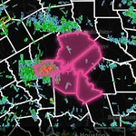
PDS TORNADO WARNING near Windthorst, Texas! Seek shelter IMMEDIATELY if you are in this warning! LIVE: youtube.com/watch?v=bWCyQEHK…
3
27
3
138
12,157
Here are our Key Messages for Sunday (4/26).
29
3
124
20,878
Wildfires fill the skies with smoke over Florida and Georgia this afternoon.
6
77
9
503
74,933
A multi-day stretch of active severe thunderstorm potential is forecast later this week into early next week across parts of the Plains into the Upper Midwest, lower/mid MS Valley, TN Valley, and lower OH Valley. Now is the time to review your severe weather safety plan.
1
75
4
244
22,402
2:38pm CDT #SPC Day3 Outlook Slight Risk: Portions of the Mid-Missouri Valley Vicinity into southern Kansas and northern Oklahoma spc.noaa.gov/products/outloo…
26
136
11,323
MULTI-DAY #TORNADO OUTBREAK POSSIBLE Thursday-Monday from the central and southern Great Plains to Dixie Alley by Monday! This map shows the five days of severe weather threat color coded by day. Thursday we may work the dry line from central KS/NE into Iowa, then settle down into the southern Plains for three days of severe weather and #tornado threat including here in Oklahoma. The #tornado threat expands into Dixie Alley by Monday. Stay tuned as we nail down precise target areas for this uptick of severe weather
36
153
19
1,002
75,862
Severe thunderstorms will be possible from northern Oklahoma into southern Minnesota on Thursday. Large hail to very large hail, damaging winds, and a few tornadoes are possible. Visit weather.gov for updates over the next couple of days.
4
47
3
206
69,770
VortexWX retweeted
Next week's severe weather setup has a pretty solid signal now. A couple of those days could be all hands on deck again for me Here's a short video I made on an interesting tidbit of that setup. Previous Cat 5 typhoon Sinlaku actually is a contributor to potential tornadoes!
8
24
4
357
49,840
SEVERE WEATHER will make a big return on Thursday, with damaging winds, very large hail, and a few tornadoes possible across the Great Plains and Midwest. It's important to stay weather aware, as another active stretch of severe weather is coming!
5
39
5
379
22,150
#WPC_MD 0123 affecting Triangle of Central Texas..., #txwx, wpc.ncep.noaa.gov/metwatch/m…
6
21
5,962
WARNING: Geomagnetic K-index of 5 expected Valid From: 2026 Apr 21 0110 UTC Valid To: 2026 Apr 21 0600 UTC Warning Condition: Persistence NOAA Scale: G1 - Minor Issue Time: 2026 Apr 21 0110 UTC bit.ly/3wVgAKH
3
25
1
112
10,799
the birth of an EF3 - Lake City, Iowa, 7-14-21
5
11
175
4,643
National High/Low temps for Monday April 20, 2026: 99 at Stovepipe Wells, CA; 4 at 17 miles northwest of Lutsen, MN, 9 miles southwest of Big Bay, MI #cawx #mnwx #miwx go.usa.gov/cu5tP
6
22
6,732
VortexWX retweeted
We are really going to have a very big problem in central and north Florida if it doesn't start raining soon. Mid 90s and continued dry weather will just dry the ground out more. Some models are hotter in the long range. Wildfires in the news are probably just starting.
5
8
3
48
9,160
Looking ahead and rainfall anomalies. EPS Euro Ensembles here on tropicaltidbits.com showing where rain is below, normal, and above 'average' the next couple weeks. Front pushing through Florida will linger flat across the Caribbean this week. Adding to the pattern for that area of a cooler and wet past several months. Next week looks like the dry spell continues. Normal, yes for this time of year. Just is more of a bigger story because of the drought many are in.
2
8
2
55
7,337
VortexWX retweeted
A special weather statement has been issued for Everglades FL, Jerome FL and Copeland FL until 4:45 PM EDT
1
1
6
1,313
VortexWX retweeted
A special weather statement has been issued for Cutler Bay FL, South Miami Heights FL and Palmetto Bay FL until 4:45 PM EDT
2
6
1,499
VortexWX retweeted
A game-changing weather data viewing experience. Simple enough for beginners, powerful enough for seasoned veterans: WeatherFront delivers professional weather data to your mobile device with unmatched convenience, accessibility, and customization. Truly your one-stop shop.
3
5
1
53
4,375