

Watching our planet 🌍 from space 🛰 to identify climate change, deforestation & natural disasters. #EarthObservation #ClimateChange #Environment
Unknown Planet🔭
Joined September 2020
- Tweets2.3K
- Following412
- Followers1.8K
- Likes18K




Pinned Tweet
🌋 #HayliGubbi — a once-dormant shield volcano in Ethiopia’s Afar Rift — has exploded to life. Its ash plume soared to 45,000 ft, signaling a rare, high-energy event in a volcano with no known eruptions for millennia.
Visualized: @NASAEarth
🛰 #NASA🌍 #worldview


Uno dei pochissimi video dell'intensa (e rara) eruzione esplosiva avvenuta in #Etiopia poche ore fa. Secondo il VAAC, la colonna eruttiva ha raggiunto una quota di 14 km. Tutti gli indizi portano al vulcano #HayliGubbi, che potrebbe aver prodotto la sua prima eruzione storica.
A dramatic satellite view of the #Mediterranean:
A sweeping #SaharanDust arc intrudes between cloud bands, staining the sea in muted browns. The contrast reveals active #atmospheric dynamics—desert aerosols sculpted by winds🌬 beneath layered clouds. ☁️🟤🌊
✂️Via @NASAEarthData


⚠️Iraq sandstorms: The dual threat of #ClimateChange.
Lack of rain, rising temperatures, drying wetlands & lakes show how environmental collapse knows no borders. What starts at the #Iraq wetlands spreads across the region. #ClimateCrisis #MiddleEast
🛰@eumetsat
✂️@zoom_earth


🛰Meteosat @eumetsat
✂️Visualized @zoom_earth
@PlatformAdam @sheffield_dust @DustStormNews @tomgillpredicts @CIMSS_Satellite @jimmcquaid
Satellite imagery captures a ~255 km pollution plume from Iraq’s Wasit Power Station🏭. Such persistence signals fine PM and reactive gases surviving long-range transport, driving aerosol loading, ecosystem stress, and diffuse health impacts beyond the source—visible from space🛰


No borders, No wars — just peace for everyone on #Earth.🌏🕊
Happy New Year, Earth🎆🎇

#Argentina: A massive power outage hit #BuenosAires and surrounding suburbs late Tuesday, Dec 30. As a heatwave grips the region ahead of #NewYear’s Eve, NASA’s nighttime imagery reveals large areas plunged into darkness across the metro area. 🎄⚡️🌑
✂️Visualized: @NASAEarthData

This #DustStorm has affected southern #Iran, especially #Hormozgan and parts of Sistan–Baluchestan. #Dust from inland sources and offshore transport reduced visibility and #AirQuality across coastal and urban areas. 🌫️
✂️Visualized: @NASAEarthData

This #DustStorm again covers the same SE #Iran🇮🇷 –Makran – Gulf of #Oman🇴🇲 region affected ~2 months ago, with similar or greater intensity. Such repetition points to sustained dry surfaces and recurring wind patterns, not a random or isolated event.#AirQuality #Dust
🛰@NASAEarth


This #DustStorm again covers the same SE #Iran🇮🇷 –Makran – Gulf of #Oman🇴🇲 region affected ~2 months ago, with similar or greater intensity. Such repetition points to sustained dry surfaces and recurring wind patterns, not a random or isolated event.#AirQuality #Dust
🛰@NASAEarth
This #Sentinel-3 satellite image (Nov 4, 2025) captures an intense #DustStorm over SE #Iran, #Pakistan, and the Gulf of Oman. Such widespread plumes are rare but possible in November, likely triggered by strong post-monsoon northeasterlies and persistent regional drought.


Satellite observations show distinct pollution plumes from heavy fuel oil #mazut combustion at major power plants in western and central #Iran.These emissions accumulate over the Tehran–Qom basin, intensifying regional haze and #AirQuality degradation.
#MazutBurning #AirPollution


کیفیت هوای افتضاح در برخی مراکز استان!
ایستگاههای سنجش کیفیت هوا در ساعت ۱۶ سهشنبه ۲دی۱۴۰۳ کیفیت هوای بسیار بد را برای برخی شهرهای بزرگ گزارش داد:
🟣کرج: بسیار ناسالم
🟣اصفهان: بسیار ناسالم
🔴 تهران: ناسالم
🔴 قزوین: ناسالم
🔴 همدان: ناسالم
🔴 شیراز: ناسالم
🔴 ارومیه: ناسالم
🔴 مشهد: ناسالم
🔴 اراک: ناسالم

📹CCTV footage from a supermarket shows the moment a powerful M6.1 #earthquake⚡️hit Taitung City, #Taiwan🇹🇼.
📼: @trtworld
#EarthquakeTaiwan


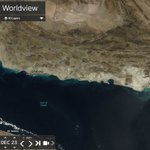
This images, captured by the 🛰#Landsat on December 23, 2025. shows the Sediment and mud, caused by the heavy rains 🌧, can be seen gushing from the Mond River, #Iran 🇮🇷, into #PersianGulf. 🟤🌊
🛰 @eos_da
🌍@EOSDALandViewer
Some drivers seem to treat flash #floods like a casual shortcut. This truck is crossing a flooded road as if gravity and rushing water don’t exist. Hint: they do. Turn back. Find safety. Risking your life for a few meters isn’t brave—it’s foolish.
@WeatherMonitors
It was a close call.🚗🌊In this video, the car crosses a creek just seconds before a flash flood hits. A few meters or seconds later, it could’ve been disastrous. Never underestimate water.⚠️If you see flooding, turn back. Find a safe route. Don’t risk your life.
@WeatherMonitors
This #RedSea dust plume shows how winds reshape storms after they form. #Dust spreads freely over open water, then bends south as steady northerlies take control. The smooth arc highlights #wind steering rather than the dust source itself. 🌬🟤🌊
#AirQuality #DustPlume


It’s interesting how satellites can now photograph each other from space, turning anomalies into visible stories. The satellite staying mostly intact suggests a quiet failure, not a dramatic breakup. Space is harsh, and reentry like this is a normal part of the cycle.

Imagery collected by Vantor’s WorldView-3 satellite about 1 day after the anomaly shows that @starlink Satellite 35956 is largely intact. The 12-cm resolution image was collected over Alaska from 241 km away. We appreciate the rapid response by @vantortech to provide this imagery. Additional data suggest that there is a small number of trackable debris objects from the event, and we expect the satellite and debris to reenter and fully demise within weeks.

Satellite imagery shows #dust from southern Iraq & northern Saudi deserts spreading over the NW #PersianGulf. Coastal southern Iran affected with reduced visibility and hazy conditions as dust layers advect SE over the region.
#AirQuality
Satellite:🛰 2025 Dec 20
@NASAEarthData


Satellite imagery shows an extensive #dust plume originating from southern Iraq & northern Saudi deserts, advected SE by strong NW Shamal winds. Dust covers Kuwait and the NW #PersianGulf, reducing visibility; marine haze evident offshore.
Satellite Data:
🛰@NASAEarthData


