

Your 24/7 source for Minnesota Weather! * https://teapawt.net/t.co/gOGcSRDdi3 * https://teapawt.net/t.co/cR7fFsvQXl
Minnesota
Joined July 2025
- Tweets904
- Following104
- Followers2K
- Likes16





Pinned Tweet
Why dontcha scooch on over to our YouTube channel and hit that subscribe button? And while you’re at it, our website has all the weather info for your neck of the woods.
Links are right here, real handy-like: 👇
🎬 youtube.com/@WeatherLoon?sub…
🌐 weatherloon.com/

🎃🌧️ A FEW RAINDROPS IN THE HALLOWEEN FORECAST! A little rain could continue to dampen parts of Minnesota tonight. Grab an umbrella along with those costumes! 👻🍬

Happy Halloween! Forecast for today calls for showers, more impactful rain settles in to kick off the new workweek. #mnwx
A few showers look possible for the weekend with a mild and partly cloudy Sunday on tap. We get a bit of déjà vu with the storm system early next week as strong breezes warm us up to unseasonable levels along with more rain and some storms Monday into Tuesday.

This year is the 35th Anniversary of the famous 1991 Halloween Blizzard that brough nearly 30" of snow to the Twin Cities. Meteorologist Todd Nelson takes a look back at the historic event and why many snow records still stand today. f.mtr.cool/h3pfo11zx0

A few isolated to scattered showers are possible on Halloween. I wouldn't worry about them too much with generally light amounts favored. If you do see them, they probably won't last too long.

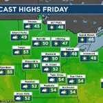
Friday: Dry with passing clouds. We got highs in the 40s and 50s. #Weatherloon #mnwx

Friday is a nice fall day across Minnesota with highs mainly in the 50s to 40s in the north. On Halloween, it won't be a state-wide washout, but we will have "pockets of annoyances" with the rain. Should you see these isolated showers, the rainfall amounts won't be very high.


6:15 PM - One line of storms that had a history of producing funnel clouds, along with large hail and some wind damage, has tracked into Wisconsin, while another line of storms and heavy rain tracks east from Plymouth to North Branch. Tornado Watch still in effect through 9 PM.
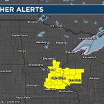
3:50 PM 10/28/26: A Tornado Watch has just been issued across eastern Minnesota and western Wisconsin, including the Twin Cities metro, through 9 PM. Storms are starting to form west of the metro that we will need to keep an eye on for tornadoes, hail, and wind. #mnwx


Risk of isolated to scattered severe storms later today. Primary risk will be tornado potential. Strong tornado possible. #Weatherloon #mnwx

Paul’s "evil twin" Doug snuck into the office and hijacked today's special Halloween Weather Hot Dish! 🍲👀
Who did it better, Paul or Doug? Watch here: youtu.be/dRLkK8So1do

Tuesday: Still watching some chances of passing rain showers today. #Weatherloon #mnwx

SNOW!! South Dakota DOT cameras are picking up snow in western South Dakota today. MSP typically averages its first measurable snowfall (0.01") around November 6th. Last year it was late (11/25), but in 2023 and 2024 MSP saw the first measurable snow right around Halloween!


Monday - timing some rain showers today. Highs 40s to some low 50s. #Weatherloon #mnwx

Saturday marks the 148th day this year the Twin Cities have measured a high of 70° or higher, which is the 5th most on record. 4 of the top 5 have happened since 2016. #WeatherLoon #mnwx

Much cooler temperatures expected today following yesterdays cold front. Scattered showers are expected today but a stronger system will bring more widespread rain on Monday. #mnwx
Mild temperatures for Saturday but we get a reality check Sunday as high temps will top out in the 50s.

Happy Saturday! Outdoor plans this afternoon could be interrupted by some scattered shower activity. #mnwx
Friday: Very warm. Breezy to windy. Chance of passing rain showers. #Weatherloon #mnwx
