

Meteorologist based in upstate New York | Husband | Dad | M.S., geosciences @msstate | B.S., meteorology @sunyoswego | Country music fan
Oneonta, NY
Joined November 2008
- Tweets37.4K
- Following4.8K
- Followers3.6K
- Likes32.7K







Record warmth today will make it feel like August. Get out and enjoy before it gets dark at 4 p.m.! #NYwx
Temperatures today will get into the 70s with morning sunshine. Clouds increase late this afternoon ahead of a front approaching the region that will bring some rain showers overnight. Rainfall amounts tonight will be light, largely less than a tenth of an inch.

ALT Image with two graphics depicting todays high temperatures and the chances of precipitation overnight.
🔥 HALLOWEEN SCORCHER?
Many parts of the Northeast will enjoy temperatures in the 60s and 70s next Saturday for Halloween. High pressure will also continue to dominate for the foreseeable future – there are no indications of any notable rainfall until the first week of November.


Severe thunderstorms are possible this afternoon in the southern tier of New York and the Hudson Valley as a cold front sweeps across the state. Damaging winds are main threat. An isolated tornado is possible to the south in Pennsylvania. #NYwx

Late-evening temperatures in the 60s and 70s would be a warm night in August, let alone mid-October.
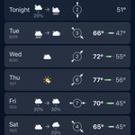
These are the warmest temperatures we’ll see for the rest of the year. By Saturday morning, many places in upstate NY could see their first non-accumulating snow of the season.


Lingering clouds and showers from the nor’easter bring a damp start to the workweek today, but high pressure returns Tuesday and lingers for much of the week ahead. As the calendar flips to October, central New York will enjoy one last taste of summer before fall-like air returns


Severe thunderstorms are possible across central New York this evening. #NYwx


Tornado Watch for all of western New York and most of central New York until 11 p.m. #NYwx
A tornado watch has been issued for parts of New York until 11 PM EDT

ALT This graphic displays Tornado Watch watch number 645 plotted on a map. The watch is in effect until 11:00 PM EDT. The watch includes parts of New York. The threats associated with this watch are a couple strong tornadoes possible, scattered hail up to two inch size possible and scattered gusts up to 70 mph likely. There are 4,436,185 people in the watch along with 1323 schools and 71 hospitals.
Multiple rounds of thunderstorms are expected across central New York today and Wednesday. However, the highest severe weather threat will be in the southern tier today and in the Finger Lakes on Wednesday. #NYwx


Aug-tober? Upstate New York can’t be even escape cold weather in the summer. #NYwx

Severe Thunderstorm Watch posted for central and upstate New York until 9 p.m. this evening. #NYwx

In a strange coincidence, the next tropical storm or hurricane to form in the Atlantic will be named Dolly. The National Hurricane Center has a given a tropical disturbance in the eastern Atlantic a high chance of development in the next two days.
Dolly has been used in the naming rotation for Atlantic tropical cyclones since 1996. It replaced the name Diana, which was retired in 1990. These naming lists are reused every six years, with any retired names replaced with new names. #Dolly – at Oneonta, NY


It’s August 25 and lake-effect season has already begun in upstate New York. Luckily, it’s lake-effect rain, but we’re only two months away from when it could theoretically become lake-effect snow. #NYwx

An October-like afternoon across the southern tier and southern valleys of central New York. A steady light rain has caused temps to fall to near 60. Northern areas of central New York escaped the rain today and remain closer to 70. #NYwx

Dog days of August? Not in New York. Our 90-degree days are over until 2027. #NYwx
