

I love life and weather and volcanoes and news too and I live in SoCal. Also do Apple news too
Southern California
Joined October 2020
- Tweets13.6K
- Following182
- Followers315
- Likes12.7K




ZoomCenter retweeted

As of 2pm PDT Saturday, “Karina” is now a strong tropical storm with sustained winds of 70mph -
The system WILL become a hurricane this evening and is forecast to rapidly strengthen into a major-category 3 storm by Monday morning.
Although the system is forecast to track well off the coast of Baja, Southern California will see another significant bump in swell action as well as more humidly and likely precipitation next week..
More updates coming-
#Karina
#CaWX

ZoomCenter retweeted

The heat remains locked in through Friday. An addition to the story is a low chance but potentially impactful shower/thunderstorm situation for Thursday-Friday, associated with moisture from decayed Tropical Storm Iselle. Stay cool and weather aware this week. #cawx

ALT Head indoors if you…see lightning, hear thunder, or experience accelerating winds.
ZoomCenter retweeted

🔔#Earthquake (#sismo) M2.0 strikes 29 km NW of #Mexicali (#Mexico) 2 min ago. More info: m.emsc.eu/?id=2030960
ZoomCenter retweeted

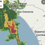
The leading edge of what will be one of the most pro longed Monsoon threats we've seen in a few years(10+ consecutive days) is moving across the Border near San Diego currently. The lower levels are still dry but some light rain and dry lightning strikes look likely from Dowtown southward to the border. An Easterly Wave/Cluster of strong Thunderstorms can also bee seen moving north eastward torwards the CA/AZ border from Mexico and could produce so lightning and Haboobs from Indio to the AZ border tonight. Scattered Thunderstorms, some possibly Severe will impact much of SoCal each day of the upcoming week. Could even see some favorable conditions for Tornados over our low deserts at some point!
#CAwx #Thunderstorms #Monsoon #SanDiego #Rain #PalmSprings

ZoomCenter retweeted

Friday, July 10, 2026 3:06 PM: Latest 0Z EU1 shows multiple inverted robust easterly wave troughs starting Sunday 4PM to Thursday 7PM. Bring moderate to strong monsoonal thunderstorms to Phoenix, Arizona, and all deserts of Southern California, and to mountain, valley, and coastal zones from Pismo Beach to San Diego.
Isolated severe storms for Southern Arizona, such as Tucson, and western Arizona, and this also includes Southern Nevada for Las Vegas too. Possible flash flooding likely.
Rainfall amounts are also trending heavier due to tropical tap from origins of Acapulco to El Salvador July 12 - 17, 2026. The humidty values begin to increase Sunday at 1 PM, 55% to 70% relative humidity, and 64F - 71F dew points will significantly increase Monday, July 13 - 16, 2026. In addition precipable water of 1.5 in - 2.2 in creates a monsoonal surge even as far as Northern California, San Francisco Bay, the San Joaquin Valley, and the northern Sierras, which will also affect Reno, Nevada, and southern Oregon, and let’s not forget Utah and Idaho.
These storms are a mixture of heavy, tropical rainfall or dry lightning; not all storms will be producing rain, but you need to be aware of ones that do, which could cause sudden haboo or microbursts. #CAwx #AZwx #UTwx #Monsoon #ElNino

ZoomCenter retweeted

Summer heat for #SoCal this week, with only slight cooling during the weekend.
By Sunday, Southeasterly flow aloft will transport Monsoonal moisture into the Southwest, bringing a chance for Showers/Thunderstorms to Mts & Deserts. Any disturbances embedded in this flow could trigger storms West of the Mountains. Something to keep an eye on. #CAwx
ZoomCenter retweeted

After a HOT mostly dry weeek in the southwest, monsoon moisture with showers and t-storms return to the southwest USA. You can really see the flip flop by late weekend. The true monsoon finally gets here this weekend.
ZoomCenter retweeted
Friday, July 3, 2026, 8:12 AM: The latest satellite shows the continued northward trajectory of the remnants of Douglas, which will start bringing high mid-level clouds now on the Fourth of July and July 5, 2026. There is continued possibility of multiple embedded disturbances affecting Santa Barbara, Ventura, Los Angeles, Orange, and San Diego counties. There chance of elevated instability, which is not a non-zero chance of showers or thunderstorms for our region within the next 24 - 36 hours. #CAwx #hurricaneseason #Douglas #ElNino
ZoomCenter retweeted
Thursday, June 2, 2026 6:42 PM: The latest water vapor satellite shows Douglas' outer fringes of remnant moisture continue to move toward Southern California in the next 24 - 72 hours. At this point in time, the main center of the tropical system low axis will not hit land.
However, the latest EU1 and GFS 0Z show elevated convection is possible for our region not out of the question this Saturday 3PM - Sunday 7PM. #CAwx #Douglas #hurricaneseason #ElNino
ZoomCenter retweeted
More mid level moisture getting more traction now there’s two impulses now. Looks interesting by Tuesday night after 8PM- Wednesday 6:45 AM. ☔🫠
ZoomCenter retweeted
Saturday, June 20, 2026, 5:48 PM PDT/8:48 PM EDT: Latest water vapor satellite shows the intensifying eastern Pacific series of thunderstorms from Acapulco to El Salvador continues to develop over the last 24 hours.
I’m going to be watching this area very closely in the next week and a half as this will become the prime focus to watch out this evolves and transports moisture up into Southern California, Arizona, Nevada, and New Mexico, including Utah.
The first wave of moisture I’m watching is June 24 - 27, 2026, for an Easterly wave and heatwave associated with embedded convection, possibly bringing monsoonal thunderstorms to Las Vegas, Nevada, and parts of Southern California as early as this upcoming week.
Then a more organized batch of storms will continue to develop over the warming of the Pacific and the strengthening of El Niño, allowing for more tropical activity to emerge in this region. Favorable tropical development continues to trend, which is concerning for the latest EU1 solutions on tropical activity for July 1 - 4, 2026. This is an evolving situation that continues to be looked at very closely to see how much tropical intensity actually occurs. #CAwx #AZwx #NVwx #Monsoon #hurricaneseason #ElNiño

ZoomCenter retweeted
🔔#Earthquake (#lindol) M3.1 strikes 73 km NW of #Alaminos (#Philippines) 14 min ago. More info: m.emsc.eu/?id=2014135
ZoomCenter retweeted
Friday, June 19, 2026, 6:29 AM PDT/9:29 AM EDT: The latest solutions of 0Z, 6Z, and EU1 have not changed in the last 4 days at all! In fact, now continues to show higher confidence in the northward trajectory of tropical interaction July 1 - 5, 2026, and possible monsoonal moisture June 24 - 27, 2026, with a 594 DM heat dome axis that will bring a heatwave to all of California, Arizona, New Mexico, and Nevada, which continues the trend as well sadly.
Projected Temperatures 104F - 115F with high humidty values above 45% to 69%, especially from San Joaquin, San Fernando, Santa Clarita, Simi, Moreno Valley, Antelope, Apple, Lucerne, Coachella, Imperial Valleys to Phoenix, Arizona, could allow for possible excessive heat, watches, or excessive heat warnings are not out of the question. Many residents are not prepared for the sudden shift from extremely cool temperatures to extremely oppressive heat and humidity in less than a week, possibly followed by tropical weather for your July 4 weekend.
I’m continuing to monitor this fast-evolving heat wave situation and the now tropical system for July 1 - 5, 2026, which continues to trend.
• First Summer Heatwave and Monsoonal moisture trending June 24 - 27, 2026
• Rare Tropical interaction July 1 - 5, 2026
#CAwx #AZwx #NVwx #Heatwave #Monsoon #Hurricaneseason #ElNino

ZoomCenter retweeted
Thursday June 18, 2026 3:25 PM PDT/ 6:25PM EDT: Latest 12Z and EU1 have an even deeper confidence continuous,
tele connection, moisture from possible tropical system into Southern California, Arizona and Las Vegas July 1- 4, 2026 gaining momentum now, three days consistency if it continues at this rate for the next 96 hours continue to monitor this developing weather situation for the holiday forecast. #CAwx #hurricaneseason #monsoon #ElNino


ZoomCenter retweeted
Tuesday, June 16, 2026, 5:43 PM: Latest 18Z and EU1 shows possibly the next named storm in the eastern Pacific has teleconnecting moisture into Southern California, Arizona, and southern Nevada around July 1 - 4, 2026. This is the first official run of this potential system.
More details will come to play in the next week or so to see if this continues to trend with the favorability of an increase in eastern Pacific hurricane activity due to El Niño, intensifying something to keep an eye on as atmospheric trends kick into gear. #Hurricaneseason #CAwx #ElNiño
ZoomCenter retweeted
🔔#Earthquake (#sismo) M2.2 strikes 10 mi N of El Centro (#California) 2 min ago. More info: m.emsc.eu/?id=2012022
ZoomCenter retweeted
🔔#Earthquake (#sismo) M2.5 strikes 10 mi N of El Centro (#California) 4 min ago. More info: m.emsc.eu/?id=2012023
ZoomCenter retweeted

3.6 mag - 10 km SW of Niland, CA @ 20:27 on 06/14/26 earthquake.usgs.gov/earthqua…
ZoomCenter retweeted

Ongoing earthquake swarm at the #Bardarbunga Volcano in Iceland following a strong 4.8 Earthquake in the area earlier. There are no indications of an eruption happening anytime soon.
