





Cat Wardell retweeted

Different types of maps reveal different characteristics. The #CliffReefs expedition is examining substrates & ecosystems around the #Galápagos, mapping them with both light+sound, hoping to explore new areas and study them in fine detail. Full video: schmidtocean.org/cruise-log-…
1/2
Cat Wardell retweeted

Read our new interdisciplinary paper to understand how internal tides influence canyon fauna distributions #cwcs #deepsea #internaltides
doi.org/10.3389/fmars.2023.1…

Cat Wardell retweeted

If you’d like to hear me talk about the #HungaVolcano #eruption #volcanoes and marine #geohazards in general then check out this @NOCnews podcast. The work of so many people so poorly credited by me but, as ever, we couldn’t do this work without all our incredible collaborators. – at Bang Lamphu Lang, Thailand

🌋 NEW PODCAST 🌋
On the latest episode of #NOCIntoTheBlue Dr Izzy Yeo covers some of the biggest marine geohazards, and discusses the devastating local and global impacts of the 2021 Tonga eruption.
Listen now 🎙️ pod.link/1634390689/episode/…
Watch now 📺 youtu.be/oVrGkin7OiY

ALT Dr Izzy Yeo on NOC Into the Blue Podcast
Cat Wardell retweeted

NOC Scientists have embarked on a month-long research expedition that seeks to reduce risk of extracting metals on the sea floor. ⛏️
Find out more about the SMARTEX project and the aims of the expedition here ➡️ noc.ac.uk/news/new-expeditio…
#smartexccz

ALT Isis ROV in the water
A descent to the abyss for a #multibeamsurvey at the #SmartexCCZ using the #ROVIsis to map the seabed collector test location. Wish us luck and lots of coffee as we’ll be flying at 50m so no cucumber sightings! @NOCnews @NHM_Science @BritGeoSurvey
Women assemble! Great to spend #WomenInScienceDay with these awesome women exploring the #SMARTEXCCZ on the #RRSJamesCook @NOCnews @NHM_London @NHM_Science @BritGeoSurvey

Farewell #WhittardCanyon on #JC237.
We see your ‘number of deployments = number of recoveries’ @Alphillips200 on #DY152 and raise you 2 recoveries!!! @NOCnews @CLASS_UKRI @iAtlanticEU #oceanrobots


Cat Wardell retweeted

Exploring life in the Porcupine abyssal plane at 4800 m water depth onboard of the RRS James Cook #jc237 @OGS_IT @CLASS_UKRI @iAtlanticEU @NOCnews @JNCC_UK
Small, medium or large? We have 3 options to core on #JC237. The #ROVIsis takes short pushcores using live camera footage whilst the larger mega and gravity cores penetrate deeper into the sediment. @BGSMarineGeo @NOCnews @iAtlanticEU @CLASS_UKRI


Drilling for rock samples in the #WhittardCanyon to groundtruth the #ROVIsis footage so we can understand species preference for rock type. @NOCnews @CLASS_UKRI @iAtlanticEU @JNCC_UK
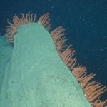
Some basket stars giving this rock ledge a lovely framed haircut at 1900m depth in Explorer Canyon. Caught on camera by the #ROVIsis, wish us safe piloting tonight!@NOCnews @CLASS_UKRI @iAtlanticEU @JNCC_UK

Cat Wardell retweeted

Interested in benthic ecosystems like this?
Help us record the biodiversity in seafloor photographs of the Clarion Clipperton Zone.
Two great job opportunities @NOCnews.
Help understand the effects of #DeepSeaMining
Be a Benthic Megafaunal Annotator careers.noc.ac.uk/vacancy/be…

We’re off! To the depths of the eastern branch of the #WhittardCanyon with our camera and claw equipped ROV to look at coral walls, avalanche deposits and the distribution of organic carbon and plastics in canyons @NOCnews @CLASS_UKRI @iAtlanticEU @JNCC_UK
New #Autosub5 multibeam data at 4000m in the #WhittardCanyon marine protected area. Submarine canyons often support increased diversity in habitats and species. AUVs allow us to map these deep areas in high resolution! @NOCnews @CLASS_UKRI @iAtlanticEU @NERCscience #oceanrobots
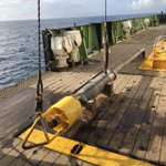
Going to the deep! Bathysnap, a time lapse camera for deep seas (4000m), has been released from the #RRSDiscovery on #DY152. We will collect it in a month from the #RRSJamesCook on #JC237. @CLASS_UKRI @NERCscience #SMARTEX @NOCnews
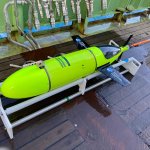
Extreme fishing! The #BoatyMcBoatface recovery team attaches a hook with a rope onto the #ALR3 with a very (very) long pole. She is then winched safely onboard and charged for her next mission! @NOCnews @CLASS_UKRI @NERCscience @iAtlanticEU

What a team! Putting #BoatyMcBoatface #ALR3 to bed after a camera survey at #HaigFras marine protected area with the #BioCAM 3D visual imaging technology for mapping the seabed @UoSEngineering @NOCnews @NERCscience @CLASS_UKRI @iAtlanticEU


Sidescan sonar data of the rock striations at #HaigFras marine protected area from the #Autosub5. Repeat surveys of this MPA allow us to assess its evolution over time. @CLASS_UKRI @NOCnews @iAtlanticEU @NERCscience #oceanrobots

Any guesses for what sea creatures we’ll see on the #Autosub5 camera survey in #HaigFras marine protected area? I’m afraid no prizes as we’re 95km off the UK coast and are eating all available chocolate @NOCnews @CLASS_UKRI @NERCscience @iAtlanticEU #oceanrobots
Home safe to the #RRSDiscovery after a sidescan sonar data mission in the #HaigFras marine protected area. This data helps determine the seabed substrate type which is then used to make habitat maps. @CLASS_UKRI @NOCnews @iAtlanticEU @NERCscience
