

KCTV Meteorologist ⛈️, NC State Grad 🐺, Baltimore sports fan 🔸🟣
Kansas City, MO
Joined July 2021
- Tweets6.4K
- Following506
- Followers868
- Likes23.1K




A Frost Advisory is posted for spots south of Kansas City & I-70 midnight tonight through 8 am Saturday morning. With the chance of some patchy fog to the south as well, freezing fog can’t be ruled out. However, we warm up quickly tomorrow, with high temps being 10 degrees or more warmer in the mid-60s. There’s a better chance for fog in the KC metro Monday morning.
#fog #frost #freeze


With the retirement of several models being replaced by the RRFS (Rapid Refresh Forecast System), including the NAM, here's a look at how far we've come in our weather models!
Weather models have a shelf life of 10 to 20+ years & get replaced to modernize &/or consolidate other models. This helps improve the model's level of detail, data capacity, accuracy, & to integrate new data into the system.

It's been a super warm fall here in Kansas City!
Since the start of September, Kansas City has had the 8th warmest average highs & tied for the 2nd warmest average lows at KMCI. Data goes back to 1888.

The Kansas City International Airport has broken a daily record for rainfall picking up just over 2 inches since midnight Tuesday November 3rd. In fact, we’ve picked up more rainfall since last night than we normally do during the entire month of November!
We could add on to those totals through this afternoon, as scattered downpours will linger in the region through about 5 or 6 pm.
#kansascity #rain #record


It appears we're going to get a lull from the severe weather for much of the evening!
The most impactful action will be around midnight, where the current batch of storms around Wichita is expected bulldoze through with strong winds & possibly embedded tornadoes.


The tornado risk has been upgraded for late this Monday afternoon through this evening.
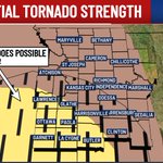
Stronger EF-2-level tornadoes are possible. If tornadoes were to occur, they likely won't be on the ground for long, but could spin up very quickly! The best chances for tornadoes will be towards the southwest.

Radar update 4:25 pm
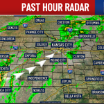
General scattered storms & downpours are moving through the metro. We'll continue to have stormy rounds all the way through the overnight hours, with the severe & flood threat ramping up.

Our storm and severe threat will begin to ramp up later this afternoon into your Monday evening. New data is showing consistent rounds of strong to severe storms alongside heavy rain by around 5 pm through the overnight hours. This will also produce a flood threat for the region alongside the severe wind & tornado risk.
#severeweather #tornado #storms #flooding #kansascity


Alongside the severe threat, the flood threat is also very real tomorrow.
The 3-4"+ rainfall swath, wherever that sets up, will have a sizeable flood risk Monday evening into the night.

A First Warn Weather Day, our top weather designation, is in place to start the week on Monday.
You’ll need to be on the lookout for rounds of downpours, strong winds throughout the day, and a severe & flood threat that’ll emerge by the evening.
#severeweather #storms #flood #tornado #kansascity


Arguably our best day of the next 7 is tomorrow (Sunday)! The worst, the next day on Monday...
Monday will features rounds of rain & storms, especially later in the day, gusty non-storm winds, as well as severe threat by the evening. Low-end flooding is also possible in some localized spots.


We fall back tonight (2am November 1st)! ⏰
The positives:
- Sunrise is now an hour earlier 🌅
- You gain an hour of sleep 😴
The negative:
- Sunset is an hour earlier 🌜
#daylightsaving #fallback


We’ll have “hit & miss” rain showers this evening for trick-or-treating! Be prepared to bring a rain jacket. ☔️🎃

Friday 5pm radar. ⛈️
Rounds of rain & rumbles moving in. This evening & night will feature rounds of heavy downpours.

Not looking too bad for Halloween

- Watch for scattered storms for your Friday evening plans
- Halloween brings off/on light rain mixed with dry hours. Many plans will be OK, but be flexible. Light rain is possible during trick ‘r treating. No storms or anything heavy
- Sunday is the pick weekend day
- Heavy rain Monday with strong storms possible
- Election Day sees lingering rain. Consider voting early in a drier stretch. There’s a decent chance of being stuck in a voting line stretched outside on Tuesday while it’s raining
#kcwx #kswx #mowx
@KCTV5


Tracking two storm chances here over the next 24 hours.
1. Thursday night through the morning
2. Friday afternoon & evening
Both rounds could be noisy, with scattered heavy downpours, some small hail, & gusty winds.


We have a lot of great events in & around Kansas City on & leading up to Halloween! 🎃
Temperatures look great, but we have to look out for some rain chances. ☔️
#halloween #forecast


