

Dickinson County (Iowa) Emergency Management 🎒 Prepare 🚔 Respond 🛠️ Recover 🤝 Mitigate
- Tweets16.6K
- Following107
- Followers1K
- Likes162


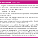




ALT WATCH = Conditions are favorable for a severe winter storm. WARNING = A severe winter storm is happening or imminent. ADVISORY = Winter weather is imminent and may cause minor inconveniences. It's important to know the terms ahead of the season. #IAwx #NEwx

ALT Today is Iowa & Nebraska Winter Weather Awareness Day! ❄️ Stay tuned throughout the day as we share tips on surviving the cold, navigating blizzards, and prepping your home & car for the months ahead. Let's start the journey here: http://storymaps.arcgis.com/stories/cac5ee84cb4d44669292c401ee31f4bc #IAwx #NEwx

ALT This graphic shows the grassland fire danger index for Friday and the max 3-hourly wind gusts for select cities.

ALT We'll stay warm and windy into Saturday, but big changes are on the way for next week as widespread rain arrives by Sunday. High winds on Friday will lead to very high fire concerns, especially for those working in the farm fields.

ALT Winds slowly increase today, but are expected to gust to 30 to 45 mph on Friday. Those working outside or in farm fields should use extreme caution as any spark may cause a fire to spread quickly.


ALT Excessive rainfall outlook for later Saturday night into Sunday.

ALT This graphic displays Severe Thunderstorm watch number 640 plotted on a map. The watch is in effect until 5:00 AM CDT. The watch includes parts of Iowa, Minnesota, Nebraska and South Dakota. The threats associated with this watch are a couple tornadoes possible, scattered hail up to two inch size possible and scattered gusts up to 75 mph likely. There are 667,111 people in the watch along with 417 schools and 39 hospitals.

ALT Here's a look at the hazard risks later this evening and overnight. Hail: 2" or larger Winds: Up to 70 mph Tornadoes: Possible. The primary time we may be impacted is 6pm to 1am

ALT This graphic displays Severe Thunderstorm watch number 597 plotted on a map. The watch is in effect until 12:00 AM CDT. The watch includes parts of Iowa and Minnesota. The threats associated with this watch are no tornadoes expected, scattered hail up to two inch size possible and scattered gusts up to 70 mph possible. There are 496,998 people in the watch along with 310 schools and 31 hospitals.

ALT Tonight's severe storm risks.

ALT Graphic displaying the Severe Thunderstorm Outlook for Monday evening through Tuesday morning. There is an Enhanced Risk (level 3 of 5) for severe storms across much of the area, mainly for wind gusts up to 75 mph overnight, but also some 2 inch diameter hail and perhaps an embedded tornado during the evening. Have multiple methods to receive possible warnings, and know where safe shelter is located.