


michael retweeted

BREAKING UPDATE: I have just learned from Acting Mayor @McKelvieTO that working with Councillor @DianneSaxe, they brought forward a motion that has been approved for staff to negotiate with two donors who have come forward to fully fund the costs of initiating and undertaking a Municipal Class Environmental Assessment, Preliminary Design, and related studies for advancing University Park. This happened during the election campaign. VERY EXCITING! Good things are happening!
Thank you @McKelvieTO and @DianneSaxe for your leadership on this.

As part of our downtown plan when I was Chief Planner, we proposed 9.5 acres of new park - by transforming University Ave. Low cost, high impact. The community + the @globeandmail championed it. City Hall? Crickets. Will @oliviachow run with it? It needs a political champion.

michael retweeted

Exactly a week away! Purchase your tickets if you haven't already! alumni.utoronto.ca/spring-so…

michael retweeted

Check out this free #GeoDev webinar on Aug 24: Integrating Deep Learning with #ArcGIS using Python p.ctx.ly/r/88ue

michael retweeted
The #Esri/ISI university student competition aims to foster research in #GIS and statistics, inspire curiosity, and encourage spatial thinking. Application deadline is November 30, 2018 p.ctx.ly/r/8cta

michael retweeted

NASA debuts online toolkit to promote commercial use of satellite data geospatialworld.net/news/nas… via @geoworldmedia
michael retweeted

Free learning plan: Fundamentals of #Mapping & Visualization. Courses cover #ArcGISPro symbology, labeling & #3D tools. go.esri.com/mapping-plan

michael retweeted

We offer courses in #geospatial programming & #webmapping, #GEOINT, #remotesensing, and #GIS applications. Learn more about the diversity of our course options here: bit.ly/2mnO9xu

michael retweeted
ICYMI: We now offer a graduate certificate in #geospatial programming & #webmapping. More info here: gis.e-education.psu.edu/geow… & email [email protected] w/ questions.
#python #javascript #mapbox #css


michael retweeted

#GIS can help plan, manage & grow #intelligent #transportation systems that are fast, reliable & cost-effective. youtu.be/_QsVSlmdfjU

michael retweeted

Hexagon Safety & Infrastructure Supports Zurich’s Public Transportation Network owl.li/K92430g0FMv


michael retweeted

#GIS #Spatialanalysis #Health #Transportation Submit an abstract to present: ow.ly/r8q630ejMFL #GISEd2017

michael retweeted

Great conference and latest intel on using spatial analysis in #transit planning #TransitGIS2017 Thx @URISA NCTR & TRB! #GIS #transportation

michael retweeted

Find out how #GIS helped #Washington DC's Department of Transportation increase their revenue p.ctx.ly/r/5i14 #Tech


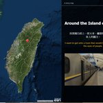
This story map is about a Taiwanese who decided to travel around Taiwan to find inner peace. arcg.is/2a8gVOo
