

The #history and #geography of #languages, #alphabets, and #writing systems; #Indigenous and minority languages; #language families; #linguistics; #toponyms
- Tweets2.6K
- Following15
- Followers922
- Likes2.7K




ALT A map showing the location of the Yugorsky Peninsula in Russia: west of the Yamal Peninsula and to the southeast of the islands Novaya Zemlya and Vaygach.

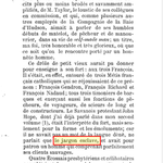
ALT The stone bears three crosses. An inscription in early Cyrillic at the lower right reads: 'In the name of the Father and the Son and the Holy Spirit, I, Samuel, servant of God, made a memory of my father, of my mother and of my brother on these crosses. Here are the names of the deceased: Nikolas, servant of God, Ripsimia and David. Written in the year 6501 since Creation, VI indiction.'

ALT 1845 sketch of the Icelandic poet Jonas Hallgrímsson by Déssington.

ALT A map of Novaya Zemlya, showing the location of the Matochkin Strait, which connects the Barents Sea in the west with the Kara Sea in the east.

ALT Part of the Madrid Skylitzes, an illustrated history by 11th-century Greek historian John Skylitzes. The brightly-coloured illustration shows mounted Bulgarian forces under Samuel ambushing Duke Gregorios Taronites of Thessaloniki.


ALT A portrait of Vuk Stefanovic Karadzic

ALT A 1606 map of the Arctic region by Gerard Mercator and Jodocus Hondius. The Kara Sea is labelled 'Oceanus Scythicus qui et Mare Tabin'. The Pechora Sea appears as Petzorke Mare, and the Barents Sea as Myrmanskoi Mare (Murman Sea: see earlier in this thread for explanation). The Arctic Ocean is labelled both Mare Glaciale and Oceanus Septentrionalis.

ALT The first page of Aleksis Kivi's 1870 novel Seven Brothers, illustrated in 1908 by Akseli Gallen-Kallela. The text is written in a blackletter script that was common in parts of northern Europe into the 20th century. The illustration shows seven figures in silhouette.

ALT "Leiv Eiriksson discovers North America", 1893 painting by Norwegian artist Christian Krohg.

ALT Hunminjeongeum, a Chinese-language document published in 1446 by King Sejong the Great, the fourth king of the Joseon dynasty of Korea.

ALT A 1541 painting of Saint Jerome in his study by Dutch Renaissance painter Marinus van Reymerswale.

ALT The top of folio 166r of the Madrid Skylitzes, an illustrated history by 11th-century Greek historian John Skylitzes. The brightly-coloured illustration shows the Byzantine forces of Emperor John I Tzimiskes attacking the Bulgarian capital Preslav. Mounted cavalry and archers are shown, as well as swordsmen scaling the city walls on ladders. Three men appear to be operating a trebuchet.

ALT A satellite map showing most of Europe and parts of North Africa and southwest Asia. Greenland, Russia, and Georgia are partially visible. Svalbard, Jan Mayen, Armenia, and Azerbaijan are mostly or wholly beyond the edges of this map.

ALT A 2005 map of Kyrgyzstan.

ALT A portrait of ethnographer, philologist, and historian Yuriy Venelin, born Georgiy Hutsa in a Rusynian village in the Kingdom of Hungary.

ALT Map showing the Ryukyu Islands of southern Japan.

ALT 2006 map of India

ALT A map of north-central Russia showing the location of the Kara Sea to the east of the Novaya Zemlya archipelago.

ALT A leaf from the Codex Suprasliensis, showing Cyrillic text and sketches of a man and a woman.


ALT A map of Russia's Franz Josef Land, which is the northernmost land in Eurasia. Markham Sound is located near the centre of the archipelago. The Austrian Strait separates the easternmost islands, including Wilczek Land and La Ronciere Island, from the rest of the archipelago.