

Christ is King 👑 @WISH_TV @StormTrack8 Meteorologist. Hoosier born & raised. Devoted husband & father- Colts/Pacers fan. @BallState Alum
Indianapolis, IN
Joined December 2008
- Tweets34.9K
- Following2.7K
- Followers6.1K
- Likes12.3K
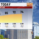


MONDAY - Another beauty today - highs in the mid 70s for the 7th day in a row. Many more to come this week. Changes coming in Saturday/Sunday as rain a cooler temps settle in to open Nov.
#INwx


FRIDAY - Another beauty on tap today. Lunch time temps hit the mid 60s, and highs hit the lower 70s later this afternoon!
#INwx

THURSDAY - Stop me if you have heard this before. Crisp and quiet this morning - sunny and warm later this afternoon with highs in the low 70s!
#INwx


FALL COLORS - We're approaching peak colors in teh Midwest - not quite there yet. High colors are noted in northern parts of the Plains, the upper Great Lakes, and the New England states.
Map courtesy: Explorefall.com
#INwx


MONDAY - Frosty start for some this morning - and we could get a bit colder before daybreak around 8am. Temps bounce back nicely, hitting the upper 60s this afternoon.
#INwx


7:20 am #ISAIAS NOW A CAT 3 - Latest update has winds up to 120mph - likely will maintain CAT 3 status through much of the day before weakening as it approaching landfall later tonight. #Hurricane #Gulf
#INwx


8 AM EDT #ISAIAS UPDATE - #Hurricane Isaias is on the brink of becoming a major CAT 3 storm - 245 miles south of #Pensacola right now - and likely will reach CAT 3 strength by lunch time, with peak winds up to 120mph. Landfall comes late tonight along AL/FL coast
#INwx


5 AM UPDATE ON HURRICANE ISAIAS - storm has strengthen, with 110 mph winds, now a CAT 2 storm, and forecast to hit CAT 3 status this afternoon, with winds up to 120mph. Landfall still expected along AL/FL coast late Fri night. #Isaias #Hurricane
#INwx


TD 9 has now been upgraded to Tropical Storm Isaias in the Gulf, with winds up to 40mph. Track remains unchanged, making land fall late Fri/early Sat. as a high end Cat 1. hurricane -with winds near 100mph along the MS/AL/FL coast.
#INwx


TUESDAY - As advertised, it's the coolest morning we've had in a while over much of the state - with some areas alread in the 30s in far northeastern IN. Another day of full blast sun - as highs top out near 70°. Dry days ahead, but some rain now possible Sunday.
#INwx


MONDAY - Crisp and clear to start the morning. We should be in for a fantastic finish this afternoon, with highs hitting the low 70s, with cyrstal clear skies all day!
#INwx


FRIDAY - Rain is pushing through along a front this morning. Nothing severe, but bus stop/morning commute will be impacted. Temps have already hit maximum - so expect mid/upper 60s through this afternoon under cloudy skies.
#INwx


FRIDAY - Skies have cleared this morning - and as expected, temps have dropped quite a bit. We are anywhere between 5 to 15° colder than Thurs. AM. Nice rebound with filtered sunshine today - Highs should hit the upper 60s/lower 70s.
#INwx


4:44 AM - Terrible crash on I-70 westbound just at Rural/Keystone exit just east of downtown. Traffic is down to one lane heading into downtown from the eastside. Several vehicles innvoled.
wishtv.com/traffic

THURSDAY - Another morning full of clouds and drizzle. Gray skies continue for much of the day - but I'm hopeful we get a few rays of sunshine later this afternoon. Highs should push closer to 70° this afternoon.
#INwx


WEDNESDAY - Gray, damp, and cool. Areas of drizzle have settled in this morning - and will hang around all day long and like into this evening. Temps only hit the mid 60s again today. Hang in there - sun returns late Thurs. with warmer temps.
#INwx


TUESDAY - We're coming off a much cooler Monday - in fact, the coolest day we've had since late May. More of the same today - cloudy, breezy, and cool. Highs will hit the upper 60s this afternoon.
#INwx


