
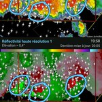




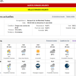


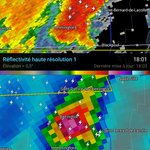

Orages violents : arbres cassés et toitures arrachées à Louiseville (Québec) #MeteoQC
lenouvelliste.ca/actualites/…


météomax retweeted

A real life illustration on the power and speed of a Texas Flash Flood . If you don’t understand - this is why people sleeping might have been swept away. This is few hours ago (afternoon of July 5) on the Llano River at the crossing of Ranch Road 3404 at the Kingsland Slab, a popular recreation spot for locals when the river is normal. I’ve crossed the river here and numerous other county roads on the river during bluebonnet season. You can see the rock (granite) structures on the sides of the river - which contributes to the velocity and rapid rise of water. It’s akin to pumping water through a garden hose with the spigot all the way open, and then putting your thumb over the opening.
Stevie Ray Vaughn “Texas Flood”
When you attend church tomorrow - think about our families and remember us in your prayers.
Lake Travis (a flood control reservoir) was 637’ yesterday, it’s already at 653’ today — and there is a few betting pools on where the lake will stop rising in a few days. A full pool is 681’.
météomax retweeted

The remains of Barry produced 20.33" of rain 4 miles northwest of Streeter TX.
Barry is the 20th tropical cyclone (or remnant) since 1913 to cause 15"+ across Interior Texas. The loop below shows the other 19.
Tropical Cyclone Rainfall Climatology: wpc.ncep.noaa.gov/tropical/r…
météomax retweeted

🔥 Dramatic scenes from the Greek island of Chios yesterday. Flames tore through the area, destroying homes, fields, and cars

météomax retweeted

Tropical Storm #Andrea has formed east of Bermuda - the first Atlantic named storm of the 2025 Atlantic #hurricane season. On average the first Atlantic named storm forms on 20 June.
Foudre des orages violents à Québec et à Lévis visible... de Trois-Rivières, à plus de 100 km de là!
youtube.com/shorts/1cW-9yyP7…
#MeteoQC
(Eh non, les "éclairs de chaleur", ça n'existe pas : c'est parce qu'on voit la foudre d'orages au loin, trop loin pour entendre le tonnerre.)


météomax retweeted

What folks beneath the MCV in Eastern North Dakota are currently experiencing is likely equivalent to a Category 1-2 Hurricane.
I don’t think I have ever tracked an MCV this intense. What a complex for the books tonight…
météomax retweeted

Extremely large wedge tornado on the ground. Going off velocity scans, this could be a violent tornado


météomax retweeted

I cant remember seeing anything like this.
People say that a lot.
But i genuinely cant remember the last time ive seen this.
The closest thing I can think of that this resembles is a stronger left front quadrant swinging through on the backside for a Hurricane.
#ndwx #mnwx #derecho

This might be the radar loop of the year.
Derecho turning into a mini-hurricane across North Dakota and Minnesota
(obviously not actually a hurricane)
But extremely impressive.
Wind gusts 100-120+ mph have been reported consistently for hours.
The damage in the morning is likely going to be eye opening.
#ndwx #mnwx #derecho
météomax retweeted

The B&W loops are back! Intense bow echo producing 80-100 mph winds in Bismarck, ND area this evening. #NDwx

météomax retweeted

Yesterday's dusty wedge tornado passing southwest of Dickinson, North Dakota over a small area of badlands as the sun illuminates the backside. #NDwx

météomax retweeted

INSANE #tornado intercept and search and rescue east of Jamestown, North Dakota. WATCH: youtu.be/mZbuoex5CFI?si=3lmQ…