
Neomapa is NFO Systems’ line of geospatial tools for the browser, which specialists use to extend their GIS productivity onto the internet.
cdmx
Joined May 2023
- Tweets7
- Following19
- Followers5
- Likes0

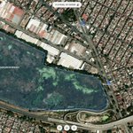

#GetCoordinatesOnline is a free, browser-based tool to find geographic coordinates on an interactive map.
Click anywhere on the map or search an address to read its latitude/longitude and copy it to clipboard. No registration required.
getcoordinates.online/

ALT #GetCoordinatesOnline is a free, browser-based tool to find geographic coordinates on an interactive map. Click anywhere on the map or search an address to read its latitude/longitude and copy it to clipboard. No registration required. https://getcoordinates.online/


Neomapa Capto: nuevo conjunto de herramientas para editar nodos de polígonos y polilíneas.
Funcionalidad añadida para enriquecer la capacidad de creación de datos #geoespaciales que la aplicación ya ofrecía de origen.

ALT Neomapa Capto: nuevo conjunto de herramientas para editar nodos de polígonos y polilíneas.
#GeospatialDirectory is a curated index of organizations and open resources in the geospatial field, covering GIS software, satellite imagery, LiDAR, remote sensing, spatial analytics, drone mapping, location intelligence, and more.
1
13
It is designed to help professionals, researchers, and developers quickly find relevant companies and data sources worldwide.
geospatial.directory
#GIS #Geospatial
#LiDAR #Location
#Imagery #Spatial

11
#NeomapaCapto is a free web tool for creating points, lines, and polygons on an basemap, with custom attributes, colour-coded layers, and one-click export to GeoJSON or KML. No install, no desktop #GIS suite, and nothing you draw ever leaves your browser.
