
New Mexico's State Geospatial Data Clearinghouse. Dedicated to advancing applications of GIS technology within New Mexico. [email protected].
Albuquerque, NM
Joined December 2009
- Tweets5.6K
- Following240
- Followers493
- Likes208


New Mexico RGIS retweeted
NMGIC Spring Conference 2022 Agenda is live!
Workshop by @allterracentral on Using Trimble DA2
Keynote by Bill Johnson on CarpeGeo &
State of GIS in NM by George "Gar" Clarke and more!
Complete agenda at nmgic.com/spring-conference-…
Don't miss out!


New Mexico RGIS retweeted
Join us on Thursdays for NMGIC Fall Geoseminar Series!
@VectorsInc, @UNM_GES, @nmrgis, @edacunm, @AlbuquerquePub1
nmgic.com/2021-fall-geosemin…

New Mexico RGIS retweeted

Definitely take a close look at what may be, currently, the world's most charming map.
This Post is from an account that no longer exists. Learn more
New Mexico RGIS retweeted
Interested to serve on NMGIC Board?
Nominations are accepted till September 17, 2021.

New Mexico RGIS retweeted

Time-lapse of this afternoon's haboob in Las Cruces. Not surprised we're getting these with the dry soils. #nmwx #duststorm #drought
New Mexico RGIS retweeted
Snapshot of the haboob from the NMED and TCEQ PM10 AQI today (May 13). #duststorm #AirQuality

New Mexico RGIS retweeted
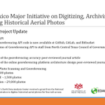
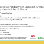
This afternoon is our last talk of the Spring 2021 Geoseminar Series. "Developing an Online Georeferencing API" - Hays Barrett, Earth Data Analysis Center, UNM.
Check you email for Zoom info. See you then!
@nmrgis, @edacunm, @UNM, @USNatArchives

New Mexico RGIS retweeted
Seems a bit early in the year to have wildfire smoke streaming over head in Las Cruces. Fire looks to be at Bylas, AZ along the Gila River. #wildfiresmoke #AirQuality #drought
New Mexico RGIS retweeted
Don't forget to join us on Thursdays in April from noon - 1 for NMGIC Spring Geoseminar Series!
@Esri, @NMSUGeography, @nmrgis, @edacunm, #RealTimeSolutions

New Mexico RGIS retweeted

To help up-and-coming cartographers, translation services make educational content easier to understand.
youtu.be/PXm0-JvvifQ
New Mexico RGIS retweeted
NMGIC is hosting a second Geoseminar Series this April. Stay tuned for more information.

New Mexico RGIS retweeted

Geomatics Update - A Japanese Perspective: LiDAR forest data for resource analysis in Japan dlvr.it/Rttlds
New Mexico RGIS retweeted

I love love LOVE making map legends. I was going over some older projects for an upcoming presentation and compiled some of my favorites together. There are so many wonderful map memories and stages of life wrapped up into these legends. #map #legend #cartography


New Mexico RGIS retweeted

Superb map in this story.
Great cartography goes beyond data and color palettes - the label hierarchy and explanatory annotations *make* this: wapo.st/3sxexVB
Don't strive for "clean" maps -- that goal often leads to the scrubbing away of detail, context, and info.

New Mexico RGIS retweeted

#Landsat 5 outlived its 3-year design life by nearly a factor of ten (28 years, 10 months)—with some help from ace @USGSLandsat mission operation engineers:

ALT Landsat 5 anomalies
New Mexico RGIS retweeted

It looks like our acquisition crew located Bruce Wayne's hideout.
#fridayfinds #aerialimage #batcave

New Mexico RGIS retweeted

It's #FreeMapMonday! Retweet and follow us for a chance to win the geologic map of Rocky Mountain National Park, CO!
#USGSStore (U.S. residents only)

New Mexico RGIS retweeted

#LandsatCollection2 is now accessible from the Amazon Web Services (AWS) cloud platform, offering new ways to explore the growing record of Landsat #EarthObservations
Learn more at ow.ly/miB950CCMtY
Link to the direct access user guide -ow.ly/LjgF50CCMtX

ALT Example of the Landsat Collection 2 level-2 science products