
Official X account for the National Weather Service Chicago. Details: https://teapawt.net/t.co/WJlrehRT4n
- Tweets50.7K
- Following1K
- Followers213K
- Likes14K


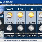
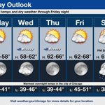


ALT This is a multiday forecast graphic for northern Illinois and northwest Indiana. Headline: Four Day Outlook. Sub Headline: Warm again on Saturday then turning cooler and more seasonable next week. Visit weather.gov/Chicago for more forecast details for your location. Graphic Created: Friday, November 20, 2026 2:57 PM CST

ALT This is a forecast graphic for northern Illinois and northwest Indiana. Headline: So Long, Warm Weather. Sub Headline: Our period of well above average temperatures is coming to an end. A cold front will usher in cooler air on Sunday. Daily high temperatures will settle closer to average values for the remainder of the month (overnight lows, as well). There is a modest signal for temperature to nudge upward for the last days of November into early December. There is no discernible signal for widespread measurable snow in our area through the end of the month. Visit weather.gov/Chicago for more forecast details for your location. Graphic Created: Friday, November 20, 2026 1:33 AM CST

ALT This is a multiday forecast graphic for northern Illinois and northwest Indiana. Headline: Pattern Change on the Way! Sub Headline: The stretch of abnormally warm temperatures comes to an end this weekend. Visit weather.gov/Chicago for more forecast details for your location. Graphic Created: Friday, November 20, 2026 1:33 AM CST

ALT This is a multiday forecast graphic for northern Illinois and northwest Indiana. Headline: Four Day Outlook. Sub Headline: Dry and unseasonably warm through Saturday, then showers Sunday and turning seasonably colder. Visit weather.gov/Chicago for more forecast details for your location. Graphic Created: Thursday, November 19, 2026 1:53 PM CST

ALT This is a multiday forecast graphic for northern Illinois and northwest Indiana. Headline: Five Day Outlook. Sub Headline: Dry and unseasonably warm through Saturday, then showers Sunday and turning seasonably colder. High temperatures will be 15 to 20 degrees above normal for mid November through Saturday. A cold front will move across the area Sunday bringing a chance of showers and then colder temperatures early next week. Visit weather.gov/Chicago for more forecast details for your location. Graphic Created: Thursday, November 19, 2026 3:02 AM CST

ALT This is a multiday forecast graphic for northern Illinois and northwest Indiana. Headline: Five Day Outlook. Sub Headline: Dry and unseasonably warm into Saturday, then showers Sunday and turning seasonably cooler. Visit weather.gov/Chicago for more forecast details for your location. Graphic Created: Wednesday, November 18, 2026 1:06 PM CST

ALT This is a multiday forecast graphic for northern Illinois and northwest Indiana. Headline: Five Day Outlook. Sub Headline: Above normal temps continue with shower chances returning late Saturday into Sunday. Above normal temperatures for mid November will continue into this weekend when a cold front will move across the area, bringing the next chance for showers and then colder temperatures early next week. Visit weather.gov/Chicago for more forecast details for your location. Graphic Created: Wednesday, November 18, 2026 3:14 AM CST

ALT This is a multiday forecast graphic for northern Illinois and northwest Indiana. Headline: Five Day Outlook. Sub Headline: Dry with above-average warmth into Saturday. Shower Chances return late Sat into early Sun. Visit weather.gov/Chicago for more forecast details for your location. Graphic Created: Tuesday, November 17, 2026 1:36 PM CST



ALT This is a multiday forecast graphic for northern Illinois and northwest Indiana. Headline: Five Day Outlook. Sub Headline: Above normal temps and dry weather through Friday night. Above normal temperatures for mid November are expected through Saturday with a cold front expected to move across the area Saturday night, bringing the next chance for showers. Visit weather.gov/Chicago for more forecast details for your location. Graphic Created: Tuesday, November 17, 2026 3:03 AM CST

ALT This is a multiday forecast graphic for northern Illinois and northwest Indiana. Headline: Five Day Outlook. Sub Headline: Dry conditions with gradually warming temperatures this week. Visit weather.gov/Chicago for more forecast details for your location. Graphic Created: Monday, November 16, 2026 1:11 PM CST

ALT This is a multiday forecast graphic for northern Illinois and northwest Indiana. Headline: Five Day Outlook. Sub Headline: Dry conditions with gradually warming temperatures this week. Visit weather.gov/Chicago for more forecast details for your location. Graphic Created: Monday, November 16, 2026 2:08 AM CST

ALT Headline: Patchy Dense Freezing Fog. Sub Headline: Graphic valid through 8 AM CST 11/16/2026. What To Expect. Patchy Dense Freezing Fog. Localized visibility ≤ 1/2 mile with temps below 32°. When: Through 8 AM CST. Where: Currently mainly across NW Indiana. Locally dense fog may expand into Illinois through daybreak. Potential Impacts: Sudden Changes in Visibility. Slowed Driving. Slippery Elevated Surfaces. What To Do: Keep a safe following distance, use low beams. Be alert for slick spots on bridges and overpasses. Visit weather.gov/chicago for the latest forecast updates. Graphic Created: Monday, November 16, 2026 1:47 AM CST

ALT This is a multiday forecast graphic for northern Illinois and northwest Indiana. Headline: Four Day Outlook. Sub Headline: Dry conditions with gradually warming temperatures through midweek. Visit weather.gov/Chicago for more forecast details for your location. Graphic Created: Sunday, November 15, 2026 1:08 PM CST

ALT This is a multiday forecast graphic for northern Illinois and northwest Indiana. Headline: Five Day Forecast. Sub Headline: Dry conditions with gradually warming temperatures through mid-week. Visit weather.gov/Chicago for more forecast details for your location. Graphic Created: Sunday, November 15, 2026 1:15 AM CST

ALT This is a multiday forecast graphic for northern Illinois and northwest Indiana. Headline: Four Day Forecast. Sub Headline: Dry conditions with gradually warming temperatures through mid-week. Visit weather.gov/Chicago for more forecast details for your location. Graphic Created: Saturday, November 14, 2026 1:02 PM CST

ALT This is a multiday forecast graphic for northern Illinois and northwest Indiana. Headline: Five Day Outlook. Sub Headline: Lake effect showers continue this AM in NW Indiana. Dry conditions return through at least midweek. Visit weather.gov/Chicago for more forecast details for your location. Graphic Created: Saturday, November 14, 2026 1:10 AM CST
