

Model. Monitor. Respond. | Quickly find, combine, and analyze earth observation data at any scale.
Philadelphia, PA
Joined October 2016
- Tweets46
- Following930
- Followers479
- Likes51




Pinned Tweet
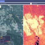
Working on a new #remotesensing model for identifying fans of the @Eagles in multispectral satellite imagery: "Eagles Support Index"
🤞for publication in a future edition of @ISPRS_SC "Journal of Photogrammetry and Remote Sensing" after a few tweaks. #FlyEaglesFly

Raster Foundry retweeted

Our recently released #rastervision library makes building new deep learning models for image recognition a breeze, but what about data storage and visualization? Read about what Raster Vision means for the future of @rasterfoundry blog.rasterfoundry.com/doubl…
In the interest of science, if you'd like to replicate these results, simply use the formula (Green ^10) - (Red + Blue) as shown in the template below. The above example uses #Sentinel2 data over Philadelphia.


Raster Foundry retweeted

🎉🎉GeoTrellis 1.2 is officially released and available on Maven Central. Read some highlights here: azavea.com/blog/2017/12/14/g… #Scala @locationtech 🎉🎉
Raster Foundry retweeted

Explore what a truly Cloud Native Geospatial world would look like. Part 1 in a series by @opencholmes medium.com/planet-stories/cl…

Use #Jupyter Notebooks and Raster Foundry as a zero-infrastructure solution for analyzing imagery programmatically blog.rasterfoundry.com/raste…
How we found and tracked wildfires in BC using @planetlabs imagery blog.rasterfoundry.com/track…
Raster Foundry retweeted
Raster Foundry creates powerful and stunning visual analysis tools using @planetlabs imagery. Exciting to see what GeoTrellis can power. xitter.cf/planetlabs/status/8978…

Attn #FOSS4G—check out this @rasterfoundry analysis tool detailing the effects of the BC wildfires: fires.rasterfoundry.com/

Raster Foundry retweeted
Attn #FOSS4G—check out this @rasterfoundry analysis tool detailing the effects of the BC wildfires: fires.rasterfoundry.com/
Raster Foundry retweeted
We're at Booth 200 throughout @foss4g Boston 2017. Learn about how we apply #opensource geospatial tech for good. bit.ly/2vJ8EdJ

ALT null
We took a closer look at #wildfire damage in British Columbia with @planetlabs imagery: fires.rasterfoundry.com

Raster Foundry retweeted
Great opportunity! "@DigitalGlobe @RadiantBlueTech is seeking developers to join the core GeoWave/GeoTrellis team." tinyurl.com/y87546kd
Raster Foundry retweeted
TSM on challenging bugs: First, name your issue. Images rendering incorrectly in @rasterfoundry = squishy thumbnails

Raster Foundry retweeted

We built #MODIS w/ @awscloud @astrodigitalgeo on AWS & learned a thing or two about publishing imagery on web/mobile developmentseed.org/blog/201…
Raster Foundry retweeted

At #rastersrevealed in beautiful Oxford, UK. @azavea folk @notthatbreezy and myself presenting on @GeoTrellis and @rasterfoundry.


Raster Foundry retweeted

Canadian satellite company MacDonald Dettwiler & Associates is in advanced talks to buy U.S. satellite-imaging... fb.me/1KEQPbjyw

Raster Foundry retweeted

Satellite & lightning data are critical tools to identify volcanic eruptions that can disrupt aviation. #Bogoslof #Alaska #AKwx @alaska_avo
Raster Foundry retweeted

This Himawari-8 gif of the fires + smoke near #Christchurch: rammb.cira.colostate.edu/ram…