

21, independent weather blogger with 6 years of experience providing weather updates for Chennai & surroundings (KTC) #ChennaiRains
Chennai, India
Joined May 2020
- Tweets18K
- Following87
- Followers12.5K
- Likes87.1K
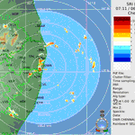


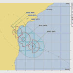
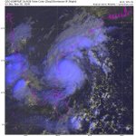
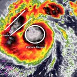


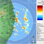

Quite intense bands over Western parts of #Chennai and city areas. Bands will move inside further as thunderstorms towards Kanchi district!
#ChennaiRains #NEM2026 #KTC

On and off rains possible over #Chennai and #Chengalpet due to strengthening easterlies though likely to be ISOLATED in nature🌦️
#Kanchipuram and parts of #Tiruvallur could expect moderate thunderstorms during noon- evg time⛈️
#ChennaiRains #NEM2026

Under the standard operational cyclone warning protocol of IMD, which color code corresponds to "Cyclone warning" stage dispatched at least 24 hours prior to adverse weather?
Kinda surprising to see what was the answer to this. Select yours!
#CycloneMurasu #weather
10%Yellow
64%Red
20%Orange
7%Green
152 votes • Final resultsComing down hopefully covers all parts of #Chennai and #KTC gets covered🤞
#ChennaiRains #NEM2026 #CycloneMurasu

JTWC is directing to a Nellore landfall for #CycloneMurasu in its latest update expecting possible SLOW along with a western movement next 6 hours before taking NW towards SAP coasts.
#NEM2026 #ChennaiRains #KTC

A slight west movement in coming hours could bring in another HEAVY spell for #Tiruvallur and most parts of #Chennai today🌧️
#CycloneMurasu heading towards Nellore. Stall/slow movement aana rains can extend till night too. Let's wait and see! 50+ ws is great!
#ChennaiRains

North #Chennai up with heavy rainfall already. Data till 12.30 am (in mm)
Mullai Nagar- 106
Sathangadu- 88
Kadapakkam- 85
Tondiarpet- 77
Pulianthope- 66
Manali- 65
Egmore- 60
More rainfall ahead with breaks!
#ChennaiRains #CycloneMurasu

More rains overnight ahead with breaks. Tomorrow looks great as well. Quantum already 50+ in Northern parts, 30-50 in city areas💥
Murasu Madras ku mixture kudukla 😌
#ChennaiRains #NEM2026 #CycloneMurasu

#Tiruvallur and #Chennai schools declared HOLIDAY tomorrow owing to heavy rainfall alert (02-11-26).
Kanchi and Chengalpet they should follow as well but real-time early morning rains will play a key role for holiday.
College kum vitruklam :)
#NEM2026 #ChennaiRains #KTC
Very intense spell approaching #Chennai city, with Northern parts already in the spell. Many places already more than 15mm from the 1st spell 🌧️
#CycloneMurasu #ChennaiRains

First rains from #CycloneMurasu 💥
Location- Thiruvotriyur
Credits- Siranjeevi
#ChennaiRains #NEM2026

Track has definitely came down than what models were expecting yesterday. A further dip south could mean heavier spells for #Chennai as well from #CycloneMurasu!
For now: moderate rains with isol.heavy spells from tonight - 4th morning on and off🌧️
#ChennaiRains #NEM2026


So with IMD announcing it in its latest bulletin, #CycloneMurasu is officially likely to form in next 24-48 hours. There is still a possibility of weakening before making landfall due to SW dry winds, and let's not forget Arnab made landfall slightly south than expected as well.

So with IMD announcing it in its latest bulletin, #CycloneMurasu is officially likely to form in next 24-48 hours. There is still a possibility of weakening before making landfall due to SW dry winds, and let's not forget Arnab made landfall slightly south than expected as well.
Very interesting to see two back to back cyclones pushing in to the same region, path could differ but coastal #AndhraPradesh is bracing up to face another cyclone in a matter of a week.
However, the wind damage will be DRASTICALLY LESS than Arnab, rainfall looks high though!
A DEPRESSION- level system is likely to come near to us in coming days, but may not exactly yield the rainfall level as we normally see, yet, light-mod rains are possible for #KTC from this system/easterlies on Nov 1-4🌧️
Full post in detail👇
#ChennaiRains #NEM2026 #Invest91B


Tamil post explanation attached #ChennaiRains
facebook.com/share/p/19kWbT9…
Genesis point matters. Arnab was unfavorable for us from the very start due to this reason. The upcoming low pressure/system track will be clear subsequently once remnants of Arnab fade out.
Until then, we could not get into any assumptions is what I feel.
#NEM2026
KTC Weatherman Saran retweeted

Due to Cyclone Arnab Storm Surge effect in Ennore North Chennai #CycloneArnab
Max Speed of 115kt i.e around 185km/h with guests likely to cross 200km/h. #CycloneArnab is already a CAT-4 cyclone🚨
For context, Vardah had 125km/h as maximum gust while crossing Chennai.
Hopefully precautions are in full measure at #AndhraPradesh & #Odisha 🙏
