

Monitor What Matters® | Turning satellite data into environmental intelligence for the places people protect, manage, and depend on 🛰️
Chattanooga, TN
Joined December 2015
- Tweets270
- Following441
- Followers259
- Likes21


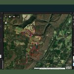


Every pond MANTA treats is building toward something bigger. Its water quality readings, paired with our satellite imagery, will one day train a model that detects algal conditions from space.
buff.ly/i1Fw6sd
#EnvironmentalIntelligence #WaterQuality

Sustainable forestry requires knowing what's happening across millions of acres of working land.
See how we helped International Paper assess and reduce risk across its fiber supply chain → buff.ly/N5z5Hwu
#WorkingLands #Forestry #Sustainability

Humans can only be in one place at a time. Satellites cover the whole map.
Planet highlights how we used satellite imagery and GeoAI to flag changes in Tennessee's wetlands, so inspectors know where to look first.
buff.ly/m9EDJr4
#GeoAI #EnvironmentalIntelligence

How do you measure tree canopy loss after a hurricane, in a city with steep slopes, deep gorges, and long shadows? A thread on the science behind Skytec's Asheville canopy assessment.
Appalachian terrain makes classification tricky. Shadows and steep slopes can confuse vegetation mapping, so the 2025 analysis used a workflow built to separate fine-scale vegetation from developed land cover.
The result: a net loss of 735.76 acres, about 5% of pre-storm canopy, with more loss from development than from the storm. The method is documented so Asheville's GIS team can replicate it.
buff.ly/po4ObOJ
#EnvironmentalIntelligence #UrbanForestry #RemoteSensing

40% of US animals and 34% of plants are at risk of extinction. For companies that depend on land, that's a business risk too. See how Ranger® pairs NatureServe and @Esri data with satellite monitoring to track habitat health.
buff.ly/BNCGnVl #Biodiversity #SupplyChain

Enterprise tools without the enterprise price tag. Through our @Esri and @planet partnerships, qualifying nonprofits pay a fraction of typical software and imagery costs. Learn more: buff.ly/5IWWo8b
#ArcGIS #Nonprofit #MonitorWhat Matters

A sustainable supply chain starts with the right data. Skytec and International Paper built a GIS solution to map sourcing regions and verify sustainable practices at scale.
Read the story: buff.ly/KjOunRK
#WorkingLands #GIS #Sustainability #ForestMonitoring
Our analysis showed that the City of Asheville lost about 736 acres of tree canopy between 2022 and 2025, roughly 5% of its 2022 total. This data is now helping guide the city's recovery and urban forestry planning.
Learn more: buff.ly/xIC1K3Z
#UrbanForestry
Small ponds make up about 95% of freshwater bodies. We helped Caddis Tech use satellite imagery to verify its chemical free algae treatment and rank which ponds need it next.
buff.ly/WAjQghT
800K additional wetland acres, mapped across Tennessee in eight weeks with satellite imagery and deep learning. Explore the tool: buff.ly/gqzH2v2
#GeoAI #MonitorWhatMatters
Behind every conservation win is a lot of monitoring.
Proud to support the Tennessee River Gorge Trust's work protecting one of the most biodiverse river gorges in the country, combining boots on the ground with our eyes in the sky. buff.ly/QT48jPH
#MonitorWhatMatters

Do more with the team you have. You shouldn't need a larger staff to manage a larger landscape. We help organizations of any size manage landscapes of any scale.
Show your commitment. Whether you're vying for grant funding or meeting conservation goals, you need data to prove it.
buff.ly/WEUT4cf
#EnvironmentalIntelligence #Ranger #GIS #MonitorWhatMatters