Meteorologist | Tweets mostly about weather, fire, and earthquakes | Flight Ops @nearmap & Co-founder of https://xitter.cf/t.co/4UIDB5Sl5k | Proud Penn State Alum | Norcal native

California
Joined June 2013
Wow! Here's a lightning bolt I just captured from the thunderstorm southeast of Sacramento. #CAwx
20
172
35
913
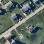
Tragic imagery out of Spokane from both the Old Trails Fire and Fairview Fire. We @nearmap captured these images around 7PM yesterday as the fire was still actively burning structures. Additional structures likely burned after these images were taken #OldTrailsFire #FairviewFire
2
949
Significant damage from yesterday’s Appleton–Menasha, WI tornado is visible in our @Nearmap ImpactResponse imagery, captured within five hours of the tornado @NWSGreenBay #WIwx
2
503
Plenty of lightning tonight across the Sacramento area. Tomorrow might be an interesting day as well! #CAwx @NWSSacramento – at Rancho Cordova, CA
2
3
7
388
78MPH gust in Oroville! #CAwx – at Folsom, CA
This Post is from a suspended account. Learn more
1
154
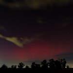
Aurora visible from just outside Sacramento, CA! #CAwx #Aurora – at Rancho Cordova, CA
2
14
1,020
Faint Aurora visible to the naked eye looking north near Rancho Cordova, CA #CAwx – at Gold River, CA
194
Significant blowing dust and smoke in the Mather/Anatolia area @NWSSacramento #CAwx – at Mather, CA
1
318
I have written a short statement responding to mass firings today of #NOAA / National Weather Service (#NWS) staff (which were concentrated among recent hires as well as highly experienced staff who had recently been promoted). Please see below screenshot & below for full text.
131
671
51
1,790
200,649
⚠️POWERFUL & DAMAGING SANTA ANA WINDSTORM INCOMING!!⚠️ Take action now to prepare your home and loved ones for another round of EXTREME WIND and FIRE WEATHER, staring tomorrow afternoon! Worst winds Mon afternoon - Tue morning. #CAwx #SantaAnaWinds
205
1,891
357
4,106
1,138,854
After becoming increasingly enmeshed in the wildfire world, you start to notice things about the way we've systematically altered our relationship with the natural environment in a way that has increased the risk of destructive fires. And then you stop being able to unsee them.
45
407
36
2,882
168,540
Total devastation in parts of Altadena from the #EatonFire. Imagery captured yesterday evening as part of the @nearmap ImpactResponse program. #CaliforniaWildfires
2
3
8
980
Some close-ups of the #MountainFire damage
We’re capturing high-resolution imagery of the Mountain Fire burning in Camarillo, CA, to provide a clear view of the event. Our team will continue to monitor and update imagery as conditions evolve: bit.ly/3U1jZQU #Wildfire #DisasterImagery #ImpactResponse
1
3
1,759
Doing a rough count of structures lost in the Camarillo Heights area from the #MountainFire using @nearmap ImpactResponse imagery and the number appears to be at least 125. #CAwx
1
6
21
2,698
Absolutely wild to see all of the cots set up within Tropicana Field! Very lucky that no one was using them when the roof tore apart. #HurricaneMilton #FLwx #TropicanaField
335
Absolutely devastating damage in parts of North Carolina (and elsewhere) from #HurricaneHelene. Honored to be a part of the team working around the clock to bring imagery like this to federal, state, and local agencies. #NCwx
The devastation caused by #HurricaneHelene in North Carolina is heartbreaking. In this video, you’ll see the hard-hit areas of Bat Cave, Chimney Rock, and Lake Lure, showing the full impact on homes and landscapes. Learn more about Nearmap ImpactResponse: bit.ly/3N9Uzwp
1
332
Damage across Surfside Beach and Jamaica Beach as a result of #HurricaneBeryl seen with @nearmap aerial imagery. Significant coastal erosion in spots as well! #TXwx
1
346
A less than ideal view to see from near the Oroville Dam as the Thompson fire encroaches #CAwx
1
2
12
3,854
RT @metrofirepio: The fire has been controlled at 585 acres and stopped at Kiefer and Sunrise. Crews are working to mop up hot spots to ens…
Pyrocumulus beginning to develop on top of the #SitesFire plume. Impressively vertically developed plume with the strong northerly winds. Illustrates the high heat and burning intensity of the fire. #CAwx
1
2
8
1,417