

Just having a fair dinkum go at life 🌴 🇦🇺 Doing lots of cool stuff at @soaratlas, Detail and Marlin (🦈)
San Francisco, CA
Joined July 2017
- Tweets3.9K
- Following1.1K
- Followers1.2K
- Likes3.9K





Amir retweeted

🚨As tensions rise in Iran, you can go back to our Iran Conflict bundle to see the bigger picture of this war.
250+ community maps documenting attacks, key findings and before-and-after imagery.
Iran Conflict Collection 🔍: tinyurl.com/bddeds23
#IranWar #MiddleEast #OSINT
Amir retweeted
Step back into the Cold War and explore a collection of vintage spy satellite images. Compare the world in the 1960s with today and see what's changed. View a detailed handmade 3D replica of the satellite.
Out Now:🚀👉 soaratlas.com/kh-7gambit
#ColdWar #History #Space
Meet San Francisco's famous Sutro Baths 🛁📸via aerial imagery from @sfgov on @SoarAtlas direct link to map in 1948 - tinyurl.com/2kzjkx67 Been going to Lands End for years. Never knew it looked like this before it burnt down in 1966. All that remains is basically a lake 😥


Amir retweeted
It's finally here!🎉👉: soaratlas.com/kh-7gambit
Step back into the Cold War and explore a handpicked collection of vintage spy satellite images with this stunning interactive experience. Compare the world in the 1960s with today and see just how much has changed.
Then take a closer look at the KH-7 Gambit 1 itself, with a detailed handmade 3D replica you can pan around.
All you have to do is pick a photo, explore, and use the slider to shift between past and present.
We put a lot of love and work into this so please let us know what you think.
#ColdWar #SatelliteImagery #History #Space
Amir retweeted
🚨Southeast Asia is facing another haze crisis.
NASA's fire map shows large hotspots across Indonesia. Satellite imagery shows smoke and active fires.
Hotspot Map 🔥: tinyurl.com/mpnpjdsj
Satellite 🛰: tinyurl.com/bdh6dc7m
#Indonesia #Singapore #Kalimantan
Amir retweeted
How much of Australia’s seafloor have we actually mapped in detail?
This map, compiled by the University of Tasmaniain in 2023, shows exactly where the seabed has been surveyed.
Explore and Compare: tinyurl.com/2htnf85e
#Australia #Bathymetry

Is Iran shifting more of its trade towards the Caspian Sea?
Shipping activity in the Caspian reportedly rose from 127 Russian and Iranian-flagged vessels in February to 211 in March 2026.
With the U.S. naval blockade putting pressure on Iran’s southern trade routes, Tehran may be increasingly relying on its northern corridor to move essential goods and maintain trade with Russia.
Satellite imagery of Nowshahr Port and Bandar Anzali could offer clues to how these routes are being used as the war continues.
Nowshahr Port: tinyurl.com/yhykyszs
Bandar Anzali: tinyurl.com/yc4acsrc
What do you think?
Amir retweeted
💥Satellite imagery of King Khalid International Airport in Riyadh appears to show a possible hole in the roof of Terminal 3. The image follows reports of a Houthi missile attack.
Explore and Compare: tinyurl.com/39k7ek7s
#MiddleEast #SaudiArabia #Houthi
Amir retweeted
☢This vintage satellite map from 1976 shows Chernobyl a decade before a nuclear disaster. Towns that were once visible have totally disappeared beneath forests and vegetation.
Explore and Compare: tinyurl.com/39haakfj
#Ukraine #Chernobyl #Nuclear
Amir retweeted
Havana is Cuba’s capital, founded by the Spanish in 1519. This vintage 1962 map offers a view of Havana during a very different period in the city’s history, just three years after the Cuban Revolution.
Explore and Compare: tinyurl.com/4ncjezdc
#Cuba #Havana
Amir retweeted
Calling all space nerds, we’ve been building a new interactive experience. 🛰
Explore vintage spy satellite maps from the Cold War, compare them with the world today, and pan around our handmade virtual replica of the KH-7 spy satellite that captured them!
Coming soon.
Amir retweeted

I made a tribute to the history of SAR with my new best friend, Sol 6.1. If you're curious about the history of SAR, this is a fun way to get a primer, and there's an out-of-this-world Easter egg hidden in there, too. sarsarsar.com/
Amir retweeted
Ultra-high-resolution imagery of Northern Gaza was briefly available to view on Israel's GovMap website. It's since been censored.
Map 🗺👉: tinyurl.com/nfr6vr4
However, one of our community members @Nrg8000 preserved the map for anyone to explore, analyse, and compare for themselves.
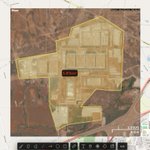
Some of these data centres are churning up the landscape like bad growing weed! soaratlas.com/maps/142936 This one in Texas is almost 6km2! 😳
It would be prudent to do analysis to see how much of the worlds surface in km2 has been taken up by data centres vs solar panels etc

Amir retweeted

Israel's GovMaps has now removed this imagery from its map platform.
soaratlas.com/maps/asia-isra…
Here it is, in the full original resolution. The fidelity of aerial imagery really highlights the complete destruction.
Thanks to @SoarAtlas for hosting the imagery.


Amir retweeted
We recently added support for uploading GIF files on Soar, meaning you can share timelapses such as this.
Check it out:👉 tinyurl.com/sex3txcu
These are simple image files so they won't support a basemap, but can be zoomed and explored like any other map!
Incredible use of the 'Stoaries' feature on @SoarAtlas

🎬 - Zaporizhzhia Nuclear Power Plant Structure -
Discover the story behind the ZNPP layout map now on @SoarAtlas, and use satellite imagery to understand its structure and functions. I hope you find this useful.
You can find the map at this link:
- 🗺️soaratlas.com/draw/3346


Amir retweeted
Gaza is one of the most restricted areas for high-res satellite imagery, making every clear look at the region significant.
New high-resolution aerial imagery of northern Gaza from 2025 was left uncensored on Israel’s government GovMap website.
The OSINT community was quick to spot it. 🔍
Shout out to @Stinky915846091 for his great work!
The imagery reveals military outposts established by the IDF across parts of northern Gaza in great detail.
Several maps are now available to explore here: 👇 tinyurl.com/3vhcykz6
#Gaza #Israel #MiddleEast #IDF
A cookie for the first person and that recognises this fabled city captured at night time from satellite, viewed in @SoarAtlas new 3D animation fly through capture mode 🎥 ⛰️