




Pinned Tweet
This will send the 1976 brigade into meltdown.
Note: the mean temperature includes nighttime temperatures and this year the nights were particularly warm.
#WarmestSummerEver

Temperatures above average later on Monday, with dew points into the teens, but cooler again later into Tuesday.
Fingers crossed but high pressure could build in later next week and although weak at first, it then looks to build further. Doesn't mean a lot of sunshine, as cloud could well be dragged in from the east but a relief from stormy conditions from the west. [although a lot of areas still need rain]
OUTLOOK
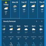
MON: Rain AM, drier PM. Windy. Mild. 15°C | 30mph
TUE: Another windy day, sunny spells & showers early & late. Cooler. 13°C | 40mph
WED: Bright spells & showers. 13°C | 30mph
THU: Winds easing, sunny spells, drier. 14°C | 15mph
FRI-SUN: High pressure hopefully building. Sunny spells and dry. Winds falling light. Some stubborn cloud and mist early on. No frosts expected at this stage. 12°C | 15mph

MONDAY
A cloudy start then rain spreading in from the SW during the morning, some heavy but clearing for the afternoon. Becoming windy once again and we slip into a warm sector so temperatures rising.
Max 14-16°C Min 9°C Max Gusts 35mph


A few showers about still and overall the wind has now trended downwards. More rain to come on Monday morning.


REST OF SUNDAY
Continuing very gusty this afternoon with bright spells and just a few scattered showers. Winds will start to ease but still remaining breezy towards evening and then eventually dropping overnight with clear spells developing. #StormBoelo
Min 6°C Max Gusts 40mph


Some of the highest wind gusts in #Scotland. Over 120mph on Cairngorm Summit.
#StormBoelo


The steady, strong and gusty westerly continues here. Should see a trend down in gusts from 2-3pm onwards. #StormBoelo

Sunny spells & some blustery showers as planned this morning but the notable feature is the wind still with 50-60mph gusts.
The wind will begin to ease slowly from mid-afternoon onwards with gusts back to 30-40mph by this evening then fading overnight. #StormBoelo


Oldham Weather retweeted

75knots or 86mph. Measured on the weather station on the Fleetwood NCI at Rossall Point. 😬 the joys of living on the coast.

SUNDAY
Amber and yellow warning in place 💨
A very windy day with locally severe gales, especially in exposure and along the coast.
The strongest winds of the day will have come during the early hours but it will still howl until evening.
Sunny spells & scattered showers, some heavy. Feeling cold.
Max 11°C Min 5°C Max Gusts 40-60mph
#StormBoelo

Rain easing away from the west now.
Turning very windy in the middle of the night with severe gales.
#StormBoelo


More heavy rain to come over the coming hours. Some places have seen an inch now. Squall-line on the back edge too. Winds picking up further. #StormBoelo

Oldham Weather retweeted

A weak tornado affected Portchester, Hampshire, just after midnight on 23 October, with a 1.6 km land track. It was associated with heavy showers that moved inland from the Channel, linked to Storm Austen. More details to follow after the analysis has concluded.

ALT Map of Portchester, Hampshire, showing damage points and debris fall recorded in the TORRO survey, with a 1 km scale bar and a locator inset of southern England.
Oldham Weather retweeted

#StormBoelo looking highly impressive as he approaches Ireland and Scotland!
REST OF SATURDAY
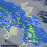
As the latest radar shows it is a horrible afternoon. The rain will continue for a few hours yet and ease into the evening but it will remain windy and becoming very windy overnight with gale-force gusts. Temperatures rising into double-figures.
Max 14°C Min 9°C Max Gusts 40-50mph
#StormBoelo
