

Drone 3D Mapping Platform [email protected]
Gurgaon, India
Joined March 2017
- Tweets167
- Following175
- Followers123
- Likes73






We use aerial images/videos taken by drones to accelerate and simplify topographic surveys for land management and planning. This holds true for site scouting, allotment planning
and design, as well as final construction of roads, buildings and utilities.
#dronamaps

1
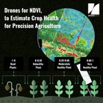
Combining the advanced drone technology and Machine Learning for Precision Agriculture to track crop fertility for improved crop yields and profitability.
#dronamaps #dronetechnologies #startupindia


In rural/urban mapping and development, DronaMaps provides a web application with highly accurate geospatial information to aid planning & monitoring of massive infrastructure projects and their volumetric change tracking.
Read more here: egov.eletsonline.com/2019/05…
DronaMaps specializes in command-and-control centers that enable prioritization and decision making on the ground, drastically cutting down the time and risk of reconnaissance at the time of disaster.
ow.ly/OOTs50K032a
1
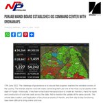
DronaMaps collaborated with the Punjab Mandi Board and Department of Governance Reform and have already digitized and incorporated 110 Mandis and 24,262 rural link roads in the GIS control and command center.
Pead more here: ow.ly/kJKS50JYTMW

2
Glimpses from India-US Geospatial Business Summit, California
Geospatial World U.S. Department of State Embassy of India in Washington and Geospatial World Chamber of Commerce
#Geobuizsummit2022 #dronamaps #startupindia


We, at DronaMaps, combine the advanced drone technology and Machine Learning for Crop yield forecasts, crop emergence analysis, irrigation monitoring, crop health, crop damage assessment, field soil analysis for improved crop yields and profitability.
#dronamaps #startupindia
It was a privilege to showcase our work with four different departments of Punjab i.e. DGR, PMD, PMIDC, GMADA at the Digital Mela 2022 Gujrat.
We thank MEITY, Digital India & other respected dignitaries who visited our stall at Digital mela 2022, Gujrat.
#digitalindiaweek2022
2
Thank you @NITIAayog and @thekiranbedi mam for bestowing the honour of “Women Transforming India” to our Director @mishra_ayushi . We feel humbled by this amazing recognition of our work, and hope to continue serving the nation for years to come!

2
This is unprecedented! The new Drone Policy 2021 allows us to scale up our operations and compete with the world, transform every state of India using drones. Thank you so much @MoCA_GoI @PMOIndia @DGCAIndia and thank you @dronefed !

The liberalization of the #drone policy & opening up sector to drive #innovation is a welcome and exciting move!
Another huge boost to innovate in India and innovate for #India! Thank you @PMOIndia and @MoCA_GoI for taking this much needed step.
#ThinkDigitalThinkIndia
3
Thank you @YourStoryCo for covering our work in combatting corona in such a descriptive manner. We are happy to be featured.
#CoronaWarriorsIndia #Covid19India @MoHFW_INDIA

This startup is working on a nationwide coronavirus project to map hotspots in the country using drones.
@DronaMaps @actioncovidteam @MoHFW_INDIA @usinghjhu @JioGenNext #COVID19Pandemic #IndiaFightsCorona
yourstory.com/2020/04/corona…
#CoronaUpdate dashboard 24/4 23077 #COVID19 cases source @MoHFW_INDIA
🖥️dronamaps.com/indiacorona.ht…
📱dronamaps.com/m.corona.html#…
@ANI @CNBCTV18News @CNNnews18 @timesofindia @TimesNow @htTweets @TheQuint @ndtv @livemint @Outlookindia @the_hindu @business @fayedsouza @FT @BBCIndia @BDUTT

1


#Fightingcovid19 in India by providing administrative dashboard with advanced features like location tracking, geofencing and predictive analytics.
@rana_in_asia

@DronaMaps has developed a live dashboard to track live #COVID19 cases in states like #Punjab & #Haryana. They were also part of the Empowered Group led by @NITIAayog Read about their solution here - bit.ly/2yeKqeH
#TechFightsCOVID19 #IndiaFightsCOVID19

#Fightingcovid19 in India by providing administrative dashboard with advanced features like location tracking, geofencing and predictive analytics.
@rana_in_asia @Forbes @ForbesAsia @ForbesIndia @ForbesTech
#Coronaindia #30Under30

Thankyou @livemint for recognizing our work in combatting #Covid19India challenges.
How two startups from Bengaluru, Gurgaon are fighting against COVID-19 livemint.com/companies/start…
@nasscom @cmohry @CMOPb @EsriIndia @Esri @PTI_News #coronavirusindia #CoronaOutbreak
@JohnsHopkins inspired public-facing & admin dashboards for authorities tracking and predicting the spatial spread. JHU alums working on #COVID19outbreak crisis in India. @usinghjhu🖥️dronamaps.com/indiacorona.ht…
📱dronamaps.com/m.corona.html#…
@HopkinsMedicine @JohnsHopkinsIH @JHUPress


@JohnsHopkins inspired public-facing & admin dashboards for authorities tracking and predicting the spatial spread. JHU alums working on #COVID19outbreak crisis in India. @usinghjhu 🖥️dronamaps.com/indiacorona.ht…
📱dronamaps.com/m.corona.html#…
@JHUBME @JHSPH_CHS @JohnsHopkinsSPH

