

Tracking weather in the Tri-Cities. We are the Tri Cities first warning when severe weather strikes. Partnered with @etnwxnetwork
Bristol, TN
Joined August 2020
- Tweets16.9K
- Following170
- Followers949
- Likes119





Pinned Tweet
HURRICANE ISAIAS: LOCAL IMPACTS AND WHAT TO EXPECT
The remnants of Hurricane Isaias will bring periods of heavy rain, gusty winds, and a localized flooding threat to our region Saturday and Sunday. A Flood Watch is in effect for our North Carolina counties and Grayson County, Virginia. While this system will bring some impactful weather, this is NOT expected to be anything like Hurricane Helene. Here is what you need to know heading into the weekend.
TIMING: The main window for impacts will be Saturday morning through Sunday afternoon. Periods of rain and strong winds will continue through the weekend, with conditions gradually improving Sunday evening.
RAIN AND FLOODING: Rain will begin moving into the region early Saturday and continue in scattered rounds through Sunday afternoon and early evening. This does not mean it will rain constantly all weekend.
A Flood Watch is in effect for our North Carolina counties and Grayson County, Virginia, where the potential for heavier rainfall and localized flooding is greater.
The overall flood risk is LOW for most of our remaining region, thanks to downsloping winds that should limit rainfall totals. However, our North Carolina counties face an elevated flooding risk, with 2–6 inches of rain possible in some locations. Most other areas are expected to receive less than 1.5 inches.
Localized flooding remains possible, especially in areas that receive heavier rainfall. Never drive through flooded roadways.
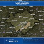
WIND: Nearly all of our counties are under some type of wind alert.
Wind Advisory: Most of our region, including the Tri-Cities, could see wind gusts of 30–50 MPH.
High Wind Warning: Parts of the Tennessee and North Carolina mountains, along with Russell and Washington counties in Virginia, could experience gusts up to 70 MPH.
Wind-prone locations: Areas such as Camp Creek could see gusts approaching 80 MPH.
These winds could bring down tree limbs, cause isolated power outages, and make travel difficult, especially in the mountains and other exposed locations. Secure loose outdoor items before the strongest winds arrive.
TORNADO RISK: The tornado threat with this system is VERY LOW. We will monitor any stronger bands of precipitation that develop, but widespread severe weather is not expected.
HOW DOES THIS COMPARE TO HELENE?
We want to be clear: this is NOT a Helene-type event. Before Helene, our region experienced days of rainfall, followed by additional extreme rainfall as the storm moved through. With Isaias, we have been relatively dry recently, and forecast rainfall totals are much lower across most of our region.
Flooding is still possible, particularly in our North Carolina counties and areas under the Flood Watch, but the current forecast does not suggest anything close to the catastrophic flooding experienced during Helene.
OUR ADVICE: Prepare for a wet and windy weekend. If you have outdoor plans, consider moving them indoors, especially Saturday and Sunday. Secure outdoor furniture and other loose items, and be cautious when traveling in areas prone to falling trees or flooding.
FirstWARN Tri-Cities will be tracking this system throughout the weekend and providing updates as conditions change.
Stay informed, stay prepared, and stay with FirstWARN for the latest local weather information.


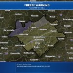
11:37 PM ET 11/6/26: Freeze Warning has been issued for McCreary, Whitley, Knox & Others in KY from midnight Sat night to 10 AM EST Sun. Temps 29–36F with coldest readings in rural valleys; frost/freezes may kill crops and damage unprotected outdoor plumbing.

11:30 PM ET 11/6/26: A Freeze Warning has been issued for Buchanan and Dickenson Counties, VA & Logan, McDowell, Mingo, and Wyoming Counties, WV, from midnight Sat night to 10 AM EST Sun. Temps as low as 30F may kill crops and damage unprotected outdoor plumbing.

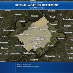
5:47 AM ET 11/6/26: Special Weather Statement issued for Knox, Bell, Harlan & Others through the morning commute as dense fog reduces visibilities to 1/4 mile or less at times. Slow down, use low beams, and leave extra distance.

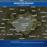
5:26 AM ET 11/6/26: Dense Fog Advisory issued for Cherokee, Clay, & Scott counties in TN/NC/VA until 9 AM EST/8 AM CST. Visibility under 1/4 mi mainly in valleys and near waterways, making driving hazardous.

3:27 AM ET 11/6/26: Special Weather Statement has been issued for Dickenson, Buchanan, Mingo, Logan, Boone, Clay, Braxton, McDowell, Wyoming, Upshur & Others this morning. Dense valley fog reduces vis to under 1/4 mi at times; slow down, use low beams, and leave extra space.

2:36 AM ET 11/6/26: Special Weather Statement issued for Cherokee, Clay, Scott & Others in the TN Valley this morning. Areas of fog may reduce visibility to under 1/4 mile at times, especially in river valleys and near lakes; slow down and use low beams.

2:58 AM ET 11/5/26: Special Weather Statement is in effect for Rowan, Estill, Powell & Others until the morning commute, where dense fog may reduce vis to 1/4 mile or less at times. Slow down, use low beams, and leave extra distance.

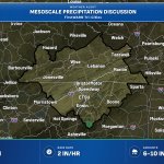
10:53 PM ET 11/4/26: Training thunderstorms are dumping heavy rain over northern GA into the southern Appalachians, with 2-4 in/hr at times and 6-10 in since midnight. Flash flooding is possible through about 9 AM local, with 2-4+ more inches in 3-5 hrs.

7:38 AM ET 11/3/26: Wind Advisory is in effect for Johnson, Cocke Smoky Mountains, Southeast Greene & Others from 4 PM this afternoon to 7 PM EST Wed. SE winds 15–25 mph with gusts up to 55 mph; isolated gusts may exceed 60 mph.

12:54 AM ET 10/22/26: A Special Weather Statement is in effect for Dickenson and Buchanan through tonight. Clear skies and calm winds may drop valley temps into the mid 30s, with patchy frost possible in higher elevations; protect tender plants.

8:55 PM ET 10/21/26: A Special Weather Statement is in effect for Dickenson and Buchanan through tonight. Clear skies and calm winds may bring mid-30s temps in valleys away from rivers/lakes, with patchy frost possible. Protect tender plants.

12:55 AM ET 10/21/26: Special Weather Statement is in effect for Fleming, Montgomery, Bath & Others until 9 AM EDT. Clear skies and light winds may bring patchy frost in sheltered rural valleys and locally dense fog near rivers, clearing by 9 AM.

4:14 AM ET 10/20/26: A Special Weather Statement is in effect for Greenup, Carter, Boyd, & Others from this morning with clear skies and calm winds. Temps fall into the mid to upper 30s in valley areas, with patchy frost possible; protect cold-sensitive plants.

3:15 AM ET 10/20/26: Special Weather Statement is in effect for Fleming, Montgomery, Bath & Others until 9 AM EDT. Clear skies and light winds may bring patchy frost in sheltered rural valleys and locally dense fog near rivers, clearing by 9 AM.

1:10 AM ET 10/20/26: A Special Weather Statement is in effect for Greenup, Carter, Boyd, & Others from this morning into the mid/upper 30s, with patchy frost possible. Cold-sensitive plants may be damaged; protect tender vegetation now.

9:08 PM ET 10/19/26: A Special Weather Statement is in effect for Fleming, Montgomery, Bath, Rowan & Others tonight. Clear skies and light winds will drop temps to the upper 30s-lower 40s, but patchy frost may form in sheltered rural valleys into the mid 30s.

6:59 PM ET 10/19/26: A Special Weather Statement is in effect for Greenup, Carter, Boyd, & Others from tonight into early Tuesday morning. Clear skies and light winds may bring patchy frost with temps in the upper 30s to low 40s. Protect tender plants.

3:56 PM ET 10/19/26: Special Weather Statement in effect for Fleming, Montgomery & Others. Clear skies and light winds will allow temperatures to fall into the upper 30s to lower 40s in most locations late tonight, except into the mid 30s through the sheltered rural valleys.

2:53 PM ET 10/19/26: Special Weather Statement in effect for Fleming, Montgomery & Others. Clear skies and light winds will allow temperatures to fall into the upper 30s to lower 40s in most locations late tonight, except into the mid 30s through the sheltered rural valleys.

