





Mario Ramirez retweeted

#ElNiño #Perú 🇵🇪
🚨#ElNiñoCostero no se detiene, @enfenperu aumenta las probabilidades de un evento entre fuerte a extraordinario:
✅99% en setiembre.
✅97% en octubre.
✅95% en noviembre.
✅84% hacia el verano (diciembre26-marzo27).
📣 Próximo comunicado, el 28 de agosto.


Mario Ramirez retweeted

In the subsurface equatorial Pacific, ocean temperatures recently reached 9.96°C (17.9°F) above average, the largest anomaly of this El Niño event so far and larger than anything observed in 1997.
The current record-breaking westerly wind burst could cause an even higher spike.

Mario Ramirez retweeted

📣 #ENFEN mantiene el estado de alerta de El Niño Costero, ya que se prevé la continuación del evento con una magnitud más probable entre fuerte y extraordinaria hasta el verano.
Comunicado ➡️ bit.ly/4xC8SPy

Mario Ramirez retweeted
A record El Niño will act like a climate time machine.
It will help push global temperatures in 2027 to levels that otherwise might not be expected for another decade or so.
This stunning development along with analysis and insights from @hausfath in the @washingtonpost 🧵

Mario Ramirez retweeted

Estado de El Niño en la costa peruana al 11 de agosto. Notar que son perspectivas personales, pero basadas en análisis científico y concordante con los pronósticos oficiales. Saludos a todos!


Mario Ramirez retweeted

‼️ 70% more anomalous subsurface heat in this El Niño than 1997 or 2015! Take a look at this comparison of the heat below the surface of the tropical Pacific. When you do the math of the ENSO 3, 3.4, 4 regions you come up with ~70% more “available” heat than the past 2 events, compared to the same baseline. So a lot of this is the excess heat from a hotter climate. Now, it doesn’t mean all this heat will be released and it does not mean this El Niño is 70% stronger - just that the heat under the Pacific surface is that much more excessive. That’s a big deal and something we need to study as to how our changed climate is impacting #ElNino and impacts. Regarding El Niño intensity, for that you need to compare the heat relative (RONI) to the global oceans, because impacts depend more on how relatively warm the El Niño region is to other ocean regions. Here are some numbers… 1/

Mario Ramirez retweeted

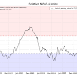
ENSO has broken away from every modern analog. Niño‑3.4 reached +2.68°C on 8 Aug -the highest for the date since 1982 - after a +3.13°C rise since 1 January. This is a daily SST anomaly, not ONI. The question now is how fully the atmosphere will couple. Do we fully grasp the magnitude of the Super El Niño signal taking shape 📈 ?

Mario Ramirez retweeted
2026 has by far the most subsurface heat across the ENSO regions when compared against the 1997 and 2015 Super El Nino’s.
But it’s somewhat misleading because what it mainly shows is the global warming signal, not really the relative difference in El Niño strength.
I’ll compare each against its own baseline when I have a moment. But for now there are still some valuable lessons:
1. Climate change is super powering absolute heat changes. We are living a new World and the excess heat released is high-octane energy for our climate system.
2. For the nerds, 2015 was more Central-East based (Nino 3.4 to 3) whereas 1997 clearly skewed its heat to the eastern Nino 3.
3. 2026’s heat is spread between central and east Pacific. There’s more heat overall. But it’s clearly the most East Based of these 3.
So the takeaway is: We’ve never seen such a mass injection of pent up heat at once into the climate system. Also I’d expect impacts more like 1997 than 2015… Looking at you Southern US/ Florida. Buckle up, it’s gonna be a busy winter!
Now, for the rest of you… What do you observe? #elnino

Mario Ramirez retweeted
Here's what a record-breaking +3.94°C El Niño could look like at its peak later this year, according to the new NMME — which trended 0.37°C stronger compared to its previous model run.


Mario Ramirez retweeted

The rise in Niño 3.4 region sea surface temperatures over the past few weeks has been nothing short of astonishing.
We are now hotter than any days during the 1997/1998 super El Niño event, and we are still many months from the peak.

Mario Ramirez retweeted

⚠️BREAKING NEWS⚠️
New ECMWF ensemble plume is in from August 1st and it trends even higher with our very strong El Niño. Seems like the CFSv2 is becoming more correct with this event as the ECMWF trends closer to it. Which by the way, this is going to be a historic El Niño that we have never witnessed since records began in the early 1800s.
I cannot believe what I’m seeing here. I’m pretty shocked that this is actually going to verify.
I will have full details on a big El Niño update on my YouTube channel scheduled for 2 PM this afternoon Pacific daylight time.


Mario Ramirez retweeted
Breaking: El Niño strength forecasts have just taken another step higher.
The new ECMWF outlook shows the event peaking near +4.0˚C in December — obliterating the previous record.
This will have sweeping implications on global climate patterns from late this year into 2027.

Mario Ramirez retweeted

El modelo ECMWF publicó hoy su actualización y como era de esperarse, por el fuerte acoplamiento océano-atmósfera que estamos observando; su tendencia es a que se mantendrían condiciones de El Niño "Extraordinario" hasta enero 2027 y baja un poco (90%) en febrero.

Mario Ramirez retweeted
Another milestone reached: the Niño3.4 SST anomaly has exceeded +2.5°C (OISSTv2.1, 1991-2020 baseline).
This exceeds the February peak of the 1997-98 El Niño (again, OISST data).
Subsurface warmth continues to build rapidly. Onward and upward.


Mario Ramirez retweeted

A anomalia de movimento vertical nos trópicos entre 25/06 e 01/08 — período que sucede o acoplamento da célula de Walker no fim de junho — já mostra o El Niño governando a convecção sobre o Pacífico.
O ramo ascendente anômalo se concentra no Pacífico central, deslocado para leste de sua posição climatológica, e é compensado por subsidência anômala em ambos os flancos: sobre o Continente Marítimo, a oeste, e sobre a América do Sul tropical, a leste.
É essa subsidência do lado sul-americano que explica o déficit de precipitação observado no extremo norte do Brasil e nos países vizinhos ao longo do período.
Já no Oceano Índico, ainda não há assinatura observacional oceânica ou atmosférica de uma fase positiva do Dipolo do Oceano Índico (IOD). Por ora, o sinal aparece apenas nas previsões sazonais, que se mantêm consistentes em indicar o desenvolvimento do IOD+ nos próximos meses.

Mario Ramirez retweeted
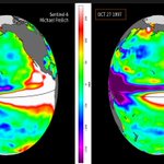
So after doing a bit of deep calculations, research & comparisons on the last three very strong El Niños since record-keeping began in 1992 with the Sentinel-6 sea height. What stands out is the 2026 super El Niño, with an estimated sea height of 199 mm compared to 181 mm at this time in 1997. So we're not only running quite a bit warmer, but sea level heights are 14- 15 mm higher so far with the 2026 El Niño, which is very shocking.
The only difference between 1997 & 2026 in this analog is that the highest sea level heights are further west in 2026 as opposed to 1997, which means the 2026 super El Niño has much more fuel in the tank to outpace any past super El Niños out there.
Now, if you're asking about 2015?
That event was mainly central-based and surprisingly had a peak sea level height of 175mm, about 6mm shy of the 1997 event at this time in late July into early August.
So is this El Niño of 2026 going to be historic?
Right now there's more than enough time left in the gas tank & heat stored in the ocean to get us into uncharted territory for the strongest possible El Niño since record-keeping began sometime in the early 1800's. So yes, I'm pretty confident (at least 85%) that we'll break an all-time record.
VERY IMPORTANT NOTE:
Super El Niños like 2026 are not a guarantee when it comes down to northern hemisphere winter impacts, as other teleconnections can outweigh ENSO, as ENSO is only one piece to the puzzle. You have to factor in the PNA, AO, NAO, EPO, WPO, NPPD, NPJ Phasing, QBO, IOD, and of course the state of the MJO. All these have the power to fully cancel out El Niño's effects since El Niño is a teleconnection & a climate phenomenon & is only one of many other teleconnections out there. But having the strongest El Niño possible increases the risk of El Niño impacts by a factor of 40%.
My next El Niño update will be released on my YouTube channel on August 5th, 2026, followed by my winter forecast on August 8th, 2026.
Stay tuned for more.


