

Chief Meteorologist Bay News 9, Tampa Bay. I have a live radar and I'm not afraid to use it. Follow the whole team @bn9weather
Tampa Bay Area, FL
Joined March 2009
- Tweets9.5K
- Following3K
- Followers4.9K
- Likes6.2K
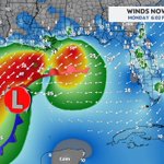




Excellent coverage all night in S FL @NickMerianos

1
109
My take: Once you have Flash Flood Watches & Warnings, you don't need to show the WPC Excessive Rainfall Outlook anymore. Why throw too much at the public?
4
183

Yep, 20 years ago I visited a ATC Center and tower. I was surpised how old the technology was then, 20 years ago

The Transportation Department earlier this year showed off just how old some of the FAA’s air traffic systems are and what they are working to upgrade. That includes *paper strips* still used to track flight routes in favor of electronic strips


8
1,027
Mike Clay retweeted

Finally, all my interests have converged!
While I agree that this is being handled poorly by the SEC, it is largely out of the hands of Ole Miss. The Ole Miss charter situation is a bit different than that of most other programs.
Ole Miss charters via JetBlue operating out of Tupelo Regional Airport, an hour bus trip from Oxford. KTUP is a small airport with little scheduled commercial traffic, it is uncontrolled after 10pm, and is not a hub or base of operations for JetBlue.
Due to the nationwide ground stop, the JetBlue crew operating the Ole Miss charter certainly would have timed out their duty day before the aircraft could depart.
Since it isn't a hub or base of operations, no relief crew would have been available to operate the charter tonight and no commercial flights departed from or arrived at KTUP after the ground stop was lifted so none could be flown in.
That means the earliest Ole Miss can depart would be when the rest period for the assigned crew is up, 10 hours, which only begins after the duty day ends. Depending on when that occurred, it is possible their next duty day couldn't even begin until after 8am. Add in an hour to bus/pre-flight, an hour to board, an hour and a half flight into Oklahoma City, an hour to load onto buses and half an hour to bus to Norman it would have been early afternoon before Ole Miss could get to OU.
Even if kick was delayed until evening, that would be pushing it in terms of player safety and it is also unclear if the SEC even offered a late Saturday kick time as an option.
Could an all-out last ditch effort made it work? Sure. But is an Ole Miss-Oklahoma game in mid-November worth making that all-out last ditch effort at the risk of player safety? I would personally say no. Unfortunately that means Oklahoma fans, through no fault of their own, get screwed. Knowing OU fans as I do, they'll find a way to make it hell on Ole Miss Sunday.


Mike Clay retweeted

BREAKING: Cargo ship hits Paddlewheel passenger boat in Mississippi River New Orleans with 129 passengers onboard.


Mike Clay retweeted

Rescues are underway in New Orleans after a tanker struck a cruise ship on the Mississippi River Friday evening.
📷: Kern Studios wdsu.com/article/mississippi…
7 ships in Port Miami on Saturday and 10 on Sunday! Good luck everyone

Busy weekend ahead at PortMiami!
Please arrive at your assigned embarkation time and remember to choose the right entrance based on your assigned cruise terminal:
🔵 PortMiami Tunnel: Cruise Terminals AA, A, B, C and D
🔵 PortMiami Bridge: Cruise Terminals E, F, J and V
Thank you for your patience and happy sailing!

ALT A map of PortMiami showing routes from I-395. A blue route directs drivers via the tunnel to cruise terminals AA through D. A red route directs drivers via the bridge and downtown streets to cruise terminals E, F, G, J, and V.
206
Mike Clay retweeted

#SeekingInfo @USCG Southeast District watchstanders are seeking information regarding 2 unmanned & adrift vessels approximately 55 mi. off Fort Pierce.
Anyone with info should call 305-415-6800. We have no reports of people missing at this time. #SAR


Mike Clay retweeted

Sunday Thoughts: A whole lot of money was spent on a lot of transfer QB's who have turned out to be pretty average.
The price for a QB keeps going up, but the play isn't getting better.

Mike Clay retweeted

Cruise passenger arrested after 500+ pills and almost $27,000 in cash found in luggage at Port Tampa Bay. The 50-year-old man is facing oxycodone trafficking charges:
cruisefever.net/cruise-passe…


Mike Clay retweeted

New ECMWF data shows the *strongest subtropical jet stream* in its forecast history blowing across the Pacific and U.S. this winter into next spring, with record-strength winds predicted from California to Florida.
There's even a connection to Europe.
El Niño fuels more thunderstorms near the equator, which release heat high into the atmosphere.
That extra warmth strengthens the Hadley circulation and steepens the temperature gradient between the tropics and the mid-latitudes, which strengthens the subtropical jet.
And that's why such a stormy winter is anticipated across the western, southern and eastern United States.
Mike Clay retweeted

Some more scenes from #McCaysville this afternoon. Going to be a long road back for a lot of these businesses that just had to rebuild over the course of the fall. @FOX5Atlanta @FOX5StormTeam #GAwx


