

Official Twitter account for the National Severe Weather Network (NSWN), a severe weather support network. For more info, visit https://teapawt.net/t.co/wjqVJXdZgF
United States
Joined November 2014
- Tweets17.1K
- Following1K
- Followers953
- Likes3.2K



National Severe Weather Network retweeted

It’s quite possible the worst of the damage has yet to be documented / reported in rural western NC. Helene will be remembered as one of the most devastating storms of the modern era. Many places have been geographically altered & the rebuilding process will take a lifetime.


National Severe Weather Network retweeted

HUGHES CO.: All lanes of east and westbound US-270 are closed between SH-48 and SH-56, near Holdenville, due to storm damage cleanup.
&
All lanes of north and southbound SH-48 are closed between SH-9E and US-270, near Holdenville, due to storm damage cleanup.
Wild

There is an isolated area east of Sulphur, OK that is currently under FIVE different tornado warnings.
At the same time.
#OKwx
194
National Severe Weather Network retweeted

11:51 - A new tornado is over Lake Murray now and headed for Dickson. Dickson was just impacted by a tornado - if you know anyone there, try to contact them, as their power may be out!

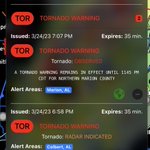
Tornado Warning including Ardmore OK, Dickson OK and Mannsville OK until 12:15 AM CDT

ALT This graphic displays a tornado warning plotted on a map. The warning is in effect until 12:15 AM CDT. The warning includes Ardmore OK, Dickson OK and Mannsville OK. This warning is for Southwestern Johnston County in southeastern Oklahoma, Northeastern Love County in southern Oklahoma, Southeastern Carter County in southern Oklahoma and Northwestern Marshall County in southeastern Oklahoma. The threats associated with this warning are a radar indicated tornado and half dollar sized hail. There are 20,936 people in the warning along with 9 schools and 1 hospital.
Praying for your family!

Oklahoma is currently experiencing a major nighttime tornado outbreak, with multiple violent, large tornadoes spawning. Reports of catastrophic damage are emerging, including people being trapped. This is exactly what I was worried about. My family members just sent me this photo as their house in Sulphur has been heavily damaged

1
120
This night is insane!

Yet another supercell on the tail end of the confluence line is ramping up fast and likely will drop a #tornado heading toward Dickson, OK once again! Time is 1153 pm

104
National Severe Weather Network retweeted
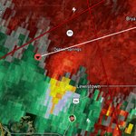
PDS Tornado Warning including Sulphur OK and Hickory OK until 12:00 AM CDT. This is a LIFE THREATENING SITUATION, SEEK SHELTER! We're tracking this using @RadarOmega LIVE: youtube.com/watch?v=40ykqb-b…

Chasers are going to have a busy busy busy day tomorrow. Radar scope is going to light up like a Christmas tree!
74

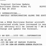
🚨URGENT: Tampa Int’l Airport will close at 12:01 a.m. Tue 8/29 due to Idalia and is not to be open as a shelter!✈️
National Severe Weather Network retweeted

Strong drillbit tornado crosses the road in front of me SW of Pleasantville, IA moments ago #iawx #tornado @accuweather
National Severe Weather Network retweeted

POWERFUL TORNADO! @RadarOmega – at Iowa, USA

National Severe Weather Network retweeted

3/3 When under a #tornado watch, be weather aware! Check your location w/ relation to storms nearby until the watch has expired. Especially in public. Know your location & storm location,direction, & speed. Encourage others to take cover when appropriate.
National Severe Weather Network retweeted
2/3 If under a warning, even if you think (by looking on radar) the tornado may miss you, tornadoes are known to change direction and speed in an unpredictable manner. Take shelter until the threat has passed. Furthest interior room or underground if possible. (Cont.)