Rediscover the places that have shaped Britain and Ireland for centuries. By the Historic Counties Institute.

Britain & Ireland
Joined January 2020
Real Counties retweeted
The City of Milton Keynes is a unitary authority, but that doesn't mean it’s ceased to be part of a geographic county. Milton Keynes is still geographically in Buckinghamshire. Changes in local-government arrangements do not change county geography. Being a unitary authority and belonging to a historic county aren't mutually exclusive. Both are true today!
2
5
1
30
1,517
Real Counties retweeted
Croydon is a London borough, but that doesn't mean it’s ceased to be part of a geographic county. Croydon is still geographically in Surrey. Inclusion in Greater London in 1965 changed Croydon’s local-government arrangements, not its county geography. Being part of London and belonging to a historic county aren't mutually exclusive. Both are true today!
11
11
5
129
13,541
Real Counties retweeted
You’ve probably been told: “Yorkshire used to have three ridings but hasn't anymore.” It sounds true. But it isn’t. Yorkshire's ridings haven’t changed, only administration has. So why are we pretending otherwise?
16
32
2
191
28,093
Real Counties retweeted
Some people assume councils or lieutenancies define England’s counties. They don’t. Every historic county is at least 800 years old; many are over 1,000. Lieutenancies date only from the 1540s, and county councils from 1889. So neither can define counties that had already existed for centuries.
2
8
25
1,023
Real Counties retweeted
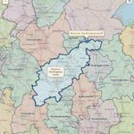
🗺️ COUNTY QUIZ 🗺️ Can you identify the highlighted county from its outline alone? No place names, no clues - just the county boundary. Put your answer in the comments. 👇 Follow for more county quizzes!
9
2
1
4
1,710
Real Counties retweeted
The County of Northumberland is a rugged shire. The largest town of Northumberland is Newcastle upon Tyne. The city stands on the north bank of the Tyne, but beyond this, Northumberland is rural and sparsely populated.
30
21
2
183
20,868
Real Counties retweeted
Have you explored the tools on our interactive map yet? This view shows the Greater Manchester lieutenancy area alongside the geographic counties, making it easy to see how the two different layers relate. You can switch boundaries on and off, compare geographic counties with council areas and lieutenancies, and zoom right down to local level. Explore it for yourself - find it at RealCounties.com.
1
8
2
21
1,661
Real Counties retweeted
NEW FEATURES on our interactive map! As well as browsing the counties, you can search, compare councils & lieutenancies, view census data & even switch on the original 19th-century @OrdnanceSurvey First Edition mapping! Find it at RealCounties.com View article
3
1
2
11
1,007
Real Counties retweeted
Think only Yorkshire has Ridings? 🤔 Think again! Lincolnshire has them too. Lindsey - one of Lincolnshire’s three 'Parts', alongside Kesteven and Holland - is itself divided into the North, South and West Ridings. Detailed interactive version at RealCounties.com
2
18
68
1,700
Real Counties retweeted
Around the turn of the 11th century, Derbyshire emerged as a shire. By about 1048, it was already recorded as Derbyscir - centuries before the landscapes that later made the county famous were transformed by industry. From the high moors and limestone dales of the Peak, down the Derwent valley to Derby and the Trent lowlands, these contrasting landscapes form one enduring county: Derbyshire - the County of Derby.
5
29
1,812
Real Counties retweeted
Lancashire’s six hundreds - Lonsdale, Amounderness, Blackburn, Leyland, Salford and West Derby - preserve a territorial geography with roots older than Lancashire itself. When Domesday Book was compiled in 1086, Lancashire had not yet emerged as a county, but several of these divisions already existed, while Amounderness and Lonsdale were established territorial names in the north. As Lancashire took shape in the 12th century, these older divisions were consolidated into its familiar six hundreds. A fascinating reminder that the county was built from an even older landscape of local territories.
10
19
4
112
9,785
Real Counties retweeted
Not one landscape but a powerful sequence: Mersey estuary, industrial towns, Pennine valleys, Ribble & Fylde, Lancaster plain, tidal bay, mountain country. Morecambe Bay is not a gap in that geography: its sands are the living connection between the main body of Lancs & Furness.
6
14
3
101
8,464
Real Counties retweeted
Long before Argyllshire took county form around 1293, this was a heartland of Dál Riata and the western Gaelic world. From Kintyre and Cowal to Lorn, Ardnamurchan and the Inner Hebrides, sea lochs and islands formed not a barrier but a connected maritime landscape - the “coast of the Gael”: Argyllshire - Earra-Ghàidheal.
3
3
1
34
4,150
Real Counties retweeted
Think England’s counties were created by the Normans after 1066? Think again. Most of England’s historic counties were already centuries old by the time William the Conqueror arrived - with origins in ancient kingdoms, shires and territories dating back to the Anglo-Saxon period and earlier. Yorkshire. Kent. Sussex. Essex. Norfolk. Somerset. Devon. These are not modern administrative inventions - they are part of England’s historic geography and identity, enduring for hundreds (and often well over a thousand) years. The Normans conquered England. They did not invent England’s counties.
7
98
3
464
27,084
Real Counties retweeted
Our interactive map is now faster, smarter and easier to use. Place searches that could take 30+ seconds now usually return in under a second, with improved matching, instant map movement and clearer historic county, council and lieutenancy information. Find it at RealCounties.com
2
4
951
Real Counties retweeted
You’ve probably been told: “Peterborough used to be in Northamptonshire but isn't anymore.” It sounds true. But it isn’t. Northamptonshire hasn’t changed, only administration has. So why are we pretending otherwise?
3
3
20
1,377
Real Counties retweeted
The counties were never abolished. So why does everyone think they were? The Government has repeatedly stated that the traditional counties were not altered by local government reorganisation. Yet maps, signs and everyday language have encouraged generations to believe precisely the opposite...
1
8
22
1,572
Real Counties retweeted
Our first census statistics by geographic county are now LIVE on the RealCounties interactive map! 📊🗺️ Explore official census data across Britain’s historic counties - with much more to come. Simply select 'Show Statistics' to begin. Find the map via RealCounties.com
5
1
22
2,602
Real Counties retweeted
Our first Census by Geographic County graphic is here! 📊 Using official @ONS 2021 Census data for England and Wales, we’ve calculated and ranked population by the enduring geographic counties - rather than council or lieutenancy areas. This is the first of many graphics bringing official statistics back to a stable county geography. Explore the data on our interactive map - find it at RealCounties.com
1
2
15
1,426
To be fair, both Arsenal and Tottenham (and Chelsea, Fulham, Brentford, & QPR) play in Middlesex. No borders have moved. Don’t confuse real ancient counties with more recent administrative councils…
❌ Myth: “Middlesex was abolished in 1965.” ✅ Truth: Only the Middlesex County Council was abolished - a body just 76 years old. The county of Middlesex is 1,000+ years old and was never abolished. Councils change. Counties endure. 🗺️ Abolished council ≠ abolished county.
1
1
4
943