Star (@StarInBoxWx) header
Star (@StarInBoxWx) profile picture

20 | ✝️ | Central Alabama Weather | National Wx: @weathertrackus

Alabama
Joined September 2016
Photo by Star (@StarInBoxWx)Photo by Star (@StarInBoxWx)Photo by Star (@StarInBoxWx)Photo by Star (@StarInBoxWx)Photo by Star (@StarInBoxWx)Photo by Star (@StarInBoxWx)Photo by Star (@StarInBoxWx)Photo by Star (@StarInBoxWx)Photo by Star (@StarInBoxWx)Photo by Star (@StarInBoxWx)
Indeed early elevated storms did produce very large hail earlier this afternoon...
Replying to @StarInBoxWx
Probably wouldn't hurt to have either a 15% hail or CIG1 for the initial activity if moisture arrival trends a little bit later. I think the 5# tornado risk makes sense today, despite it being very conditional. Going to be an interesting 'under-the-radar' type setup today...
1
3
448
New @aguacerowx computer
We brought Touch to the Mac! From the all-new iPad mini to the 14-inch MacBook Pro and iMac... and now MacBook Pro with PROLED XDR Display and Touch, creators have new tools to do their best work yet.
2
234
This is why we can't have nice things...
This feels like a poor use of time and resources. Is your forecast confidence really increasing that much to make changes from the morning to the afternoon in that far of a range?
1
6
842
I personally don't understand why some (especially some, albeit a small minority) meteorologists are upset about this update. We've advanced enough in forecasting to be able to have such changes, and somehow that's a problem?
1
1
232
Not to mention, likely within the next couple of years, especially when we see the full implementation of the MPAS-RRFS, we'll have a standalone Day 4 Outlook, and all hazards Day 3 Outlook. These incremental advancements should not be frowned upon.
1
1
220
NEW: The Storm Prediction Center, on or about November 16, 2026 will begin issuing afternoon Day 4-8 Severe Weather Outlooks, at 2130 UTC (4:30 PM CDT/3:30 PM CST). The content and format of the outlooks will not change; only the addition of afternoon issuances.
3
77
7
345
16,211
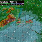
Wind profiles will undoubtedtly be supportive for SigTors this afternoon, the main question lies in thermos. Will moisture arrive in time before storms grow upscale? I think initially storms will be elevated, with primarily a hail risk, before the tornado threat ramps up...
A couple of tornadoes are possible across parts of Minnesota and Wisconsin, including the Minneapolis-St. Paul metro today. There is also a conditional risk for a strong (EF2+) tornado. Main timing is from 2-7pm CDT. Remain weather aware!
1
5
30
2,020
Probably wouldn't hurt to have either a 15% hail or CIG1 for the initial activity if moisture arrival trends a little bit later. I think the 5# tornado risk makes sense today, despite it being very conditional. Going to be an interesting 'under-the-radar' type setup today...
1
1
579
I also UNDOUBTEDLY can't spell this morning... forgive me, it's early.
117
Since July 20, I’ve uploaded 20 videos to the channel, experimenting with different formats and styles little by little. Winter might be fun…👀🤫
2
344
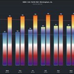
Upper-70s expected this weekend and into early next week, with rain returning on Sun/Mon, and again on Thu. Some isolated areas in Central AL could briefly touch 80 between Fri & Mon. Temperatures return to seasonal averages late next week, with 60s for highs.
1
1
229
A few strong-severe storms can't entirely be ruled out across the state on Sunday or Monday, with some instability, and a strong storm system moving in. Specific details are unavailable, and lots of uncertainty exists, but I wouldn't rule out a marginal severe event next week.
1
93
Mild days and cool nights will continue for the rest of the week, with a warming trend next week, with clouds and rain back in the forecast, as early as ~Nov 1. Upper 70s and isolated 80 degree spots likely first week of Nov, before cool temps return the following week.
1
3
315
Most locations will be in the upper-70s early next week, but a couple of areas could briefly reach 80 at peak heating. It's possible that a lot of the guidance is still running a bit too warm right now for many locations.
114
Upper 70s possible next week, with rain coming back in the picture around Nov 1-3. Some areas in the Deep South could touch 80 in early November, but mostly upper-70s expected for Birmingham and North Alabama. Some signal for a cool down coming the 2nd week of November.
4
245
America wins when Tennessee loses
1
254
Thank you beam blockage
1
1
18
889
We thought this was going to be the largest outbreak that second season
October 24, 2021: An outbreak of 17 tornadoes impacted Kansas, Missouri, and Illinois. Four were significant (EF2+), three of which were spawned by a cluster of supercells south of St Louis. EF3s at Farmington & Fredericktown leveled structures and injured 2 people. #wxhistory
2
20
1,343
I love my state
A really high dude at Whataburger just gave me $300 in cash??? "Go get you a nice shirt and a good haircut, and go get you some tail my boy" ALRIGHTY THEN
3
387
Unless we have some very dry/clear days in early November, it will not be in the 80s in Birmingham. Regardless, a mild/wet pattern is still in store after Halloween, and through early November. Can't entirely rule out the potential for a few strong storms in the broader region.
1
189