

20 | ✝️ | Central Alabama Weather | National Wx: @weathertrackus
Alabama
Joined September 2016
- Tweets22.8K
- Following114
- Followers3.9K
- Likes13.9K


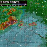



Indeed early elevated storms did produce very large hail earlier this afternoon...


New @aguacerowx computer

Pretty self explanatory...
There really isn't much to question here. It's been long overdue for updates to the SPC's outlooks. In fact, the SPC began doing afternoon updates in 2024, and it's been a huge success.
I don't see why this would be any different.

Not to mention, likely within the next couple of years, especially when we see the full implementation of the MPAS-RRFS, we'll have a standalone Day 4 Outlook, and all hazards Day 3 Outlook.
These incremental advancements should not be frowned upon.
I personally don't understand why some (especially some, albeit a small minority) meteorologists are upset about this update.
We've advanced enough in forecasting to be able to have such changes, and somehow that's a problem?

Star retweeted

NEW:
The Storm Prediction Center, on or about November 16, 2026 will begin issuing afternoon Day 4-8 Severe Weather Outlooks, at 2130 UTC (4:30 PM CDT/3:30 PM CST).
The content and format of the outlooks will not change; only the addition of afternoon issuances.

Wind profiles will undoubtedtly be supportive for SigTors this afternoon, the main question lies in thermos.
Will moisture arrive in time before storms grow upscale?
I think initially storms will be elevated, with primarily a hail risk, before the tornado threat ramps up...


Since July 20, I’ve uploaded 20 videos to the channel, experimenting with different formats and styles little by little.
Winter might be fun…👀🤫
Here's what we know (and what we don't know) about next week's active weather pattern, potentially featuring severe weather:
youtube.com/watch?v=nXjYRM9m…

A few strong-severe storms can't entirely be ruled out across the state on Sunday or Monday, with some instability, and a strong storm system moving in.
Specific details are unavailable, and lots of uncertainty exists, but I wouldn't rule out a marginal severe event next week.

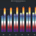
Upper-70s expected this weekend and into early next week, with rain returning on Sun/Mon, and again on Thu. Some isolated areas in Central AL could briefly touch 80 between Fri & Mon.
Temperatures return to seasonal averages late next week, with 60s for highs.


Most locations will be in the upper-70s early next week, but a couple of areas could briefly reach 80 at peak heating. It's possible that a lot of the guidance is still running a bit too warm right now for many locations.

Mild days and cool nights will continue for the rest of the week, with a warming trend next week, with clouds and rain back in the forecast, as early as ~Nov 1.
Upper 70s and isolated 80 degree spots likely first week of Nov, before cool temps return the following week.


Upper 70s possible next week, with rain coming back in the picture around Nov 1-3.
Some areas in the Deep South could touch 80 in early November, but mostly upper-70s expected for Birmingham and North Alabama.
Some signal for a cool down coming the 2nd week of November.


