

Daniel - amateur UK forecaster. All year round weather shenanigans et al. Somewhat sane. Please support my work on Patreon 🙂
London, England
Joined December 2015
- Tweets91.5K
- Following1.4K
- Followers34.2K
- Likes34.8K


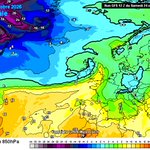


Wet wet wet 💦 persistent rain should be cleared by near lunchtime in London, but risk of patchy drizzle thereafter.

Unsettled start to new week but still somewhat milder than average highs up to 17C in London.
From Wednesday onwards dry and calm weather sets in, temps will progressively get cooler and slip below average by end of next week.
Early November is looking pretty chilly well for the modern era more traditional weather around Bonfire Night is likely. #ukweather


Best thing about return of GMT model runs initialise 1 hour earlier 🙏 #niche

London & Southeast 🔆 retweeted

Maybe the word "unprecedented" is overused in weather/climate but the forecast of the strong weakening of the #PolarVortex in early November is truly without precedent. My stratospheric AO forecast disappeared at -4 SD! Good timing for a PV blog tomorrow! published.aer.com/aoblog/aob…


A months worth of rain has fallen in places over last 4 days but the week will end nicely.
Unbroken sunshine however still breezy. Cool wind.


Northern Hemisphere air temp anomalies spiking to unseen before levels in short term 🔥
Arctic areas extremely warm, the polar vortex normal rapid development in late autumn is being scrubbed.
As a result this could transform expectations in Europe for late autumn/early winter, which was very hostile for blocked and cold weather #ElNino


Early indicators for November, a quiet and settled opening. Potentially quite chilly with weak continental drift, risk of mist and fog.
Frosts could become regular on continental Europe more unclear for us but good news if you’re tired of rain.
Dry weather returns middle of next week and here to stay.


It’s very rare the UK mainland is all seeing rain simultaneously but it’s a imminent reality. #ukweather


