

Jesse Ferrell, AccuWeather Meteorologist & Digital producer. Opinions my own. WeatherMatrix, Since 1996: "The Weather is Always Interesting."
State College, PA
Joined May 2008
- Tweets50.7K
- Following1.5K
- Followers10K
- Likes2.7K


Jesse Ferrell retweeted

After ECMWF began teasing with a Polar Vortex core split and wind reversal in the stratosphere, the GFS model now caved in and is going into proper Stratospheric Warming with a core split and reversed flow in the mid-stratosphere.
The GFS 3D Polar Vortex forecast really nicely reveals the disruption process of the Polar Vortex and the split of the core area.
All products, inclusing the live 3D #polarvortex forecast arw available in my own Polar Vortex hub, link in the comments. 👇
AIFS remains conservative, which is expected for a model of its type, so we are still in a high-caution mode for now. This also prevents to really discuss potential weather impact, as we first need need to properly resolve which "side" will win in the stratosphere.


Jesse Ferrell retweeted

This is going to be a generational winter for coastal flooding and erosion along California’s coast.
A marine heatwave plus a Kelvin Wave from El Niño have already rapidly raised water levels in recent weeks. Combined with king tides this winter, it’s likely every coastal city from the Bay Area to SoCal will see their highest water levels in recorded history.

Jesse Ferrell retweeted

Cars and storage containers were seen floating through a neighborhood in Hurricane, Utah, after flash flooding inundated the area, leaving residents stunned by the rising waters.
Jesse Ferrell retweeted

Orkantief #Manja trifft jetzt auf Schottland mit einem Kerndruck von aktuell etwa 947 hPa. Man beachte die Windböen in der kommenden Nacht:
kachelmannwetter.com/de/mode…
/FR
Jesse Ferrell retweeted

other reasons. 1) Very large at that time, so its inflow, if you took vector analysis, was aimed where it was moving towards. The larger the storm, the harder it is to weaken. ( Also the weaker the storm the harder because its already week). This is exactly why the power and impact scale is so dang good: size matters with hurricanes, 50 kt and 34 kt windfields both get the same rating, with spot wind at the surface. A quick calculation of Wilma at landfall. Ike 2 days after landfall was knocking out power in the Ohio valley. ( in fact Ike was the inspiration for the Power and Impact scale) The upper flow was lined up nicely for maximum transport of wind down to the surface. We see this sometimes in the northeast on the east side of hurricanes. But this added fuel to my seeding of smaller, more intense storms coming to the coast as its a great anti-log as opposed to a storm that is focusing its fury as its coming to the coast. So, based on the NHC report, Pressure gets a 3.5. Wind gets a 3.7; gusts get a 4.9; hurricane winds get a 2.6; 50 kt gets a 3.2; 34 kt gets a 3.6. So it's a 3.6 without pressure adjustment (if rapidly falling, add; if weakening, subtract, since an intensifying storm will have better transport to the surface than a weakening storm). Classic case: Idalia ( weakening). In this case, power and impact and Saffir-Simpson were close ( NHC should use tenths at the least). Size matters, and so do gusts! In the case of Ike, it was a high-end 3 on our scale. Think about it. Charley vs. Donna in southwest Florida. Both cat 4s, but Charley can not hold a candle to Donna except within the 10 mile area of landfall

Last year before Hurricane Melissa hit Jamaica as a CAT 5.

Folks: Jamaica has never had a Cat 4 or 5 landfall, can you believe it? Map shows the Cat 3s.
Most recent close pass by Cat 4 was just last year, Beryl 2024. #Melissa could be closer, stronger, and last longer.
List of deadliest/strongest Jamaica Hurricanes accuweather.com/en/hurricane…


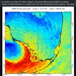
Incredible animation of Hurricane Wilma's landfall on southern Florida. Because it essentially moved over a swap, it barely lost intensity and caused an unexpected amount of wind damage in the Miami area. Via @bmcnoldy.bsky.social
facebook.com/reel/1143611761…

Jesse Ferrell retweeted

It’s been in development a long time, but finally, “threats-in-motion” likely to come in 2028 as new software is implemented across the National Weather Service. Severe storm warnings will move with the storm. @nwas
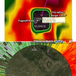
A TVS (Tornadic Vortex Signature) *IN* the Cone of Silence? Don't think I've ever seen this before! The Flagstaff radar tagged a TVS overhead at "Range: 1 mi" (first image is MRMS composite)

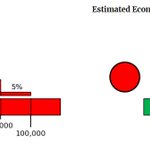
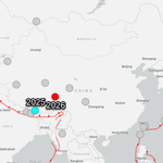
The USGS Pager has turned red for the China 7.0 earthquake, forecasting 100s of fatalities & $billions in damage. Rarely, this can be inaccurate, especially in remote areas. earthquake.usgs.gov/earthqua…


A powerful magnitude 7.0 earthquake struck northern Tibet, China, late Thursday, shaking a remote, mountainous region where communities sit at some of the highest elevations on Earth. bit.ly/488B6GO

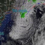
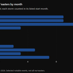
Nor'easter / Josephine's Greatest Hits (Last 24 hours)
Nantucket, MA: 54 mph
Buoy 41120 (Offshore from Hatteras): 17 ft waves
Duck, NC: +3.14' storm surge

Big shallow 7.0 quake in China. Last 7+ mag was Jan. 2025. Around 8 of that mag or higher since 2000. earthquake.usgs.gov/earthqua…

A local resident & County commissioner has asked that Highway 12 on the NC Outer Banks be moved temporarily until a long-term bridge can be built.
wtkr.com/news/in-the-communi…

Hail trails yesterday in Flagstaff & Phoenix. Max LSR was 2" hail near Phoenix. Arizona averages ~1 two-inch-or-larger hailstone per year.


Jesse Ferrell retweeted
Strengthening steering winds will push Josephine over progressively colder waters in the North Atlantic. It could pass close enough to the large Canadian island of Newfoundland to bring wind-driven rain and snow on Saturday. bit.ly/4k9xcVl

