

Aerial, Drone & Mobile Geospatial Video Mapping Software & Video Recorders for Critical Infrastructure Inspections
Fort Collins, CO, USA
Joined October 2012
- Tweets111
- Following56
- Followers111
- Likes19


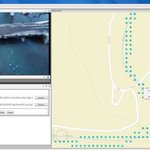



Time Flys! (And so do our #geoDVRs and #LineVision.)
Today the @RemoteGeo team is please to celebrate 10 amazing years in business!
To all our customers around the globe - Thank You for making this possible!

Remote GeoSystems Awarded Patent for Essential Geospatial Full Motion “Video Geo-editing” Technology
READ MORE: remotegeo.com/remote-geosyst…
Pleased to announce our revolutionary new map-based video editing software - Video GeoEditor - has been added to the @Esri ArcGIS Marketplace:
linevision.maps.arcgis.com/h…
Now anyone can playback, geotag and edit any video using maps and GIS data! Get a Free 7-day Trial!
30% Off Remote Geo Software - Our Black Friday / Cyber Monday Sale Starts Now! - mailchi.mp/remotegeo/30-perc…
How-to video on @RemoteGeo's useful new feature for DJI drone users needing an easy way use their videos in @Esri ArcGIS MISB FMV Add-in: youtu.be/4DRaNJBBMX0
Currently available in LineVision Desktop - Ultimate: remotegeo.com/software/linev…
Free trial!
LineVision Desktop and Video GeoTagger now feature Litchi app video geotagging support!
See the How To Video:
youtu.be/iUJrchU17s4
@remotegeo Winter 2019 Newsletter Now Available - Geospatial Video News (Heli-Expo Edition) mailchi.mp/remotegeo/2019-wi…
Announcing the release and availability of the new geoDVR MISB FMV module for the direct recording of video with MISB FMV/STANAG 4609 compliant location metadata from airborne gyro-stabilized gimbal camera systems. remotegeo.com/geospatial-vid…
Video of a @DJIGlobal drone mapping and monitoring of #Kilauea lava flows in LineVision. @RemoteGeo donated and deployed the new LineVision Ultimate edition with CRASAR's drone public safety specialists in Hawaii the last few weeks.
Video GeoTagger FREE & PRO officially released! ow.ly/eLPz30k3jFW Check out the YouTube Videos: ow.ly/RnA430k3jLP
Video GeoTagger FREE by @RemoteGeo is now available in the @Esri @arcgis Marketplace - ow.ly/dUu630jHoYY - The easy way to geotag and view your videos with a map!


In Denver this week for the IEEE PES T&D Power conference? Come check out @RemoteGeo at the Trakka Systems booth 4033 to see the latest in #airborne and #drone #utilities inspection imaging and reporting technologies.
So to celebrate our 7th birthday the U.S. Patent Office gave us a little present - @RemoteGeo - U.S. Patent No. 9,936,214 - Geospatial Media Recording System!


Geospatial Video & Media News - Winter 2018 (Heli-Expo edition) - mailchi.mp/0144b0825eaa/l6jr…
I added a video to a @YouTube playlist youtu.be/FliBnOLh8co?a How to Add Shapefiles Display Labels LineVision Esri Maps
I added a video to a @YouTube playlist youtu.be/FliBnOLh8co?a How to Add Shapefiles Display Labels LineVision Esri Maps
I added a video to a @YouTube playlist youtu.be/voFiTUfMCsQ?a How to Geotag Video with Video GeoTagger
I added a video to a @YouTube playlist youtu.be/Sl-9XRp2CbQ?a Helicopter Powerline Inspection Takeoff - Haverfield Aviation