

Lead @ZoneWatchWX & Alpha Weather Analysis; One mission, to inform people and save more lives. Forecasting since 2010 🇮🇷🇩🇪🇺🇸🇨🇳
Joined June 2020
- Tweets438
- Following98
- Followers1.4K
- Likes833


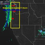
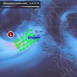
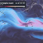
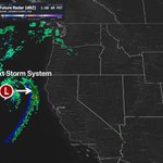

⚠️ AWA NOTICE: A Significant Storm Pattern Is Developing Across the Pacific West Coast | Mid-November Through Late November 2026
Read the FULL BREAKDOWN and details below:
alphaweatheranalysis.com/new…
Stay tuned for more details and info as we get closer.

EYE OPENING TREND & MORE ACTIVE THAN ANTICIPATED SHOULD IT LOCK
Good Morning, Saturday November 7th, 2026 at approximately 11:11am PT.
Discussion: A strong Pacific front brings rain and potentially damaging winds to Washington and northwest Oregon this afternoon through tonight, with gusts near 60 mph along exposed coastal locations and 45 to 50 mph from Seattle northward overnight, increasing the risk of falling trees and power outages. Large waves make Northwest beaches dangerous tonight through Sunday, while high tides and powerful surf threaten shoreline flooding around San Francisco, San Pablo and Monterey Bays through Monday and vulnerable Central and Southern California beaches, with the greatest southern coastal impacts Monday.
Santa Ana winds peak this morning, creating critical fire danger in affected portions of Los Angeles and Ventura counties and localized gusts near 45 mph farther south before easing Sunday into Monday. The front reaches eastern Washington overnight into Sunday with gusts of 30 to 40 mph, while 3 to 4 inches of snow could make travel slippery at Washington Pass. Dam releases keep Arizona’s Salt and Gila rivers elevated through Monday, making flooded crossings unsafe, while north winds gusting 20 to 35 mph between Laughlin and Needles today create hazardous conditions for boaters along the lower Colorado River.
We have a very active weather pattern ahead, as we've been mentioning, and keep in mind, this is VERY EARLY in the season! For regions such as Southern California and the Southwest, patterns this active are more commonly associated with the heart of winter, particularly January and beyond. However, an exceptionally strong El Niño can significantly influence the timing and intensity of these patterns, potentially bringing more active conditions earlier than usual. Stay tuned.
NOT FINAL ANTICIPATED RAINFALL TOTALS BUT, BEING MONITORED....ADJUSTMENT LIKELY....UP OR DOWN


Good Morning, Friday November 6th, 2026 at approximately 11:22am PT.
Discussion:
Rain (moderate at times) and gusts near 50 mph affect Washington’s coast and northern interior today, with another Pacific system arriving Saturday night that could bring damaging winds to exposed headlands along southwest Washington and northwest Oregon, potentially damaging trees and causing isolated power outages. Large ocean swells make Washington and Oregon beaches increasingly dangerous Sunday, while high tides and powerful surf bring coastal flooding concerns to California’s bays and exposed shorelines throughout the weekend. Santa Ana winds reach their strongest tonight into Saturday, with localized gusts of 45 to 55 mph in the Los Angeles and Ventura County mountains creating critical fire danger, while exposed passes and slopes farther south see gusts of 25 to 40 mph.
A passing disturbance could trigger isolated Arizona thunderstorms this afternoon into early Saturday, with localized flash flooding possible in Cochise and southern Graham and Greenlee counties, while separate dam releases keep portions of the Salt and Gila rivers dangerously high through the weekend. North winds of 30 to 35 mph, locally nearing 40 mph around Laughlin and Bullhead City, will create hazardous boating conditions on Lakes Mohave and Havasu today through Saturday afternoon.
Update on Medium Range Forecast broken down into sub regions with zoomable images & more here: alphaweatheranalysis.com/liv…
Stay tuned for more updates as the pattern changes with time. #CAwx #ORwx #wawx #ElNino


One of our biggest releases for snow lovers & more. Check it out especially if you're into skiing, snowboarding, need to know snow levels etc.

❄️ WINTER IS COMING. ARE YOU READY FOR THE MOUNTAINS OR KNOWING YOUR SNOW LEVELS?
Meet ThreatNet Snow, powered by ZoneWatch! Whether you're skiing, snowboarding, or planning your next mountain adventure, get the information you need before heading out.
🏔️ Track snowfall at your favorite ski resorts and mountain elevations.
🌨️ See exactly where snow levels will be, including when rain, snow, or mixed precipitation is expected.
📊 Explore detailed mountain conditions from base to summit, including snowfall totals, temperatures, and upcoming storms.
⛷️ Plan ahead with 10 day snowfall forecasts, snow quality insights, and the best days to hit the slopes.
🎿 Track your favorite resorts, including Ikon, Epic, Indy Pass, and more!
Less guessing. More time on the mountain.
📱 Available through ZoneWatch on iOS with version 4.10 (android coming very soon).
BONUS LOCK IN DISCOUNT LIMITED TIME ONLY: zonewatchpro.com/season-open…
#Skiing #Snowboarding #WinterWeather #CAwx #Cowx


Good Morning, Thursday November 5th, 2026 at approximately 10:10am PT.
Discussion:
A series of Pacific fronts brings rain and gusts of 40 to 50 mph to Washington’s coast and areas north of Everett tonight through Friday, with another round of strong winds Saturday evening also reaching coastal northwestern Oregon, so secure loose outdoor items ahead of time. Santa Ana winds strengthen across Southern California Friday and Saturday, producing gusts of 25 to 40 mph through exposed passes and mountain slopes and increasing fire danger to locally critical levels around Los Angeles and Ventura counties.
High tides could flood vulnerable shorelines around San Francisco, San Pablo and Monterey Bays through Saturday, while exposed nearby beaches face breaking waves of 12 to 16 feet and unexpectedly large surges of water, with coastal flooding concerns also developing along Orange and San Diego counties Friday. North winds gusting near 40 mph Friday through Saturday will build waves of 2 to 3 feet on Lakes Mohave and Havasu, making conditions dangerous for small boats and paddlers. Despite mostly dry weather across Arizona, water released from dams keeps portions of the Salt and Gila rivers hazardous through the weekend, so stay out of flooded crossings and avoid recreation along affected waterways.
Stay tuned for some major releases today from ZoneWatch & also more updates including a public article by tonight.

Good Morning, Wednesday November 4th, 2026 at approximately 7:45am PT.
Discussion:
A stronger system Thursday night into Friday with heavier rain, gusty winds and hazardous surf potential, especially along Washington’s coast and north of Everett. Dense fog could slow this morning’s commute between Albany and Eugene, while pockets of freezing fog could reduce visibility and create slick spots in Nevada valleys tonight and Thursday night.
Arizona’s flood danger continues despite mostly dry weather, with dam releases keeping flows high along the Salt and Gila rivers through Friday and lingering flooding across some southeastern waterways, so avoid flooded crossings and stay out of swollen rivers. High tides bring minor flooding around San Francisco, San Pablo and Monterey Bays through Friday, while incoming swell adds sneaker waves, strong rip currents and surf of 12 to 16 feet along nearby Pacific beaches beginning Thursday. North winds could gust 30 to 40 mph along the Colorado River Valley Friday, building waves near 3 feet on Lakes Mohave and Havasu and creating dangerous conditions for small boats and paddlers. Southern California, slight warm up but nothing in terms of impact just yet…
Longer term impacts, risk and forecast is coming up today on AWA services. Stay tuned. We also at ZoneWatch have a surprise as well coming sometime today with details (snow lovers will like this one).


A reminder... From a professional meteorological perspective, we do not rely on individual model runs weeks into the future. We analyze the overall atmospheric pattern, underlying dynamics, and whether the setup fundamentally makes sense. I keep hearing, "It's too far out to know." Yes, for exact rainfall totals, storm tracks, timing, and localized impacts, absolutely.
However, identifying a major pattern shift is entirely different. A potentially powerful jet stream, favorable atmospheric dynamics, and significant moisture transport are strong signals of a more active pattern ahead. Models are tools, not the atmosphere itself. Those relying too heavily on individual model runs may be seriously humbled this fall and winter. There is a major difference between predicting exact rainfall totals two weeks out and recognizing a significant atmospheric shift. Understanding the fundamentals matters, and confidence in the overall pattern does not require certainty about every individual storm.
Good Morning, Tuesday November 3rd, 2026 at approximately 9:12am PT.
Discussion:
A Pacific low moving into Northern California brings wet roads around the Bay Area this morning, followed by a chance of afternoon thunderstorms mainly over coastal waters near the North Bay, where isolated waterspouts could develop before activity winds down tonight. Arizona stays dry, but continued runoff and dam releases keep portions of the Salt, Verde and Gila river systems dangerous through Thursday, with flooding lingering in other areas as well, so take this seriously and avoid flooded crossings and swollen waterways.
Southern California’s mountains and deserts could see gusts of 35 to 40 mph this evening, followed by increasing offshore winds Thursday near the Ventura and Los Angeles county line that could make exposed roads difficult for commercial vehicles. Fog may limit visibility across western Oregon and Washington Wednesday morning before another front brings rain Wednesday afternoon through Thursday morning, coastal Washington gusts of 25 to 35 mph and light snow in the higher Olympic and Cascade Mountains. Bay Area beaches remain dangerous today as unexpectedly large waves and strong rip currents affect the coast, while rising tides could cause minor coastal flooding Wednesday and Thursday.
Several updates are coming today through AWA Insiders and Essentials, breaking down the upcoming pattern in more detail. A public article will also be available, with a broader overview, and you can follow conditions for your location in the @ZoneWatchWX app (major updates coming up!).
I want to say enjoy the slight warmup, but honestly, I’m so over this heat. I’m missing temperatures in the 40s and 50s at this point.

BACK TO BACK STORM SYSTEMS BEING WATCHED:
This is exactly what we're watching as the overall weather pattern is expected to undergo a significant shift toward mid November.
We're monitoring the potential for multiple powerful storm systems arriving in succession, bringing periods of heavy rainfall, especially if atmospheric rivers become involved, which appears increasingly possible.
Keep in mind: This is not entirely because of El Niño. These types of storm patterns are normal during fall and winter. However, El Niño can significantly enhance the overall atmospheric dynamics, moisture availability, and storm activity.
Northern and Central California appear to be first in line, followed by Southern California and the surrounding regions as the pattern evolves. The visual is showing you the Jet Stream digging and slowing down aka strengthening storm systems.
Stay tuned for more updates.
AWA Insiders and other AWA services: Expect a full breakdown tomorrow, including the atmospheric setup, potential timing, regional impacts, and what we're watching as we head deeper into November.

🚨 Track storms smarter with ZoneWatch!
We've recently introduced advanced SMART Storm Tracks and Signatures, powered by machine learning (ML), to help identify hail size, storm direction, intensity, movement, estimated arrival times, and much more, all in real time.
And hail tracking is just one of many powerful features available!
Access these advanced capabilities with our MAX plan or subscribe to ThreatNet Storm on its own.
✅ Try it before you commit! Our pricing is significantly more affordable than many competing services, with the flexibility to pay for the features you actually use, not the ones you don't need.
More intelligence. More control. Less cost.
Experience the next generation of storm tracking with ZoneWatch.
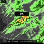
🚨 DANGEROUS THUNDERSTORMS ARE MOVING ACROSS OKLAHOMA! Powerful storms are producing large hail, with severe weather posing a significant threat to communities in their path!
Track these storms LIVE with ZoneWatch on Web & App
Featuring advanced radar, real time lightning detection, SMART tracks for estimated hail sizes, confidence levels, storm motion and speed, strengthening or weakening trends, rotation detection, severe weather warnings, detailed storm history, and projected storm and hail paths up to 60 minutes ahead.
See where storms are heading, how quickly they are moving, and which areas could be impacted next.


Good Morning, Monday November 2nd, 2026 at approximately 9:09am PT.
Discussion:
The departing storm allows drier weather to return to the Southwest, but runoff remains dangerous across Arizona today, with river flooding continuing into Wednesday in some locations, so avoid flooded crossings and activities near swollen rivers. Utah’s remaining mountain snow fades this morning, while patches of morning fog and freezing fog could reduce visibility and create slippery spots in Nevada valleys through Tuesday. Fog may also disrupt travel across the Pacific Northwest this morning, especially in western Washington, where visibility could drop below a quarter mile. Another Pacific disturbance brings rain into the Bay Area Tuesday, potentially making the morning commute wet, with the largest rainfall amounts favored across the North Bay before conditions dry out Wednesday. Ocean swell keeps the threat of unexpectedly large waves in place along Oregon and Bay Area beaches through Tuesday, while elevated surf could push seawater into low coastal areas of San Diego and Orange counties near this afternoon’s high tide around 3:30pm.
REMINDER: Precipitation totals are not exact and only a reference given the timeframe.
Southern California and Arizona get a break from storm activity as attention shifts toward Northern California and the Pacific Northwest. Stay tuned for more updates today, including a closer look at the upcoming pattern and what comes next. AWA services we will be breaking it down even further…


FLOOD EMERGENCY FOR PRESCOTT AZ
We previously highlighted the significant flooding threat across Arizona, and unfortunately, conditions continue to worsen. Prescott has now declared a state of emergency following excessive rainfall, widespread flooding, and water overtopping Watson Lake Dam and Upper Goldwater Reservoir. Several roads and low water crossings remain closed as officials continue monitoring conditions.
This is part of a much larger and increasingly active weather pattern across the Southwest, with California potentially facing similar threats as additional Pacific storms move into the region. More on this soon, as additional flooding risks will be monitored for any changes. More rainfall expected or precipitation totals expected from @ZoneWatchWX . Update on pattern comes tomorrow. Full details on AWA.

Good Afternoon, Sunday November 1st, 2026 at approximately 1:55pm PT.
Discussion:
An atmospheric river feeding into a Pacific trough moving east keeps dangerous flooding concerns in place across parts of Arizona and southern Utah today and tonight, with some rivers remaining hazardous through Tuesday and flooded roads, washes and slot canyons best avoided (way too much water). A few Arizona thunderstorms could produce damaging winds this afternoon and evening, while exposed areas of northeastern Arizona see gusts of 40 to 50 mph before conditions improve overnight. Mountain snow makes travel difficult across northeastern Nevada through tonight and Utah through Monday morning, with locally heavy snowfall in the Ruby Mountains, East Humboldt Range and higher elevations of the Wasatch and Uinta Mountains.
Southern California’s remaining showers gradually taper off today and tonight with little support for strong thunderstorms, while fog could significantly reduce visibility across western Washington and northwestern Oregon during Monday’s morning commute. Minor flooding remains possible along vulnerable San Francisco and Monterey Bay shorelines today, followed by dangerous beach conditions along the Bay Area coast Monday and Tuesday, while unexpectedly large waves could surge onto Oregon beaches beginning this evening. Stay tuned for more updates.
Tomorrow, expect multiple back to back updates including medium to long range and much more info.


Happy Halloween again! 🩸 Hope you guys enjoy the rain in Southern CA while AZ and surrounding regions is getting a bit too much of it and much more coming! Update in the morning. Don’t mind me sharing my dark side …
Stay tuned for more updates.

HAPPY HALLOWEEN Oct 31st, 2026
Read the full Update, Zoomable Images Here 👉:
alphaweatheranalysis.com/new…
Stay safe and have a wonderful fun day! Stay tuned for more updates. As a reminder, please read the article as it will answer your question. NEED MORE? Check out AWA Services breaking everything down even further. This system drove many crazy... @ZoneWatch customers, nothing wrong just the rainfall totals shifted like a woman trying to decide what to dress for his man...

Folks, please take lightning seriously. It is extremely concerning to hear that four adults were reportedly injured by a lightning strike near Maricopa Elementary School in El Mirage, Arizona. Thankfully, based on the latest information, no serious injuries have been reported.
However, this serves as an important reminder that lightning is an extremely dangerous and potentially deadly threat. Thunderstorms do not need to be classified as severe to put your life in danger. Even an ordinary thunderstorm can produce deadly lightning strikes, sometimes miles away from the heaviest rainfall.
The coverage continues and more updates are coming up...


Severe Storms Possible in AZ & Details For Elsewhere Covered
Good Morning, Friday October 30th, 2026 at approximately 9:28am PT.
Discussion:
A strong subtropical jet and a series of Pacific disturbances bring two rounds of wet weather to the Southwest, starting with Arizona thunderstorms today that could produce large hail, damaging winds and localized flash flooding, especially around Phoenix, south of the Mogollon Rim and parts of southeastern Arizona. Following a relative break Saturday, a longer period of rain develops Saturday night through Sunday, increasing concerns for overflowing washes and river flooding across central and northern Arizona, while southern Utah faces flash flooding risks today and again Sunday.
Southern California’s rain expands Saturday evening through Sunday morning, potentially affecting Halloween plans, with heavier rainfall favored across San Diego County and isolated thunderstorms possible, while the potential for stronger storms remains under review. Today’s downpours could also cause localized flooding in northwestern Arizona, while Nevada turns wetter Sunday as lowering snow levels bring possible light accumulation to higher passes and heavier snow to mountain peaks. Flooding around high tide continues along vulnerable California shorelines today and parts of the Bay Area through the weekend, while frost and freezing temperatures could damage sensitive plants across inland western Oregon and southwestern Washington Saturday morning, followed by more chilly mornings and patchy fog.
Expect multiple updates throughout today given the severe weather threat across Arizona, as well as potential impacts across Southern California, especially San Diego.
AWA Insiders: Detailed risk maps, severe weather assessments, and timing breakdowns will be released following the Arizona article.
Important Reminder: If an update is not released, it means there is still too much uncertainty surrounding the storm track and its potential impacts. From a professional standpoint, we want to avoid publishing frequent updates that do not provide meaningful, reliable information to our audience. This is more than simply reporting what weather models show. We have clients who rely on our forecasts to make important decisions involving their businesses, daily activities, travel plans, and more. Every forecast and update requires careful analysis, professional judgment, and discretion to ensure the information we provide is genuinely useful and actionable. Update following this post within 1hr.


KEEP IN MIND: More details will be provided in the next update. We do not expect thunderstorms to be the primary concern across Southern California. In fact, due to widespread cloud cover and limited atmospheric lift, the thunderstorm risk appears extremely low.
Instead, this setup favors periods of rain, heavy at times, especially across San Diego County, where locally significant rainfall could become the primary concern.
Good Morning, Thursday October 29th, 2026 at approximately 7:51 AM PT.
Discussion:
A strengthening Pacific trough and powerful subtropical jet stream will pull moisture into Arizona tonight, bringing thunderstorms on Friday, including a few that could become strong to severe. Localized rainfall totals of 1 to 2 inches, flash flooding, damaging winds, and large hail will be possible, especially around Phoenix, the Mogollon Rim foothills, and portions of southeastern Arizona. Showers will also spread into northwestern Arizona and parts of southern Nevada on Friday, while southern Utah could face a flash flooding risk if the disturbance tracks far enough west. Arizona should experience a relative break on Saturday before rain returns late that night.
Rain becomes more likely across Southern California Saturday afternoon and night, potentially affecting Halloween activities, although the exact timing and rainfall amounts around Los Angeles still need to be determined. Overall, the heaviest precipitation is expected to focus across Arizona, with a more detailed update coming as the forecast becomes clearer. However, the positioning of this system could significantly increase the thunderstorm risk across Southern California, including a few potentially strong storms. While widespread rainfall totals may be lower than in Arizona, thunderstorms across Southern California could produce locally higher amounts than models indicate, along with additional impacts from lightning, gusty winds, and intense downpours.
Meanwhile, unusually high tides will continue threatening vulnerable California shorelines today and Friday, with significant coastal flooding possible around San Diego and Orange County late this morning. Moderate coastal flooding is also possible along portions of the Bay Area through Saturday.
Across the Pacific Northwest, showers and light mountain snow will continue through Friday, with limited additional accumulation expected. Isolated thunderstorms remain possible across western Oregon today, while frost could affect sensitive plants in interior valleys Saturday morning.
Stay tuned for more updates. A full article is coming soon, along with another update or two exclusively for AWA Insiders.
For our @ZoneWatchWX users, be sure to take advantage of the latest features, including highly accurate Smart Storm Tracks powered by machine learning and artificial intelligence, along with advanced storm contours that help identify potential hail, storm rotation, tornado signatures, and damaging winds.
And what's next? SNOW For all the skiing and snowboarding enthusiasts out there, we have something special coming your way. Stay tuned.

Good Morning, Wednesday October 28th, 2026 at approximately 7:55am PT.
Discussion:
A Pacific low moving slowly along the coast keeps the Northwest cool and unsettled through Friday, while tropical moisture starts moving into the Southwest late Thursday and Friday. Western Washington sees repeated showers and isolated afternoon thunderstorms today, with snow levels around 3,000 to 3,500 feet and up to 6 additional inches near Mount Rainier, while several inches of snow and brief heavier bursts keep Stevens Pass and Washington Pass hazardous through this afternoon. Showers continue across western Oregon through Thursday as snow levels drop toward 3,000 to 4,000 feet, potentially making roads slippery around Santiam Pass, Willamette Pass and Government Camp.
Arizona remains mostly dry through Thursday before widespread showers and isolated thunderstorms arrive Friday, with heavier downpours potentially causing minor flooding, especially across south central and southeastern Arizona; an AWA Insiders update breaking this down follows shortly. Moisture could begin reaching northwestern Arizona, southern Nevada and eastern California Thursday night, while unusually high tides near record levels continue bringing coastal flooding to vulnerable Southern California, Bay Area and Central Coast shorelines. Multiple updates expected today, we heard you guys loud and clear! I was mainly looking for more short term consistency in the pattern before providing an update. From a professional standpoint, I wanted to avoid constantly shifting the forecast back and forth, especially regarding potential impacts, until there was greater confidence in how the pattern would evolve.
Stay tuned for further updates.

