


usd retweeted

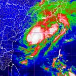
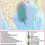
The Severe Cyclonic Storm “Akvan” [Pronunciation: Akvan] over the westcentral Bay of Bengal moved northwards with the speed of 12 kmph during past 06 hours and lay centered at 0530 hours IST of today, the 19th November, 2026 over the same region, near Latitude 14.5°N and Longitude 85.3°E, about 440 km east-southeast of Narsapur (Andhra Pradesh), 440 km south-southeast of Kalingapatnam (Andhra Pradesh), 580 km east-northeast of Chennai (Tamil Nadu), 530 km south of Gopalpur (Odisha) and 590 km south of Puri (Odisha).
It is likely to move north-northwestward and cross North Andhra Pradesh & Yanam and South Odisha coasts between Narsapur and Puri, close to east of Gopalpur, by noon of 20th November, 2026 with the maximum sustained wind speed of 90-100 kmph gusting to 110 kmph.


usd retweeted
The #Severe #Cyclonic Storm “#Akvan” [Pronunciation: Akvan] over westcentral and adjoining central parts of south #Bay of #Bengal moved northwards with the speed of 05 kmph during past 06 hours and lay centered at 2330 hours IST of yesterday, the 18th November, 2026 over westcentral Bay of Bengal, near Latitude 13.9°N and Longitude 85.3°E, about 480 km southeast of Narsapur (#Andhra #Pradesh), 510 km south-southeast of Kalingapatnam (Andhra Pradesh), 560 km east of #Chennai (Tamil Nadu), 600 km south of #Gopalpur (#Odisha) and 660 km south of #Puri (Odisha).
It is likely to move north-northwestward and cross North Andhra Pradesh & Yanam and South Odisha coasts between Narsapur and Puri, by noon of 20th November, 2026 with the maximum sustained wind speed of 90-100 kmph gusting to 110 kmph.


usd retweeted
The Severe Cyclonic Storm “Akvan” [Pronunciation: Akvan] over the westcentral and adjoining central parts of south Bay of Bengal moved north-northwestwards with the speed of 08 kmph during past 06 hours and lay centered at 1430 hours IST of today, the 18th November, 2026 over the same region, near Latitude 13.3°N and Longitude 85.3°E, about 520 km southeast of Narsapur (Andhra Pradesh), 560 km east of Chennai (Tamil Nadu), 570 km south-southeast of Kalingapatnam (Andhra Pradesh), 660 km south of Gopalpur (Odisha) and 720 km south of Puri (Odisha).
Continuing to move north-northwestward, it is likely to cross North Andhra Pradesh & Yanam and South Odisha coasts between Narsapur and Puri, by noon of 20th November, 2026 as a severe cyclonic storm with the maximum sustained wind speed of 90-100 kmph gusting to 110 kmph.


usd retweeted

ବାତ୍ୟା ‘ଅକୱାନ’ର ଗତିପଥକୁ ନେଇ ବଢ଼ିଛି ଅନିଶ୍ଚିତତା। ଓଡ଼ିଶାର ଅନେକ ଜିଲ୍ଲାକୁ ରେଡ୍ ୱାର୍ଣ୍ଣିଂ। ମୁକାବିଲା ପାଇଁ ୩୭୦ ଫାୟାର୍ ଓ ଏମର୍ଜେନ୍ସି ଟିମ୍ ପ୍ରସ୍ତୁତ।
#CycloneAkvan #OdishaCycloneAlert #RedWarning #OdishaWeatherUpdate #OdishaNews
odisha.live/2026/11/18/cyclo…

usd retweeted

More than 9,00,000 people lost their lives worldwide due to weather extremes, resulting in direct economic losses totalling more than $4.7 trillion in the past 30 years (1996-2025), with India figuring as the 10th most affected country by recording 78,000 deaths and losing $170 billion due to 436 extreme events during the period, shows a Climate Risk Index (CRI) 2027 report by a Germany-based environment and development organisation released on Tuesday.
More details 🔗 toi.in/DOHKHY
Catch every update on the TOI App 👉 timesofindia.sng.link/Cqhd4/…
#ClimateRiskIndex #ClimateChange #ExtremeWeather #ClimateCrisis #GlobalWarming #WeatherExtremes #India

usd retweeted

Homi Bhabha, Robert Oppenheimer, Paul Dirac, Lise Meitner, and other scientists photographed together, dated unknown.

usd retweeted
Severe Cyclonic Storm “Akvan” [Pronunciation: Akvan] over central parts of South and adjoining Westcentral Bay of Bengal [Cyclone Alert for Andhra Pradesh and adjoining South Odisha coasts—Orange Message]*
The Cyclonic Storm “Akvan” [Pronunciation: Akvan] over central parts of South and adjoining Westcentral Bay of Bengal moved very slowly north-northwestwards with the speed of 03 kmph during past 06 hours, intensified into a severe cyclonic storm and lay centered at 0530 hours IST of today, the 18th November, 2026 over the same region, near Latitude 12.7°N and Longitude 85.5°E, about 580 km east of Chennai (Tamil Nadu), 650 km northeast of Trincomalee (Sri Lanka), 610 km southeast of Machilipatnam (Andhra Pradesh), 610 km south-southeast of Visakhapatnam (Andhra Pradesh) and 730 km south of Gopalpur (Odisha).
Continuing to move north-northwestward, it is likely to cross Andhra Pradesh & Yanam coasts between Nellore and Visakhapatnam, around noon of 20th November, 2026 as a severe cyclonic storm with the maximum sustained wind speed of 100-110 kmph gusting to 120 kmph. Se


usd retweeted
चक्रवात अक्वान अपडेट:
19 नवंबर तक अति प्रचंड चक्रवाती तूफान में बदलने की संभावना |
#CycloneAkvan #CycloneAlert #cyclonicstorm
@moesgoi
@PIB_India
@DDNational
@ndmaindia
usd retweeted
Cyclone Akvan (central adj westcentral BoB) at 0530IST 17 Nov, 610km East -Chennai, 660km Southeast -Machilipatnam, 670km South-southeast -Visakhapatnam. Become Severe Cyclone tonight, Very Severe Cyclone on 19th evening; Cross Andhra Pradesh-Yanam Coasts around 20th Nov noon.


usd retweeted
CS Akvan over central adj westcentral BoB at 0530IST 17 Nov 610km E of Chennai 630km NE of Trincomalee 660km SE of Machilipatnam 670km SSE of Visakhapatnam 790km S of Gopalpur. Likely SCS today VSCS on 19th. Crossing AP coast as VSCS on 20th Nov.


usd retweeted
बंगाल की खाड़ी में बना चक्रवाती तूफान "अकवान"!
19/11/2026 की सुबह तक इसके और अधिक तीव्र होकर 'अति भीषण चक्रवाती तूफान' (Very Severe Cyclonic Storm) में बदलने की संभावना है।
अपडेट्स के लिए IMD को फॉलो करें।
#CycloneAkvan #WeatherDecode
@moesgoi @airnewsalerts
usd retweeted
Cyclonic Storm “Akvan” Formed Over the Bay of Bengal!
The system is likely to intensify further into a Very Severe Cyclonic Storm by morning of 19/11/2026.
Follow IMD for updates.
#CycloneAkvan #WeatherDecode
@moesgoi @DDNewslive
usd retweeted
How are cyclonic disturbances classified?
Explore the different categories based on Maximum Sustained Wind (MSW) Speed.
For the latest weather updates, visit: mausam.imd.gov.in/
#WeatherDecode #CycloneAwareness #WeatherUpdates
@DrJitendraSingh @moesgoi @DDNewslive


usd retweeted
बंगाल की खाड़ी में बनने वाले चक्रवात तूफान के बारे में अपडेट: 19 नवंबर 2026 तक आंध्र प्रदेश के तट के पास पहुंचने की संभावना है।
#CycloneUpdate #CycloneAlert #BayOfBengal #CyclonicStorm #AndhraPradesh #WeatherUpdate #IMD #IMDAlert #SevereCyclonicStorm #WeatherForecast
@moesgoi @airnewsalerts @DDNational @ndmaindia @ICRER_MHA
usd retweeted
Updated on upcoming Cyclonic Storm Over Bay of Bengal Likely to Reach Near Andhra Pradesh Coast by 19 November 2026
#CycloneUpdate #CycloneAlert #BayOfBengal #CyclonicStorm #AndhraPradesh #WeatherUpdate #IMD #IMDAlert #SevereCyclonicStorm #WeatherForecast
@moesgoi @airnewsalerts @DDNational @ndmaindia @ICRER_MHA
usd retweeted
The #Depression over Southeast & adjoining Southwest #Bay_of_Bengal moved north-northwestwards with the speed of 15 kmph during past 06 hours and lay centered at 1130 hours IST of today, the 15th #November, 2026 over the same region, near Latitude 9.8°N and Longitude 86.8°E, about 620 km east-northeast of #Trincomalee (Sri Lanka), 680km west-southwest of #Sri_Vijaya_Puram (Andaman & Nicobar Islands), 800 km east-southeast of #Chennai (Tamil Nadu), 960 km south-southeast of #Visakhapatnam (#Andhra_Pradesh) and 1070 km south-southeast of #Gopalpur (#Odisha).
It is very likely to move north-northwestwards, intensify further into a #Cyclonic_Storm over the central parts of south & adjoining westcentral Bay of Bengal on 16th November and into a #Severe #Cyclonic #Storm over westcentral Bay of Bengal on 17th November, 2026. Thereafter, it is likely to intensify further and move northwestwards towards Andhra Pradesh coast during subsequent 2 days.


usd retweeted
बंगाल की खाड़ी के ऊपर बना निम्न दबाव का क्षेत्र 16 नवंबर तक चक्रवाती तूफान में बदलने की संभावना।
#IMD #मौसमअपडेट #चक्रवातअलर्ट #बंगालकीखाड़ी #निम्नदबावक्षेत्र #चक्रवातीतूफान #CycloneAlert #BayOfBengal #LowPressureArea #CyclonicStorm #WeatherUpdate #WeatherForecast #IndiaWeather #मौसमविभाग #IMDWeather
@moesgoi @airnewsalerts @DDNational @ndmaindia @ICRER_MHA
usd retweeted
Low Pressure Area Over Bay of Bengal Likely to Intensify into Cyclonic Storm by 16th November
#IMD #CycloneAlert #BayOfBengal #LowPressureArea #CyclonicStorm #Depression #WeatherUpdate #WeatherForecast #CycloneUpdate #SevereWeather #IndiaWeather #FishermenWarning #MeteorologicalDepartment #IMDWeather #WeatherNews #TropicalCyclone #AndamanSea
@moesgoi @airnewsalerts @DDNational @ndmaindia @ICRER_MHA
usd retweeted
Daily Weather Briefing (13.11.2026)
A Low-Pressure Area formed over Southeast Bay of Bengal. It is likely to become Well Marked Low Pressure Area on 14th, into a Depression on 15th over the same region, Thereafter, it is likely to move north- northwestwards and intensify further into a cyclonic storm over the central Bay of Bengal around 16th November evening.
X : teapawt.net/i/broadcasts/2BlPYWQzM…
For more information, visit Us : mausam.imd.gov.in
#IMD #WeatherUpdate #CycloneAlert #BayOfBengal #WeatherForecast #RainfallAlert #WesternDisturbance #HeavyRainfall #Thunderstorm #IndiaWeather #FishermenWarning #WeatherNews
@moesgoi @airnewsalerts @DDNational @ndmaindia @ICRER_MHA

usd retweeted
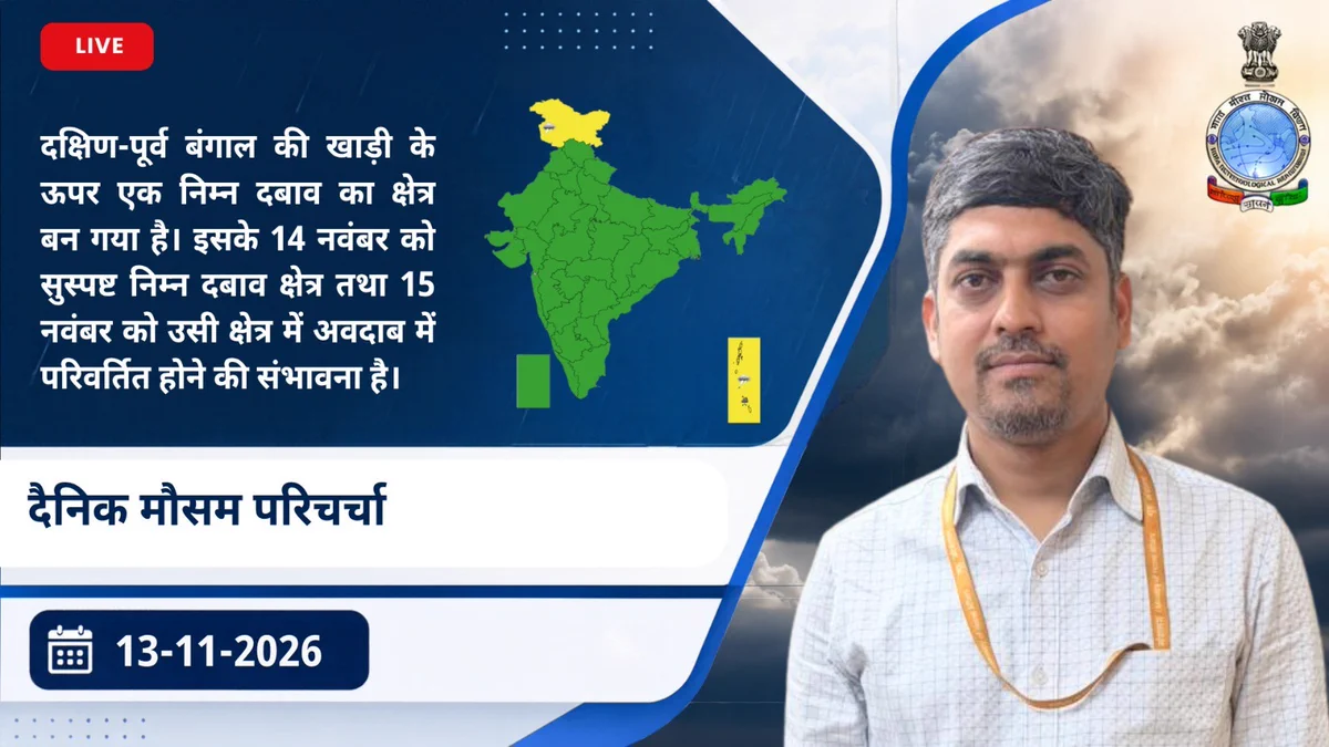
दैनिक मौसम परिचर्चा (13/11/2026)
दक्षिण-पूर्व बंगाल की खाड़ी के ऊपर एक निम्न दबाव का क्षेत्र (Low Pressure Area) बन गया है। इसके 14 नवंबर को सुस्पष्ट निम्न दबाव क्षेत्र (Well Marked Low Pressure Area) तथा 15 नवंबर को उसी क्षेत्र में अवदाब (Depression) में परिवर्तित होने की संभावना है। इसके बाद, इसके उत्तर-उत्तर-पश्चिम दिशा में आगे बढ़ने तथा 16 नवंबर की शाम तक मध्य बंगाल की खाड़ी के ऊपर चक्रवाती तूफान (Cyclonic Storm) में और अधिक तीव्र होने की संभावना है।
X : teapawt.net/i/broadcasts/2onzEqYJv…
For more information, visit Us : mausam.imd.gov.in
#IMD #WeatherUpdate #CycloneAlert #BayOfBengal #WeatherForecast #RainfallAlert #WesternDisturbance #HeavyRainfall #Thunderstorm #IndiaWeather #FishermenWarning #WeatherNews
@moesgoi @airnewsalerts @DDNational @ndmaindia @ICRER_MHA