

Maps, mapping, geoviz. No politics. Fellow @RGS_IBG Past board member @wmsmapsociety
Joined January 2020
- Tweets2.3K
- Following487
- Followers8.6K
- Likes2.6K




Pinned Tweet
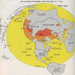
My new wall map "East Asia and the Pacific: Viewed from Eurasia" is now available for free (CC BY-NC 2.0) as a high-resolution download. Prints well at 20"x30" or larger. Thanks to everyone who provided helpful comments during many revisions.
thinkinginspace.net/latest-m…

In response to popular demand, all of the mapmaking tools on my site have been updated with unit selectors for miles, kilometers and nautical miles.
thinkinginspace.net/tools.ht…


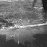
Amazing aerial photograph of Utah Beach from @USNatArchives. This perspective really highlights the beach exits and causeways.
catalog.archives.gov/id/2210…

Thanks to @simongerman600 for sharing my map with his many map-loving followers.

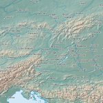
The Baltic Sea from a different angle. Perspective matters. This looks vastly different and more involved than a standard map of Europe. Source: buff.ly/PvqiVck

Rhodes Cartography retweeted

I mapped every airport, airline, and flight in the world.
flights.theojaffee.net
Rhodes Cartography retweeted

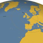
For a while during the Northern Hemisphere’s summer, the sun sets in Eastern Brazil before it does in Ireland. Now you know.


Rhodes Cartography retweeted

A little Polish joy. These panoramic sketches weren’t created during the Battle of Monte Cassino - they were drawn afterwards by Second Lieutenant Zdzisław Brunne and Officer Cadet Jan Bisiński, serving in 12 Kompania Geograficzna (12th Geographical Company), 2nd Polish Corps.


Rhodes Cartography retweeted

This is a sad day. Prof Symonds gifted us with some of the most agile and thoughtful texts on the US navy and its history. Sober, balanced, insightful, his writing inspired many of us in the business and guides - and will continue to guide - generations of students. RIP.

The U.S. Naval Institute mourns the passing of Dr. Craig L. Symonds, distinguished naval historian, award-winning author, and professor emeritus of history at the U.S. Naval Academy. Through three decades of teaching and a lifetime of scholarship, he helped generations of naval officers and readers understand the people, decisions, and sacrifices that shaped our naval history.
In May 2023, Dr. Symonds addressed the Naval Institute’s 150th Annual Meeting, reflecting on the enduring relationship between the Navy and its independent forum. His remarks became his most recent Proceedings article, “A Two-Way Street: The Navy–Naval Institute’s 150-Year Relationship.” In it, he described the Institute as “a sounding board and not an echo chamber”—a reminder of the value of thoughtful debate in advancing the naval profession.
We honor his lasting contributions to naval history and extend our deepest condolences to his family, friends, colleagues, and former students. His legacy lives on in the people he taught and the history he brought to life.
Read his article and revisit his 2023 remarks.
usni.org/magazines/proceedin…


Have just finished Patrick Leigh Fermor, A Time of Gifts. Should have read this remarkable book long ago. But I constantly needed a reference map to follow along his rambles, so I quickly made this Rotterdam to Constantinople map. No borders, only natural features.

Much of Fermor's book talks about the many names that different towns have gone by over the centuries. This map uses the Natural Earth English defaults, which will probably dissatisfy everyone slightly.
Rhodes Cartography retweeted
This is one of my favourite vintage (1851) #infographics! It compares the length of #rivers and size of lakes. Source: buff.ly/2JB8vgM #geography #hydrology #history

Rhodes Cartography retweeted

The future of war is now - and mass provides new opportunities for weaker powers!

A new era of warfare has begun—one in which “weaker states are no longer priced out of the military power game” and “stronger states are not guaranteed the upper hand in major battles,” writes @mchorowitz.
foreignaffairs.com/iran/how-…

Thanks for the mention.
Original link is here:
thinkinginspace.net/maps/all…
During WWII, Allied ships crossing the North Atlantic faced a deadly gap in air protection. This map shows where Allied shipping losses occurred and how limited aircraft range left convoys vulnerable to German U-boats in the middle of the ocean. Source: https\://thinkinginspace.net/maps/allied-shipping-losses-and-the-north-atlantic-air-gap/

Rhodes Cartography retweeted
Pour commander cette jolie carte unique de l'Histoire du pourtour méditerranéen, pour avoir les infos des papiers proposés et du format d'impression c'est ici.
le-cartographe.net/publicati…
Les premières cartes partiront jeudi prochain. 🎁🍷 Prochaine carte : la Baltique :)


