

Spectrum News 1 Ohio Meteorologist. Columbus, OH📍. Ohio State🌰, UC🐾, UK🐱, Reds🔴, Colts🐎 & Thunder⚡. Coffee & craft beer. ☕️🍺. Born & raised Ohioan. 🎢
- Tweets59K
- Following3.4K
- Followers11.8K
- Likes48.5K







ALT This image is a 2026 Fall Color Forecast map of Ohio, showing peak foliage times across the state. Icons of trees in varying shades of orange and red indicate different regions. Key areas marked include Toledo, Cleveland, Akron, Dayton, Columbus, Cincinnati, and Portsmouth. The map has a color legend indicating mid-October, mid to end of October, and late October to early November for peak fall colors. A small inset features a scenic autumn landscape.






ALT This graphic displays Severe Thunderstorm watch number 506 plotted on a map. The watch is in effect until 8:00 PM EDT. The watch includes parts of Indiana, Kentucky, Ohio, Pennsylvania and West Virginia. The threats associated with this watch are a couple tornadoes possible, scattered hail up to ping pong size possible and scattered gusts up to 70 mph likely. There are 10,373,405 people in the watch along with 3341 schools and 230 hospitals.

ALT StormNet-v4 tornado probability map with a 38% maximum 12-hour risk from 2026-07-21 18Z to 2026-07-22 06Z. Model initialized 2026-07-18 18Z at forecast hour 084.





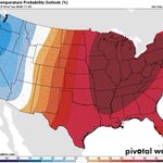
ALT High temperatures in the 90s to low 100s will make for a significant heat wave across the central and eastern U.S. beginning on Sunday and lasting through next week. These hot temperatures combined with high humidity will lead to heat indices of 100-110 degrees, and locally as high as 115. Low temperatures only dropping into the 70s will provide little overnight relief. Multiple days of Major to Extreme HeatRisk are forecast across the Mississippi and Ohio Valleys next week. These levels of heat mean health impacts become more likely in general, and may occur in ANYONE without adequate hydration or cooling. High or moderate extreme heat risks cover much of the U.S. east of the Rockies July 4-5, with a broader slight risk through July 7 extending as far west as the Great Basin. Heat indices of 100-110 degrees are possible, and warm nights in the 70s-80s may limit relief over the holiday weekend. Stay informed and take steps to protect yourself from heat related illnesses.


ALT This graphic displays Tornado Watch watch number 347 plotted on a map. The watch is in effect until 5:00 AM EDT. The watch includes parts of Illinois, Indiana, Kentucky and Ohio. The threats associated with this watch are a few tornadoes likely, isolated hail up to ping pong size possible and scattered gusts up to 75 mph likely. There are 5,504,170 people in the watch along with 1621 schools and 114 hospitals.

ALT StormNet-v4 tornado probability map with a 81% maximum 12-hour risk from 2026-06-17 18Z to 2026-06-18 06Z. Model initialized 2026-06-16 18Z at forecast hour 036.

ALT StormNet-v4 tornado probability map with a 75% maximum 12-hour risk from 2026-06-17 18Z to 2026-06-18 06Z. Model initialized 2026-06-15 18Z at forecast hour 060.


