

True enthusiast of pasta, legos, hurricanes & weather phenomena, sometimes even a storm chaser. Proud dad of 4 kids. Opinions here are only mine. 🇲🇽 🇮🇹
Guadalajara, México
Joined July 2007
- Tweets14K
- Following585
- Followers2.1K
- Likes68.5K






Pinned Tweet
Hurricane life - la vida de un “huracanero” #AGATHA
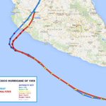
En el punto más álgido del #HuracanAgatha, a un pelo del ojo, intensas rachas de viento y el cambio en su dirección nos obligó a @iCyclone y a mi a reubicarnos del otro lado del edificio sin poder resguardarnos adecuadamente.
Erik Sereno🌪 retweeted

#Xavier now has max winds of 145 mph - the strongest November Southern Hemisphere tropical cyclone east of the International Date Line on record. Prior record Sina - 120 mph in 1990.
Erik Sereno🌪 retweeted

It's hard to describe the massive scale of the waves along the Oregon coast this weekend. The people on the cliff on the left side of the video are standing about 75 feet above the water. Just an incredible thing to witness. Keep watching- the 4th wave is the largest! #orwx
Erik Sereno🌪 retweeted

Independent Reanalysis of Hurricane Gilbert’s Yucatán Landfall Intensity
This continues the Atlantic Category 5 series. Landfall companion to the peak intensity post.
Official HURDAT2 — 14 September 1988, 1500 UTC
Near Cozumel/northeastern Yucatán (20.7°N)
Winds: 140 kt (160 mph)
Pressure: 900 mb
Eye: 8–10 n mi
WxProbe Reanalysis:
MSW: 140 kt
MSLP: 900 mb
Reconnaissance
Operational center-fix data (NWS NHC 42, Table 6) list a 145 kt flight-level wind near the landfall window together with an 8 n mi eye. The sampling came from the NOAA research flight on September 14, which flew cardinal radials rather than a rotated Alpha pattern. #Hurricane Gilbert was tracking west-northwest, so the right-front quadrant sat in the northwest sector. The radials intersected the flanks of the right-front quadrant, but did not fly the northwest azimuth itself. Consequently, a pure right-front sample of the type used in modern Alpha patterns wasn’t obtained.
A modest +3 kt allowance is applied for the unsampled northwest sector, consistent with the treatment of Allen (1980) and Gilbert’s peak. This yields an adjusted peak flight-level wind of 148 kt.
Structure
Black and Willoughby (1992) and Black et al. (1999) document that Gilbert was in an active concentric eyewall cycle at landfall. The outer eyewall had formed and was strengthening and contracting while the inner eyewall showed some signs of weakening. Both eyewalls survived passage over the peninsula, with full replacement occurring later in the Gulf. The 8 n mi eye and 145 kt flight-level wind used here correspond to the inner core.
Reduction Factor
The RMW is estimated at a distance of 6–8 n mi from the 8 n mi eye. The inner core meets the compact criteria, and the 900 mb pressure is below the 910 mb gate required for the 0.94 factor. However, Gilbert’s large R34 takes it out of that bin, triggering the same size veto applied at peak and holding the factor at 0.935.
148 kt × 0.935 = 138.4 kt, which rounds to 140 kt.
I should note that the strengthening and contracting outer eyewall redistributed the wind field outward, weakening the inner-core pressure gradient relative to the previous evening. That structural broadening is reflected in the drop from the peak flight-level winds to the 145 kt value near landfall and in the filling from 888 mb to 900 mb. The large R34 and the 0.935 reduction factor already capture the broader outer structure; the lower flight-level winds are therefore a real reduction in the inner-core maximum, not an artifact of undersampling.
Pressure Check
KZC at 20.7°N, 900 mb, translation ~12–15 kt, and a large outer field returns approximately 142–148 kt. As mentioned previously, the relation runs slightly high relative to the reduced flight-level result, consistent with its behavior on other deep, large-envelope cases.
Final Estimate
MSW: 140 kt (160 mph)
MSLP: 900 mb
RMW: 6–8 n mi
Time: 1500 UTC 14 September 1988
That is no revision of the official wind or pressure. The 140 kt value balances the measured 145 kt flight-level wind, the modest right-front allowance, the size veto at 0.935, and the extreme central pressure.
Series Comparison
Please see the updated attached graphic for a full listing of completed cases.


Independent Reanalysis of Hurricane Gilbert’s Peak Intensity.
This continues the Atlantic Category 5 series. Peak only. Landfall is a separate post.
Official HURDAT2 — 13 September 1988, 2100–2200 UTC
Winds: 160 kt (185 mph)
Pressure: 888 mb
Eye: 5–10 n mi
WxProbe Reanalysis:
MSW: 160 kt
MSLP: 888 mb
Reconnaissance
A NOAA WP-3D research flight conducted multiple eyewall penetrations on September 13. The critical pass near 2152–2153 UTC produced a 1 km radial maximum of 80.2 m s⁻¹ storm-relative (north inbound) at approximately 12 km from the center, corresponding to an earth-relative value of 165 kt after motion is restored. The flight-level minimum pressure of 888 mb was extrapolated on the same pass. Subsequent legs after 2323 UTC showed higher pressure and weaker winds. The pattern was a west-to-east penetration followed by a north-to-south penetration. The northern radial was the strongest of the flight and concurrent with the pressure minimum. It intersected the northern flank of the right-front quadrant on a west-northwest track, but did not fly the northwest azimuth itself. Consequently, a pure right-front sample of the type used in modern Alpha patterns wasn’t obtained.
Pressure
Willoughby, Masters, and Landsea (1989) revised the original flight-level extrapolation to 888 mb (± 2mb). The 2152 UTC fix is the lowest on the flight; the 2323 UTC penetration was already 3–5 mb higher. A transient value near 887 mb is inside the published uncertainty, but is not assured by the reconnaissance sequence. The official 888 mb is retained.
Structure
The Inner-core radius of maximum winds was 6.5–8 n mi during the peak pass, with an eye diameter of 5–10 n mi. A secondary maximum was already forming near 40 n mi. Even so, the small inner maximum remained the engine at the time of the 888 mb fix. Tropical storm-force diameter was approximately 450 miles, placing the average R34 near 195–200 n mi.
Reduction Factor
RMW: 6.5–8 n mi
Pressure: 888 mb
R34: 195–200 n mi
The top bins (0.94–0.95) are reserved specifically for small-core, compact systems with R34 ≤140 n mi. #Hurricane Gilbert meets the pressure and inner-core criteria, but not the outer size threshold. The large R34 is the size veto that holds the factor at 0.935 rather than 0.94. The measured 165 kt peak flight-level winds plus a modest 4 kt allowance for the unsampled northwest sector gives 169 kt. That is a 1 kt higher allowance than for Allen (1980) because the larger RMW places a greater fraction of the peak winds outside the sampled northern radial.
169 × 0.935 = 158 kt, which rounds to 160 kt.
Pressure Check
KCZ at 19.7°N, translation ~12 kt, mean R34 of 200 n mi, environmental pressure ~1010 mb: approximately 167 kt at 888 mb. The large outer field is already accounted for in the solution. The relation runs high relative to the reduced flight-level result, consistent with its behavior on other deep, large-envelope cases.
Satellite
Velden et al. (2017) ranked Gilbert as the strongest Atlantic ADT case in that reprocessing, with a lifetime maximum near 170 kt/887 mb after viewing-angle adjustment. This is treated as secondary confirmation of the extreme depth and organization, but not as a primary intensity constraint.
Final Estimate
MSW: 160 kt (185 mph)
MSLP: 888 mb
RMW: 6.5–8 n mi
Time: 2150 UTC 13 September 1988
That is no revision of the official wind or pressure. The 160 kt value balances the measured northern-radial maximum, the modest right-front allowance, the size veto, and the extreme central pressure.
Series Comparison
Please see the updated attached graphic for a full listing of completed cases.


Erik Sereno🌪 retweeted

La emotiva vigilia con los jóvenes que el Papa León presidió en su última noche en Argentina culminó con "Alma Misionera", una de las canciones más queridas por los católicos de América Latina y que el Pontífice disfruta cantar.
En Buenos Aires, la multitud cantó junto al Papa mientras un espectáculo de fuegos artificiales iluminaba el cielo.
Sigue nuestra cobertura del Papa León en Uruguay, Argentina y Perú en ewtnnews.com/es y mira todos los videos completos de todos sus eventos en YouTube.com/@EWTNNewsES
Erik Sereno🌪 retweeted

#ad Remember Cat 5 #Hurricane DORIAN—how I was trapped on Great Abaco for days afterward? Island was totally cut off. Rest of world had no idea how bad it was. Today it would be different. Using its SAR satellites, @ICEYE would document entire impact footprint & extent of damage (down to the building!) within 24 hours—regardless of conditions or time of day. Incredible stuff. Game changer for getting help faster. Check it out: hubs.li/Q04DpQ_r0

Erik Sereno🌪 retweeted

La interpretación de “La Vie en Rose” por la cantante italiana Giulia Falcone se ha convertido en un fenómeno viral en redes sociales, acumulando millones de reproducciones y elogios por devolverle la frescura a este icónico himno de París.
Con una voz sumamente dulce, elegante y un dominio técnico impecable, Falcone logra capturar la profunda melancolía y el romance de la obra original de Édith Piaf sin perder su propio estilo contemporáneo.
A diferencia de otras adaptaciones modernas que alteran demasiado el ritmo, la versión de Giulia Falcone en su canal de YouTube mantiene la instrumentación acústica y un tono íntimo que evoca las calles parisinas.
Su interpretación ha sido compartida masivamente en plataformas como Instagram y Facebook, donde amantes de la chanson française destacan su perfecta pronunciación y su emotividad.
Lanzada originalmente en 1947 por "El Gorrión de París", esta canción sigue siendo el símbolo definitivo del optimismo amoroso ("ver la vida en rosa"), y voces jóvenes como la de Giulia aseguran que siga conquistando a nuevas generaciones.
Erik Sereno🌪 retweeted

Quisiera dirigirme también a los padres y a los abuelos. Los jóvenes necesitan verlos rezar, acercarse a los sacramentos, tratar con respeto a sus esposas, pedir perdón y vivir con honradez también cuando hacerlo exige sacrificios. Un hijo aprende mucho al ver que su padre puede arrodillarse delante de Dios sin sentirse menos hombre por ello.
Erik Sereno🌪 retweeted
Madres y abuelas: ¡no se cansen de transmitir la fe! Prediquen con su vida y también con su palabra. Insistan en la oración, en el amor y en la esperanza. Háganlo con paciencia, sin desaliento. Aunque sus seres queridos parezcan lejos de Dios, sigan poniéndolos ante Él. Hay puertas que ustedes no pueden abrir, pero Dios sí. #ViajeApostólico #Uruguay
Erik Sereno🌪 retweeted
Cuando ser justo y honrado tenga un precio, páguenlo. Cuando perdonar parezca una derrota, perdonen. Cuando todos les digan que piensen primero en ustedes mismos, no tengan miedo de hacerse los últimos; sean capaces de entregar tiempo, dinero, comodidad y proyectos para servir a los demás. Que quien los mire pueda preguntarse: “¿Por qué vive así? ¿De dónde saca esta libertad? ¿Por qué se aman tanto?”. #ViajeApostólico #Uruguay
Erik Sereno🌪 retweeted

Difficult to imagine the wind capable of such incredible tree damage. #Haiyan


Erik Sereno🌪 retweeted

13 years ago today, 195 MPH Super Typhoon Haiyan (Yolanda) brought terror to the Philippines.
One of the strongest landfalling storms that’s ever been recorded anywhere on Earth.

Erik Sereno🌪 retweeted
Today (08 Nov) marks 13 years since one of the greatest catastrophes of the 21st century: Category 5 Super #Typhoon #HAIYAN in the #Philippines—known locally as YOLANDA.
This fast-moving, *extremely* intense storm came roaring ashore on the island of Leyte just after dawn with jaw-dropping ferocity—one of the most intense cyclone landfalls ever observed. And although it was small, HAIYAN aimed perfectly, with its potent right eyewall nailing the large, low-lying city of Tacloban.
As the typhoon's center passed just south of the city, the winds shifted direction, forcing a tremendous volume of water into tiny San Pablo Bay—too much water. It overflowed into waterfront neighborhoods in a great, tsunami-like surge, engulfing almost the entire city in a matter of minutes. Unable to react quickly enough, many thousands of people perished. Yes, thousands.
I was there and I'll never forget it: first the wolf-like howl of the winds raking the city streets... then the crashing of windows breaking and doors tearing off... then the rushing of water invading the hotel from above and below... and then the screams. People in danger—trapped in their rooms as the surge rapidly swallowed up the first floor.
I remember having a sick feeling—that I was going to watch people die. Right in front of me. I needed to do something—anything. I threw my camera down and jumped into that black, horrible water. Working with my chase partners, Mark Thomas and James Reynolds (@EarthUncutTV), and a few other fellows, we somehow managed to pull everyone out of their flooded rooms—through the windows—and get them up to the second floor. I'm proud to say no one in our hotel died, although there were injuries—the most serious being Mark's. While performing rescues, he gashed his leg open—an injury so serious doctors had to fight to save his leg days later in Taiwan. (Someone was watching over me, because despite swimming in that same treacherous water wearing nothing but athletic shorts and a tank top, I had only a few scratches.) (Thanks to James for this shot of me rescuing a victim—it's from his incredible video of this event.)
The aftermath of the typhoon was so horrid it almost drove me to retire from stormchasing. Dead bodies everywhere. Injured children. Whole neighborhoods erased. A scale of misery that I couldn't comprehend. I remember shutting off my emotions—just going ice cold—because I knew if I let myself feel anything at all, I would not be able to function. A week later, when I was safely home and had the luxury to feel again, there were many tears.
HAIYAN was life-changing. It brought me face to face—in a raw, harsh way—with the ugly side of something I'd always seen as spectacular natural wonder. The urge to chase came back—but very slowly.
I've been back to Tacloban City several times since the catastrophe: a couple of months after, a year after, and ten years after. The city occupies a special place in my heart—like a home on the other side of the planet. Seeing Tacloban heal so remarkably—and reconnecting with fellow survivors of the storm—has been healing for me. ❤️


Erik Sereno🌪 retweeted
At exactly this hour 13 years ago, the incredible Super #Typhoon #HAIYAN was rapidly closing in on the #Philippines. One of the most extreme specimens ever observed, it was barreling W with estimated winds of 170 knots. I was in Tacloban City (star) waiting for it. I remember in those predawn hours, the city was calm, quiet, serene. Three hours later, an atmospheric nuclear bomb killed thousands of people & left the city almost unrecognizable.

Erik Sereno🌪 retweeted
What eyewall replacement cycles do to a storm’s core structure:
Super Typhoon Champi’s first Category 5 peak intensity versus her third.


Erik Sereno🌪 retweeted

Una verdadera belleza! Amanecer tapatío con su Luna menguante y #Spica buenos días viernes!!! 13°C
@MeteoJalMX @Trafico_ZMG @webcamsdemexico @Aeropuerto_GDL @augustpeztutu @_EarthSeaSky @PabloLatapi @metmex @JaliscoTV @nmasguadalajara @JaliscoEsMexico


Erik Sereno🌪 retweeted

GOOD NEWS: National Weather Service morning balloon launches have officially returned to normal levels while offices across the US have filled various vacancies. It seems like after an incredibly stressful and tumultuous 20 months in our industry, things are moving back to normal.
It’s important to remember though that the fight must continue. The United States of America has long been the global leader in weather infrastructure. We must do everything to ensure NOAA, and by extension the NWS, is fully and properly funded to maintain this status and continue to innovate. Accurate and timely forecasts save lives and keep money in your pockets.


Erik Sereno🌪 retweeted

It's November, and the Eastern Pacific isn't done yet.
The basin is looking to add more ACE to its record-shattering 356 units so far, with Invest 95E south of Hawaii, and an area of interest near Central America. The next names are WINNIE and XAVIER.

Erik Sereno🌪 retweeted
Buenos días #Guadalajara aquí 13°C
@MeteoJalMX @Aeropuerto_GDL @Trafico_ZMG @PabloLatapi @augustpeztutu @JaliscoEsMexico @Tavaresalaire @SkyAlertMx @metmexJAL @NTRGuadalajara @nmasguadalajara @esereno @sunset_wx


Erik Sereno🌪 retweeted

10 am PST - NHC is monitoring two systems for development over the next week. The system moving into the central Pacific has a high chance of becoming a tropical depression while the system off Central America has a low chance. Visit hurricanes.gov for updates.
