

ᴍᴏᴠᴇᴅ ʜᴇʀᴇ → https://xitter.cf/t.co/moBQSp3blU
Vienna, Austria
Joined November 2007
- Tweets1.6K
- Following366
- Followers773
- Likes2.1K





Florian Ledermann @[email protected] retweeted

Award Announcement
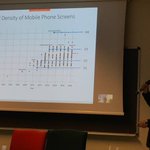
Congratulations to @floledermann, winner of the Henry Johns Award for most outstanding paper in The Cartographic Journal in 2022: "The Effect of Display Pixel Density on the Minimum Legible Size of Fundamental Cartographic Symbols".
bit.ly/3ZNRx6f

ALT Figure from the winning article 2022
Florian Ledermann @[email protected] retweeted

The Norwegians proving that you don't have to go with pastels on topographic maps #ICC2021

Florian Ledermann @[email protected] retweeted

Shadowmap will get out of beta and launch globally on May 25th.
Featuring:
☀️ Worldwide buildings
☀️ Shadowmap Pro
☀️ Special launch offer
Save the date!
#shadowmap #launch #globalbuildings #shadowmappro
Florian Ledermann @[email protected] retweeted

Has science gone too far?
🌊🌊🇨🇦🇺🇸🇲🇽🌊🌊
Florian Ledermann @[email protected] retweeted

anarchism functional programming
🤝
state is inherently
dangerous and should
be eliminated

Florian Ledermann @[email protected] retweeted

Today, it's back to the basics, what I wanted to do when I started out: @openstreetmap in D3 (via @observablehq). Found a nice set of tutorials by @floledermann (and cue a rabbithole into that awesome timeline!) observablehq.com/@flolederma… observablehq.com/@flolederma…(and 2)
Florian Ledermann @[email protected] retweeted
This map by @NadiehBremer is stunning but the blog is even better. Lifts the lid on all the work, and "thinking" that is so crucial to the art of good design. Throwing data on a map is not good enough. Understand the data. Make informed decisions. THINK! Great work Nadieh.

BLOG! 🎉 After almost a year I've written a new blog 😃 Read about the total data prep & analysis + design + creation + bloopers of my @NASAHubble #dataviz that I made for @PhysicsToday to celebrate Hubble's 30-year anniversary 🛰️
👇
visualcinnamon.com/2020/04/d…


Florian Ledermann @[email protected] retweeted


Florian Ledermann @[email protected] retweeted
What about "cartography"? 🤣
Florian Ledermann @[email protected] retweeted

There are twelve black dots at the intersections in this image. Your brain won’t let you see them all at once.

Florian Ledermann @[email protected] retweeted

Sunset over Kitzbühel on Sept. 25th. Fully interactive right in your browser. #shadowmap powered by @threejs_org #threejs #realtime #soon on shadowmap.org.
Florian Ledermann @[email protected] retweeted

True “deep learning” = listening, engaging, reading, observing, thinking, reflecting. Not curve fitting.

Florian Ledermann @[email protected] retweeted
In 2003 Adam Nieman created this image, illustrating the volume of the world’s oceans and atmosphere (if the air were all at sea-level density) by rendering them as spheres sitting next to the Earth instead of spread out over its surface ow.ly/b41X30mNpZ1

Florian Ledermann @[email protected] retweeted

Charts, maps & tables in transition

Anlässlich der Bundeslisten, die aktualisierte, etwas erweiterte und überarbeitete Darstellung zur Mandatsvergabe bei Nationalratswahlen vis.strategieanalysen.at/man…
Florian Ledermann @[email protected] retweeted
Read the spec - the "fragment identifier" part of an URL (after the # sign) is *not* sent to the server, but only evaluated in the browser. mapzr.com serves up only static HTML & JS.
Florian Ledermann @[email protected] retweeted

Mapzr by @floledermann: Quick and easy way of sharing locations on a map, such as the location of the forthcoming @CartoSoc / @bcsweb conference at @OrdnanceSurvey
mapzr.com/#c=51.25,-0.98&z=8… #maps #location #openstreetmap

Florian Ledermann @[email protected] retweeted

The Bellerby & Co 80cm diameter Albion Desktop Globe. Colouring here is Gagarin & the base is handcrafted in Walnut.
The globe has added hand drawn & hand painted illustrations | each globe is made bespoke to order #globemaker
Florian Ledermann @[email protected] retweeted
What kind of sorcery is this
