





NOVAwx retweeted

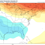
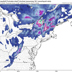
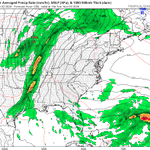
Watching for a potential coastal system this upcoming weekend. An area of upper-level vorticity is expected to develop off the coast of Florida before lifting north/northeast through the weekend. There is potential for a period of heavy rainfall, with the highest risk currently near and east of I-95, depending on the eventual track of the low. A cold front will then bring a shot of much colder air to start Thanksgiving week.
This is far from a slam dunk, as considerable spread remains within model guidance (as expected 6 days out). The faster the upper-level wave moves across the Great Lakes, the greater the likelihood that the coastal system gets pushed out to sea. I'll continue to monitor trends closely. As of now, AI guidance is favoring greater coastal to I-95 impacts, while traditional physics-based models generally favor a track farther offshore. #EcWx


NOVAwx retweeted
Now... looking more long range:
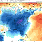
(1) A warmup is expected with above average temperatures with a strong ridge for the end of the upcoming week. A southwest flow will lead to positive height anomalies over the eastern US.
(2) The pattern will likely change Thanksgiving week as a -EPO develops, pushing colder air south.
(3) A troughing signal develops over the southern US. We'll have to wait & see if this is able to interact with the cold air pushed southward from the Alaskan ridge.
(4) I'm watching for a 2 week opportunity (Nov 28-Dec 12) for a potential impactful snow event somewhere across the Great Lakes/Mid-Atlantic/Northeast US.
#EcWx


NOVAwx retweeted
Morning KaneCast ~ MD / VA / NJ
Showers are about to break out across the NOVA/MD region as an area of low pressure drives strong low-level convergence and rising motion. Model guidance is currently under-doing the rainfall activity pushing east, so expect a stronger push of showers than what is currently modeled.
Severe weather will be possible this afternoon/evening across much of NJ. Strong large-scale ascent and wind shear, despite relatively low CAPE, will work together to support a late-season severe threat.
Have a great Thursday! #MdWx


NOVAwx retweeted

Both European AIFS (left) and Google WeatherNEXTv3 (right) AI models showing nice Alaskan ridge spike late next week, which is expected to displace cold air southward ahead of the Thanksgiving holiday.
Lack of a corresponding +PNA pattern will likely muddle the pattern with some milder Pacific air. Means we still turn chilly, but the strongest cold tends no to penetrate as far to the southeast as when it links with a PNA ridge spike as well.
Active pattern, but (at least for the DC area) nothing about it is screaming snow threat to me at this time. But we are still talking about 2 weeks out. So we'll monitor how the pattern unfolds and monitor for detail changes.
NOVAwx retweeted
Our first legitimate shot of some cold air looks to be gaining traction on model guidance for the Mid-Atlantic & Northeast. Cold looks to build in late next week for the following weekend (November 12-15th). Could be cold enough for some lake effect & high elevation upslope snows. Think this is the first punch before we get stronger punches late month into early Dec with the weaker polar vortex.
#EcWx

NOVAwx retweeted
2026-2027 Winter Outlook:
(1) Super El Niño
- Very warm sea surface temperatures across the equatorial Pacific.
- An enhanced subtropical jet stream will lead to more frequent storms and a more active storm track across the southern and eastern United States.
- The negative PDO regime continues to slowly weaken (current index: -0.74). Any potential flip into positive territory could line up with higher snowfall potential (as seen in prior years), although the base state is expected to remain generally negative.
(2) Historical Analogs
- Using past winters to help anticipate the upcoming season. Analogs provide a general expectation of how the winter may unfold. They aren't perfect, but they offer a useful starting point.
- My top analog for this winter is 2015–2016. This winter serves as an example of a typical strong El Niño pattern, featuring troughing over the Gulf of Alaska that helps direct warmer Pacific air into the CONUS. Troughing is also expected across the southern United States.


NOVAwx retweeted
Sudden Stratospheric Warming Event (SSW) ?!
(1) There has been a lot of hype surrounding a very rare early-season SSW event, which guidance suggests will likely begin this weekend. However, just because an SSW occurs does not guarantee cold air and snow along the East Coast.
(2) Right now, the influence of our base-state El Niño pattern is evident, as the Pacific jet shows no signs of relaxing through mid-November. This should keep much of the CONUS warm and generally above average, with limited to no Arctic air intrusions through mid-month.
(3) However, given the typical 2–4-week lag associated with SSW events, some type of pattern change by mid-to-late November remains possible as the SSW event couples down to the troposphere, weakening the tropospheric polar vortex, potentially displacing the cold.
(4) For now, my focus remains on the next two weeks, which look warm and generally above average, with no significant Arctic air intrusions expected east of the Rockies as pacific air continues to pour in.
(5) I'll continue monitoring the mid-to-late November period as it comes into better forecast range and we see how guidance handles the potential impacts of the SSW event.
#MdWx #EcWx


NOVAwx retweeted

Todays 00z is (by memory) the first run period so far, that all 3 main ensemble systems agree on a #polarvortex wind reversal and an official Stratospheric Warming event. The 2 main single-run models also agree on a reversal, while the AIFS remains the only one yet to show a wind reversal, likely limited by its own design, or time will tell.
While its clear that something is going to happen in the stratosphere, what people want to know is how it will change their daily weather. I think we are still not at a point where we can definitively say "ok THIS is what will change for you".
We all know the usual impacts following an SSW event in mid-winter, and it can greatly increase the chance colder air and snowfall across parts of the United States, Europe, and other mid-latitudes, at least on average.
But we are very early in the season, dealing with the earliest SSW event on record if verified, but we are also dealing with a most easterly based Super El Nino on record. This puts the atmosphere in a very unforgiving setup to find any typical SSW impact right now. Just something to keep in mind as the situation unfolds


NOVAwx retweeted
With a lot of talk about the upcoming Polar Vortex disruption and a potentially official SSW (Stratospheric Warming) event, most people cant see what makes this event "unprecedented" as its often called. And for a good reason, as a single map of the #polarvortex can be vague in context. I decided to visualize that context.
The official criteria for an SSW event is the reversal (0 or negative value) of the stratospheric winds at the 10mb level along the 60N polar circle line. We are still on the edge if we will reach a reversal with this event, but there are forecast runs that suggest its likely. Link to those live forecasts is in the comments 👇
Most of the SSW events occur in January and February. I decided to look at every first SSW of each season (some seasons had two) and when it occurred. As you can see, a reversal in the current event would break the record for the earliest SSW on date by at least 3 weeks!
This is really a strong outlier, and having an SSW this early in the season is what makes this event unprecedented in itself, perhaps more so than any temperature or pressure anomaly in the stratosphere.
Its likely not a coincidence we get this with a very strong Super El Niño ongoing in the Pacific. So overall, this is truly a very interesting season for anyone that is into monitoring the weather and seasonal development.

NOVAwx retweeted
Pattern Update:
(1) Ridging will keep much of the eastern U.S. warm and dry this week, with high pressure dominating across the Great Lakes and East Coast.
(2) Above-normal temperatures continue over the next 7 days, although mornings will remain chilly.
(3) Watching an upper-level low that could bring rain to parts of the East during the Nov. 4–7 timeframe.
(4) Colder air remains bottled up well to the north through the first week of November. Snowfall across the U.S. will be largely limited to higher elevations in the West.
#MdWx #EcWx


NOVAwx retweeted
Polar Vortex update: the 12z suite of models is slowly pulling towards agreement, with the 12z ECMWF now pulling back the reversal and showing good agreement with GFS in terms of #polarvortex strength. Heighy anomaly wise, GFS and AIFS are in good agreement.
But make no mistake, even without a reversal all main 3 models agree on reaching the weakest Polar Vortex on record for this time of year. Tho its still too early in the season and this event, to talk any long-term impacts, especially since a rebound is expected for the Polar Vortex, and the Super El Niño is ramping up for the season.
But overall, this is still a significant event in the making for this time of year.
All the plots (and more) are available in my Polar Vortex monitor hub, link in the comments. 👇


NOVAwx retweeted

Model guidance did a great job nailing this cold front that just swept through well over a week ago. But they wanted this cool down to only last a few days then warm up quick again. That no longer looks to be the case. Cooler than average air will now stick around (mainly East of the Apps) for the next week!
This has turned into a long duration cool down!

NOVAwx retweeted
The latest Euro weeklies run with the troughiness over the western US slowly pushing westward into the pacific makes sense to me. This would allow a more poleward flow at times into CONUS, increasing the chances for cold air intrusions for mid-late November. For now the cold likely stays bottled up through early November. A more typical, strong +ENSO pattern is beginning to take shape come November into December.
For snow lovers across the Mid-Atlantic & Northeast, this will be a high boom/bust winter which will all be determined from Jan 15-Feb 15th. I'll have my full synopsis in my winter forecast on Sunday, November 1st.
#EcWx #MdWx

NOVAwx retweeted

TONIGHT: Frost advisory and freeze warning issued for western parts of the area -- runs 1a-9a Sunday. 🥶
Coldest air of the season so far, mainly clear skies, and weakening winds. Temps range across 30s most spots, close to freezing some western suburbs: capitalweather.com/frost-adv…
NOVAwx retweeted
Will need to keep a close eye on another potential strong coastal system which is expected to develop this weekend & slowly drift northwest through the upcoming week. Strong onshore flow will lead to additional beach erosion & coastal flooding. Rain amounts will depend on exact track of storm. Euro AIFS continues to bump NW on rainfall for late week. #EcWx

NOVAwx retweeted

Hybrid Howler still possible next week. 👇 This is likely a preview as to how the winter will go! Plenty of coastal storms. Just like with the last Nor'Easter, it is difficult to give details this far in advance. All we can say right now is that a storm is probably going to develop near the Mid Atlantic/SE Coast sometime early next week. Stay tuned...

NOVAwx retweeted

Just in: El Nino looms large over U.S. Winter Outlook
Expected impacts include warmer North, wetter South and East
--> News release + map images at noaa.gov/news-release/el-nin…
Via @NWS @NWSCPC
#WinterOutlook #ElNino


NOVAwx retweeted
We are still looking at the potential for a strong low pressure developing off the East coast next week. The beginning stages would begin this weekend. There is still big model disagreement.
NOVAwx retweeted

The Hurricane Hunters have found #SIMON has remained steady in intensity. If anything, the pressure is slightly up from the NHC’s previous advisory of 928 mb.
And satellite imagery does reflect a plateau/slight weakening in intensity with a continued cloud-filled eye, shrinking CDO, and cloud tops warming a bit. Regardless, SIMON should only weaken from here as it approaches the coastline of Jalisco, #Mexico.
One thing I would watch for is a track slightly farther west, potentially keeping the center offshore. Some models really lean on that western solution, keeping SIMON over warm water and potentially a problem farther north up the Mexican coastline.


NOVAwx retweeted
Short-range models catching on to the faster timing of Isaias, which made landfall a few hours earlier than previous runs suggested in the last couple of days. For DC, the faster timing means...
1) Some rain starts Saturday evening, from south-to-north. Rain may start between 7-10pm in DC proper.
2) Heaviest of the rains are overnight through Sunday morning. 1-3" of rain possible, higher amounts locally.
3) Breaks in the action Sunday afternoon. Would help the Commanders/Giants game in terms of it not being a deluge, but unlikely to be totally dry.
4) Some thunderstorms then possible Sunday afternoon & evening. Isolated tornadoes would be possible in the storms due to the extra low-level spin associated with the storm.
5) While not expected to lead to widespread damage, Sunday is still a breezy day...with winds gusting 30-40mph as the storm passes by.
6) Showers linger into Monday, before low exits to our northeast. Sun then returns into Monday afternoon.