

Weather Enthusiast | NOT a Meteorologist | Located in South-Central PA | Focus on Severe, Tropics, and Winter
Joined November 2024
- Tweets9K
- Following760
- Followers2.3K
- Likes147K





Weather Sphere retweeted

In the U.S, we tend to focus on northern Canada for the annual rebuilding of cold air in the Fall, but Siberia is the true cold air factory, and it's producing a surplus right now. Much colder than normal air has spread all the way to, and beyond, the Mongolia & China border.

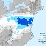
I think one of the big problems with current winter forecasting, especially in the Northeast, was our generational run of snowstorms from 2010-2017 and the impact it had on the kids growing up in that era, myself included.
A lot of us were experiencing at least one major snowstorm (10"+) nearly every year, occasionally multiple times a year like in 2010. Our brains were basically wired to assume we would get big snows every winter, with an exception or two.
But since then it hasn't happened too much, especially for areas further south like into PA/NJ/MD/VA, especially areas that were missed by the blizzard last winter. That's not to say there hasn't been snow, but it's mostly been smaller events, with only a couple bigger storms like December 2020 or the duo snowcrete and blizzard of last winter.
At least in my opinion, when we miss out on huge, crippling snowstorms like we had last decade, and instead get smaller events that may actually end up close to or exceeding those big storms, people wind up thinking that they got screwed over. I myself am guilty of this too lol.
Point of the matter is, don't feel too bad if you miss out on big snowstorms, because chances are you're still getting decent snows from small events, even if you end up below average for the year.


Weather Sphere retweeted

Hi guys
I was tired of missing cool sunsets so I made a bot and website to show sunset quality forecasts.
SkyGrade compares several recent runs of a high resolution weather model to grade every spot's sunrise and sunset from A+ to F, based on how much high cloud there is to catch the color, whether lower clouds block the light, and how much smoke or haze is in the air.


Weather Sphere retweeted

❄️ The 2026-27 Pennsylvania Winter Outlook is here! A strong El Niño, one of the strongest on record for this time of year, is taking charge this winter, and it shapes almost everything about the season ahead. I dug through every strong El Niño winter since 1957 to see what it could mean for your town’s snowfall, winter temperatures, and what it means for your heating bills, ski season, and much more!
Snow lovers, don’t give up just yet! The full outlook has town-by-town snowfall, maps, the window to watch for a big storm, and a Q&A 👉 paweatherplus.com/pennsylvan…

Weather Sphere retweeted

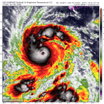
Cyclone Arnab could be a disaster in coastal Andhra Pradesh, India, coming ashore at major hurricane-equivalent strength. The system rapidly intensified into a Category 4-equivalent monster, and weakening has been delayed. It's a small, tightly-wound monster packing extreme power into a small area. That's why it ramped up so quickly.
The eye is 12 miles in diameter, symmetric, and surrounded by an extreme buzzsaw of 130 mph wind gusts. That's the eyewall. Radar from Visakhapatnam suggests a well-structured eyewall and no signs of any eyewall replacement cycles in the near future.
Category 2 or 3 impacts are likely the coastline near the mouth of the Godavari River. That means winds gusting 100 to 125 mph (160 to 200 km/h) at the immediate coast.
A 1-2 meter storm surge is possible as far north as Kakinada, with 2 to 2.5 meters from the Upputeru River to Kottapalem.
The eyewall appears to be aiming at Narasapur. Devastation of vulnerable infrastructure is likely.

Weather Sphere retweeted

Looking ahead to November, exceptional warmth is forecast across Canada as low pressure near Alaska’s Aleutian Islands blows in mild Pacific air — a hallmark of El Niño.
Because of this lack of cold air, snowfall advance will be much below average across North America.

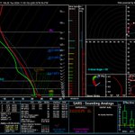
Well, I've seen worse soundings for November standards... could be a low-end tornado threat with our expected storm system early next week.


RT @Recretos: With a lot of talk about the upcoming Polar Vortex disruption and a potentially official SSW (Stratospheric Warming) event, m…

More heavy mountain snow on the way for the Rockies over the next week.
Sure would be nice to see some of that out east...


Weather Sphere retweeted

There’s a debate in the meteorology/ climate community about how to visualize the 2026 El Niño. One method subtracts recent tropical ocean warming mainly due to climate change (relative RONI index) and one that simply visualizes the event with no correction.
So how does 2026’s El Niño compare with 1997 after accounting for warmer tropical oceans? Bottom line: 2026 is still significantly stronger than 1997.
For these October 14–20 maps, a RONI-style adjustment subtracts the tropical-average SST anomaly: 0.29°C in 1997 and 1.14°C in 2026.
Niño 3.4 changes from:
• 1997: +2.13°C → +1.85°C
• 2026: +3.34°C → +2.21°C
2026 remains warmer but its lead shrinks from 1.21°C to 0.36°C after adjusting for tropical-ocean warmth.
ENSO region numbers to follow… 🧵 1/

NSSL starting to pick up on our severe threat for much of the South starting early next month. Still over a week out so details are aways away, but a threat exists nonetheless.


Weather Sphere retweeted

Yup. Though I'd always be careful with some of the headlines that seem to guarantee certain things.
It is projected to be a very strong split for early November. But in this regard the atmosphere works top-down, so it will take some time for the atmosphere to respond to it (usually a week or two) and that response is typically a more wavy polar jet pattern...which just means the potential is there for some stronger cold-air intrusions and stormier pattern say during the second half of November.
It's the details that we're not going to know for a bit yet, like where will that "wave" be in the jet. Does the cold dump west, and the plains are stormy, and the east warm? Plains cold, east stormy, west warm? And with the storms are we talking snow for some, mostly rain for others? That's all wait and see.
For the moment, the only thing the weakening suggests is "expect a more chaotic weather pattern thanks to a more active polar jet stream in the middle-to-late November" and then we work from there!
Also we've had both cold & warm El Niño Novembers, so I would not say that a strong split in early November is indicative of what the rest of the winter could bring. Just my 10 cents there.


Hey @MikeTFox5, I read something about an unprecedented polar vortex weakening in early November. What's your take on it?
Weather Sphere retweeted

URGENTE 🌪️ Más registros del tornado EF-2 que afectó la localidad de Requinoa, región de O'Higgins.
©️ Video compartido por la comunidad de RedGeoChile.
Weather Sphere retweeted

New this winter: NWS can include Particularly Dangerous Situation (PDS) wording for Blizzard Warnings and Ice Storm Warnings. This will be reserved for storms where there is high confidence in a rare and extreme event. #NDwx

ALT Infographic: "This is a Particularly Dangerous Situation". Starting this winter, you might see these words on Blizzard Warnings or Ice Storm Warnings. This means that there is high confidence in a rare and extreme event that poses an exceptional threat due to its historic nature. During a Particularly Dangerous Situation, stay off the roads and exercise extreme caution.